Displaying items by tag: West Pier
Ireland's largest sailing school, the Irish National Sailing School on Dublin Bay, has welcomed this week's announcement of new pontoon facilities near its base at the West Pier of Dun Laoghaire Harbour.
School Principal Alistair Rumball told Afloat "we have long campaigned on safety grounds for the installation of a pontoon to give the school and other users direct access to the harbour waters at the West Pier and it's great to see this now approved".
 The new pontoon, to be installed by Dun Laoghaire Rathdown County Councill will be located at the public steps close to the DMYC at the West Pier. Photo: Google Earth
The €40,000 pontoon is one of a number of approved harbour works under a €38m government scheme as Afloat reported here.
The new pontoon, to be installed by Dun Laoghaire Rathdown County Councill, will be located at the public steps close to the DMYC at the West Pier.
Local TD Cormac Devlin has also welcomed the new pontoon as part of a number of improvement measures for Dublin Harbours.
#DLHarbour - Concerns have been raised over apparent damage to the East and West Piers in Dun Laoghaire Harbour that may be worse than previously estimated.
Visibly damaged stonework lies at the waterline of the West Pier roundhead some four weeks after Storm Emma resulted in “substantial damage” to the East Pier, as previously reported on Afloat.ie.
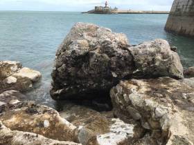
One large part of the concrete and stone ‘apron’ just before the roundhead, estimated at 50 tons, appears to have been upended and moved as much as 40 metres.
There are growing fears that this surface damage may indicate further damage undermining the structure of the pier roundhead
Evidence of subsidence is also visible above the low water line on the outside pace of the roundhead, which may also be a result of last month’s storm.
There are growing fears that this surface damage may indicate further damage undermining the structure of the pier roundhead — a problem that could be exacerbated by thrusters of cruise liners should proposals for a new berth come to fruition, it has been suggested.
It is not known what repair works would be required, though the issue of potential effects on the roundheads was raised during the oral hearing on the cruise berth plans more than two years ago.
Afloat.ie understands that the last time a significant breach of the harbour’s piers occurred was during the ‘great storm’ of November 1915.
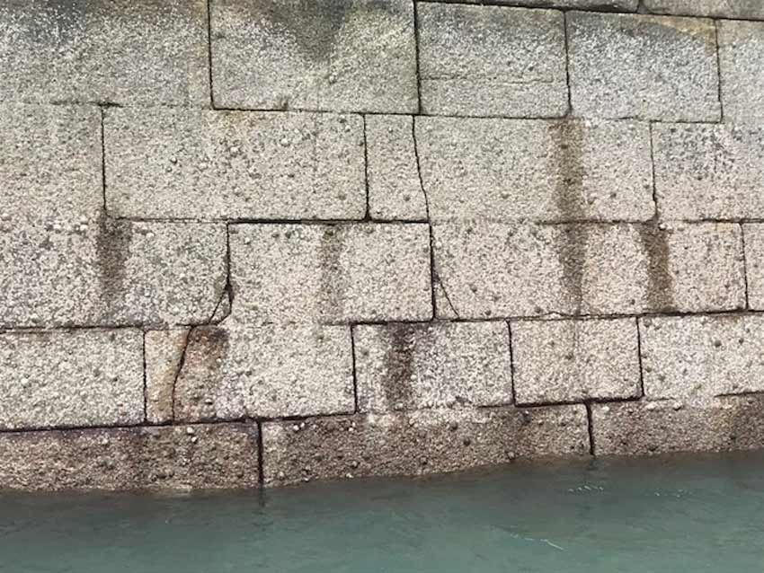 Cracks and subsidence in the roundhead wall
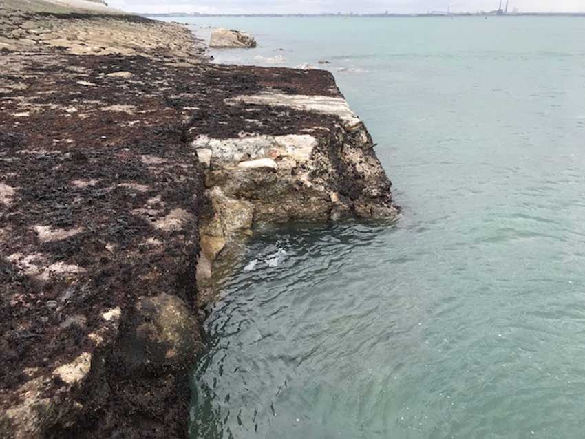 Weathering and erosion of the apron just before the West Pier roundhead
Dun Laoghaire Harbour Tenders for 'Marina Village' Design Proposals

#DunLaoghaire - The Dun Laoghaire Harbour Company has issued a tender for a design team to draft a vision for the proposed 'Marina Village Project' in the port town.
The Marina Village development is on the site of the former Shell Chemicals facility at the West Pier next to the Dun Laoghaire Motor Yacht Club, at an area known as the 'Gut'.
It is also part of the Masterplan launched in mid-2011 intended to "position Dun Laoghaire Harbour as a marine, leisure and tourism destination of international calibre".
As per the Masterplan, the development is intended for residential and water-sports use, and the aim of this tender us to "identify the optimum development proposition for the site".
The tender document suggests that proposed water-sports facilities at the site "could potentially be occupied by users such as the Sea Scouts".
In their joint response to the launch of the Masterplan in June 2011, Dun Laoghaire's yacht clubs identified a "significant amount of shore space" ripe for development in the area earmarked for the Marina Village scheme.
The request for proposals is available to download as a PDF below.


