Displaying items by tag: Spike
Cork Week and How You Can Win
 How you can win at Cork Week
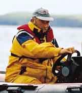
with more than a little help from local expert Eddie English [pictured left] – Cork Week 2004 (reprinted from Afloat July 2004). For all the up to date information and news on Cork Week click here.
Eddie English stands high on Cobh’s historic waterfront and looks out across Cork Harbour, south towards Roche’s Point Lighthouse and the entrance to the natural sanctuary. Immediately below, a huge Brittany Ferries ship heads slowly out to sea; it’s not even close in size to a previous visitor to the former Queenstown, but then again, the RMS Titanic belonged to a different era.
To his left, the inshore waters north of the Whitegate oil refinery hide the channel to East Ferry where the Marlogue Inn stands over its marina and just opposite, the legendary Murphs on the mainland shore.
On his right, the channel between Spike and Haulbowline Islands and Cobh is the main shipping route for the Port of Cork for ferries, commercial shipping and the Irish Naval Service base.
But it’s the view straight out to sea that confirms one of the magic ingredients that have made Cork Week an international regatta of worldwide repute: vast tracts of open, unobstructed water and all within easy reach of the shoreside facilities of the hosts at the Royal Cork Marina at Crosshaven.
When it comes to local knowledge, few are as expert as English. Not only is he chairman of the event's racing committee, not only does he run a long-established sailing school in the harbour, but when you are offered an insight from someone who takes his dog for a walk on notorious mud banks at low water springs, they tend to be nuggets of the golden variety.
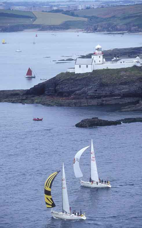
Left: Sigma 33s negotiate Roche’s Point
"The harbour course is the key to Cork Week," says English. "It's the decider where the event is won or lost and has the most variables involved." So this, then, is the Eddie English step-by-step guide to gaining an edge for that course, plus the coastal, wind/leeward and Olympic-type courses at Cork Week 2004.
Harbour Race
Above all, be conservative at the start of the Harbour Race if the tide is with you on the start off Weaver's Point. There can be two knots of tide here typically and an OCS in any fleet represents the end of the story with recovery improbable. Ideally, a short tour of the harbour during the weekend registration stage of Cork Week will pay dividends. If you can, borrow a RIB and take the tour at low-water.
Two marks form part of this course outside the harbour and rounding order will depend on wind-direction on the day. The first is off Ringabella to the south-west shore heading towards Kinsale. If there’s a flood tide, hug the shore. In fact, if the breeze is SW, go right, even in an ebb.
The second is off Trabolgan, east of Roche's Point. Crucially, beware of the strength of tide when traversing the channel across the harbour entrance. Don't just rely on the GPS – plot the tidal vectors to find the true course to steer. Once to the east of Roche's Point, there’s negligible tide and often a tide line can be observed.
This course then takes the fleet into the harbour but beware when entering on the east side of the Harbour mouth – the Cow and Calf rocks are extensions of Roche's Point up to one cable off the shore.
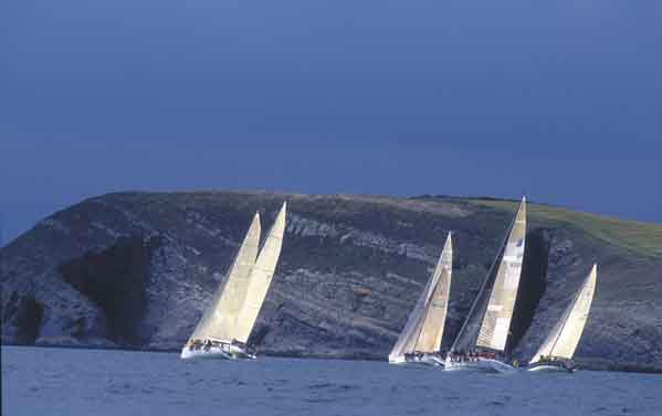
Above: Hugging the shoreline for a tactical advantage
Most races will come into a buoy east of Cobh, making this a long leg in, but offer plenty of hazards on a falling tide. After the Cow and Calf, it’s possible to dodge into White Bay but be wary of rocks and shallows on the south end of the bay close to Roche's Point.
The Dog's Nose promontory is next and it’s possible to cut into the area north of here though close inshore it shallows and the Black Rock is marked by a perch as the main hazard.
Bear in mind the sailing instructions that require clearance of 50 metres off the oil refinery jetty at all times. A listening watch on VHF Ch. 12 is useful for avoiding shipping.
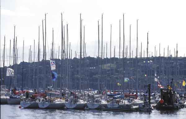
Above: The fleet at anchor – everyone’s gone to the pub...
Once past the refinery jetty, the tide running north-east/south-west for the East Ferry channel can suck you in or push you out.
The alternative to the eastern shore approach is to hug the western shore and involves rock-hopping from Ringabella in past Weaver's Point. An option is to duck into the Owenbue River at Crosshaven – the tide ebbs here up to 30–40 minutes before HW Cobh.
North of here, the Curlane Bank, south of Spike Island, offers an option but beware of shallows. The area south-east of Spike is littered with rocks and, in particular, off the eastern end is a large rock marked by a perch.
The Spit Bank is the biggest in the harbour and is located from the north end of Spike from the lighthouse to the corner off Haulbowline. On very low spring tides, football is played on this bank. The key here is: go as close as you dare. The bank is mostly mud except for ‘The Seven Stones’ aka The Ballast Rocks located approximately two cables east south-east of the No. 20 (Port) Buoy.
Having made the turn for the final approach to the Cobh rounding buoy, one of the showcase marks in the entire event set beneath the picturesque back-drop of the town, this leg from ‘Cuskinny Turn’ offers several options in tide. With the tide is a straight-forward matter of choosing the deepest water so check the charts. Usually, the north shore offers no significant gains. Keep a sharp watch for the passenger ferries running from Cobh to Spike and Haulbowline Islands.
From Cobh, the Harbour Race will have a new finishing line in 2004, moving to the No. 7 (starboard) buoy south of the refinery.
Coastal Course
Going west from the start in a south-westerly or filling sea-breeze, taking the right-handside of the course, pays off, thanks to lifts off the shore. Use the bays to get out of the tide, with the exception of the first bay after Robert's Head/Daunt buoy – it’s called Rocky Bay and it is!
The tide here follows a south-west/north-east direction in line with the heads with a one-knot maximum. Keep the harbour entrance strategy from the previous course notes in mind too.
For 2004, the former south-east mark located approximately three miles east of Roche's Point has been renamed Moonduster as a tribute to the late Denis Doyle and his legendary 51-foot yacht that is synonymous with Cork.
All Courses
The Olympic and windward/leeward are located outside the harbour so allow plenty of time to get afloat – some courses could take you up to an hour to reach as the number of yachts leaving Crosshaven at one time can mean congestion. The furthest course is three miles south-east of Roche's Point which in turn is two miles from Crosshaven. Don't assume the Race Officers will wait – best advice is to follow the professionals' example and leave early to be at sea on time with an opportunity to practice a few crew drills.
These courses usually have no significant tidal factors as most are located outside the harbour and beyond the main entrance tide line. More importantly, if a sea breeze builds, this will be of more use to you.
If a sea-breeze applies, it generally tends to build from around 11am, peaks at 3pm and is gone by 6pm. It will usually begin in the south/south-east provided the gradient doesn't block it. It tends to veer throughout the day until it comes from the SSW to SW – always moving right as the day progresses. Be vigilant to spot it building as it applies to all courses.

