Displaying items by tag: Port of Cork Schools Initiative
The winners of the 2011 Port of Cork Schools Initiative have been announced.
St John the Baptist National School in Midleton took the prize for best project in this year's contest, with the theme of ‘Making Cork Harbour a Green Energy Hub for our Future’.
Fifth classes from more than 60 primary schools in the Cork area got creative for the project, some even producing whole scale models of Cork Harbour.
Chairman of the Port of Cork, Dermot O’Mahoney, said: "We are delighted with the efforts put in by the participating schools. This is a great way of educating school children on the different forms of energy within Cork harbour while also highlighting the role of the Port of Cork."
Every participating class will be invited for a visit to Customs House in Cork city with a boat trip around the harbour before the end of the summer term. As top prize winners, pupils from St John the Baptist will get to visit one of the many luxury cruise liners that call at the port.
All projects are currently on display in the reception of Customs House.
Glasheen Boys School Cruise to Victory

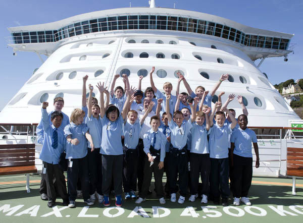
During the summer Glasheen Boys National School were announced as the overall winners of the 2010 Port of Cork Schools Initiative. As overall winners, the 5th class boys were treated to a tour onboard MV Independence of the Seas, the largest cruise liner to visit an Irish port.
While onboard the boys were shown around the huge liner and got to see the amazing flow rider in action on the top deck, as well as the climbing wall, running track, nine hole miniature golf course, the ice skating rink and of course the Alhambra theatre. They were also taken to the exclusive helipad for a photo with the Captain of the Independence of the Seas. Here the boys got a bird's eye view of the Cobh and the lower harbour.
Over 50 schools in and around Cork were invited to take part in the Port of Cork Schools Initiative which was themed 'Cork Harbour through Your Eyes – commercial, leisure and environment – Working in Harmony'. All submitted projects were put on public display in the reception area of Customs House.
Commenting on the school projects and the trip onboard the Independence of the Seas, Captain Pat Murphy, Port of Cork Community Liaison Officer said; 'Congratulations to Glasheen Boys National Schools for their excellent submission, it is clear they went to a lot of effort creating their project and we were delighted to bring them onboard the Independence of the Seas today.'
He continued: 'The Port of Cork will run the Schools Initiative again next year and we hope to encourage even more schools around Cork to take part. This is a great way of educating school children on the history of the Port and Cork Harbour.'