Displaying items by tag: Nephrops
#MarineScience - A new survey sampling Nephrops larvae from the area west of the Aran Islands is currently being conducted for the first time aboard the RV Celtic Voyager.
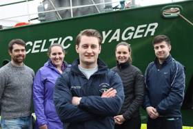
“Nephrops are more commonly known as Dublin Bay prawn, Norway lobster or scampi, and are the most valuable demersal fishery in Ireland,” said Ryan McGeady, PhD candidate at NUI Galway and chief scientist on the two-week mission which began on Tuesday 3 April.
“The value of Nephrops of landings by Irish vessels was €60 million, the stocks around Ireland that the Marine Institute assess with the underwater TV surveys is more than €100 million.”
Nephrops are widely distributed in Irish waters, found in the Irish Sea, the Celtic Sea and off the West Coast of Ireland. They spend a great deal of time in their burrows found in areas of muddy sediment at the bottom of the ocean only coming out for food or mating purposes.
Unlike fish, Nephrops cannot be aged directly. Coupled with their complex biology and behaviour, stock assessment of Nephrops is notoriously difficult to assess.
Since 2002, the Marine Institute has been using underwater television surveys to independently estimate abundance, distribution and stock sizes on the Aran Grounds, Western Irish Sea and the Celtic Sea.
However, the primary focus of this survey is to collect data on the distribution of Nephrops larvae from two commercially important grounds, including off the West Coast and the Irish Sea.
Female Nephrops mature at three years of age, when they start to reproduce each year. After mating in early summer, they spawn in September, and carry eggs under their tails until they hatch in April or May. The Nephrops larvae develop in the plankton before settling to the seabed nearly two months later.
“The importance of this survey is that it is multi-disciplinary which allows us to use both oceanographic data and biological sampling to increase our knowledge on what influences larval distribution and retention on mud patches where the species lives,” Dr Colm Lordan of the Marine Institute said.
The data collected will be used to improve the accuracy of computer models that simulate the movement of Nephrop larvae in the ocean. The information gathered during the survey will also be used to validate or ‘ground-truth’ the model to ensure its accuracy.
“It is hoped that an improved model can be used to estimate the proportion of larvae surviving to adulthood each year. This will make it easier to estimate the health of the stock,” said Dr Anne Marie Power of NUI Galway.
Acoustic records of pelagic fish shoals will also be collected to compare with characteristics of the environment. Observations will be carried out to examine the effect of trawling on fish aggregations once gear has passed through.
Fish shoal sampling will contribute towards an IRC-funded project that will use models of mackerel collective behaviour to improve traditional fisheries assessments and provide a framework for using shoals as an indicator of population health.
Oceanographic data collection will feature hyper-spectral light measurements to assist in the validation efforts of Irish satellites. This will support a Marine Institute Cullen Fellow examining space-based observations of marine phytoplankton in Northeast Atlantic surface water masses and potential environmental monitoring applications.
The team of scientists supporting Cullen Fellow Ryan McGeady board the RV Celtic Voyager includes Darragh Furey (Galway); Sophia Wasserman (Maryland, USA; IRC postgraduate scholar); Catherine Jordan (Mayo; Marine Institute Cullen Fellow/ NUIGalway); and Leigh Barnwall (Dublin). Dr Anne Marie Power Dr Colm Lordan are providing base support for this research.
This research survey is carried out with the support of the Marine Institute, funded under the Marine Research Programme 2014-2020 by the Irish Government.
Marine Institute Hosts Aran Grounds Nephrops Fishery Meeting

#Fishing - The Marine Institute and Bord Iascaigh Mhara (BIM) convened an information meeting on the Aran Grounds Nephrops fishery and recent gear trials at the institute's headquarters in Oranmore this week.
The meeting on Tuesday 24 February was attended by more than 30 active skippers together with representatives from the IFPO, IS&WPO, IS&EPO and the KFO.
Marine Institute port-based and BIM gear technology personnel, as well as a Department of Agriculture, Food and Marine official were also in attendance.
Dr Paul Connolly, director of fisheries and ecosystem services at the Marine Institute, opened the meeting by saying that Nephrops (better known as Dublin Bay prawns or langoustines) are "a key resource for Irish fishermen, as over the last five years the value of the landings at first sale has doubled to almost €50m in 2014. Sustaining the stocks and the quota is a key management priority for the industry and the department."
He also noted that it was positive to see scientists and so many active fishermen discussing issues together.
The group heard presentations on the methodology and results of Marine Institute Nephrops Underwater Television Surveys (UWTV) on the Aran Grounds and other areas by Jennifer Doyle of the Marine Institute.
The latest ICES assessments and management advice for Nephrops on the Aran Grounds was also presented by Dr Colm Lordan from the Marine Institute, who chaired the discussions by the group.
Dr Lordan highlighted that "the assessments indicate that the stock size has declined to the lowest in the time series in 2014.
"Although fishing effort in terms of number of boat and days fished on the Aran Grounds shows no long-term trend since 1995, there has been an increase in both fishing power and efficiency with the increased uptake of quad rigs in the fishery".
According to Dr Lordan, a combination of high landings and reduced recruitment has resulted in harvest rates in 2012-2013 being twice that recommended by ICES.
He further advocated "national measures to reduce catches and effort in the short term in advance of the 2015 UWTV survey were required. This would demonstrate responsible management and give the best chance for increased stock size in June."
In response to this, Francis O'Donnell of the IFPO proposed that effort on vessels less than 20m would be limited to less than 20 days and effort for vessels larger than 20m would be limited to less than 10 days for the months of April and May. This was going to severely have an impact on some of his members, he said.
David Kirwan of the IS&EPO suggested that effort for all vessels be limited to less than 40 days for the three-month period April to June.
These proposals will be investigated by the Marine Institute to assess if they would be likely to deliver significant catch and effort reductions.


