Displaying items by tag: SOCAT
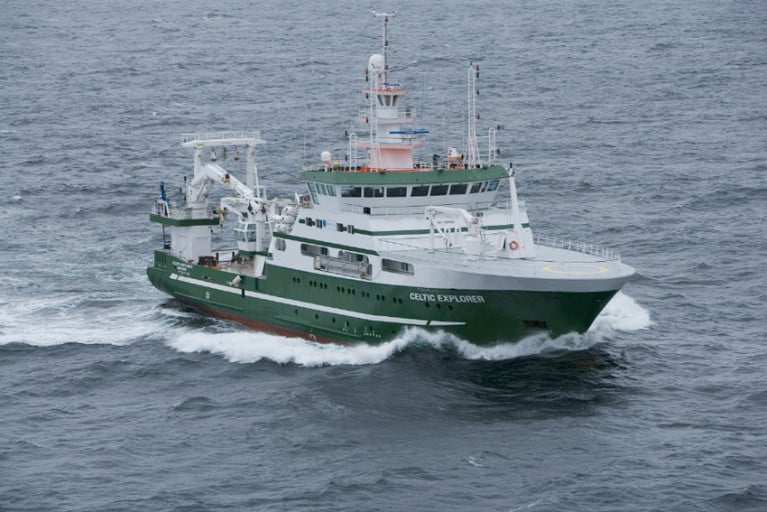
Surface ocean carbon dioxide observations from Irish waters collected by the Marine Institute’s RV Celtic Explorer have been published in the 2023 version of the Surface Ocean CO2 Atlas (SOCAT).
With over 42 million surface ocean CO2 measurements from across the globe, SOCAT is a key dataset for quantifying the evolving ocean uptake and sink for CO2.
This data provides scientists, climate researchers and international policy makers with essential information on ocean carbon dioxide measurements. And such observations are essential to understand current and project future climate change as well as for monitoring changes in ocean chemistry and predicting the impacts of these changes.
Atmospheric carbon dioxide concentrations continue to rise rapidly and currently are at about 420 parts per million (ppm), up from 280ppm in preindustrial times.
The current atmospheric level would be significantly higher, and climate change even more pronounced, but for our global ocean absorbing about a quarter of CO2 emissions from human activities each year.
There is, however, a cost: Absorbing additional CO2 increases the acidity of seawater. This process is known as ocean acidification, and it may have dramatic consequences for marine life, as detailed in a recent assessment by OSPAR.
If sea water is too acidic, it can make it difficult for marine organisms such as coral, oysters and mussels to form shells and skeletons. The impacts of ocean acidification and warming could also extend up the food chain, affecting fisheries and aquaculture, threatening food security for millions of people.
Evin McGovern at the Marine Institute, who was co-convenor of the international expert group that produced the OSPAR Ocean Acidification assessment said: “High-quality measurements of surface ocean carbon dioxide are needed for a better understanding of the impact of ocean-atmosphere interactions on climate. The Marine Institute is contributing to global science, providing advanced scientific knowledge which will help inform policy and our response to a changing ocean.”
Ocean and atmospheric CO2 measurements have been collected on the RV Celtic Explorer since 2017. This year Ireland joined the Integrated Carbon Observing Station (ICOS), a European Infrastructure network supporting standardised high-precision carbon flux measurements between atmosphere, land and the ocean, and the RV Celtic Explorer was adopted as an ICOS Ocean “station”.
In Ireland, marine CO2 measurements are also collected at fixed stations and additional CO2 observing capacity will be available on the new national research vessel, the RV Tom Crean, extending the coverage.
Surface ocean carbon dioxide observations collected by the Marine Institute’s RV Celtic Explorer have been published in the 2020 version of the Surface Ocean Carbon Atlas (SOCAT).
These data provide scientists, climate researchers and international policy makers with essential information on ocean carbon dioxide measurements.
About 36 billion tonnes of carbon dioxide are added to the atmosphere each year as a result of human activities. The ocean absorbs about one-quarter of these emissions, which helps to slow down climate change by removing CO2 from the atmosphere.
However, absorbing additional CO2 increases the acidity of seawater. This process is known as ocean acidification, and it could have dramatic consequences for marine life.
The impacts of ocean acidification would extend up the food chain, threatening food security for millions of people
If sea water is too acidic, it can make it difficult for marine organisms such as coral, oysters and mussels to form shells and skeletons.
Ocean acidification may impact some plankton species, which form the base of marine food webs and would impact larger animals like fish and whales.
The impacts of ocean acidification would extend up the food chain, affecting fisheries and aquaculture, threatening food security for millions of people, as well as the tourism industry.
Ocean acidification is a global problem. The European Union has committed to cut its greenhouse gas emissions by at least 40% below 1990 levels by 2030 and aims to be climate-neutral — an economy with net-zero greenhouse gas emissions — by 2050.
To understand the Earth’s changing climate, it is essential to collect high-quality data on surface ocean CO2 levels.
Since 2017, the Marine institute has been measuring dissolved carbon dioxide (pCO2) in Irish and Atlantic surface waters using a General Oceanics pCO2 system on board the RV Celtic Explorer. This system enables near-continuous and high-accuracy carbon dioxide measurements in surface water and the atmosphere when the vessel is at sea.
The close collaboration between the Marine Institute and P&O Maritime Services, with support from GEOMAR in Germany, has resulted in the successful collection of this data.
SOCAT has become a milestone in research co-ordination, data access, climate research and in informing policy
The high-quality measurements of CO2 collected by the Marine Institute are now included in the 2020 version of the Surface Ocean Carbon Atlas (SOCAT) and fill “a notable data gap”, according to the Irish State agency for marine research.
The Marine Institute submitted data from nine surveys in 2017 and a further 15 surveys in 2018 to SOCAT, whose data set os used globally by climate researchers and contribute to the work of the Intergovernmental Panel on Climate Change (IPCC).
SOCAT has become a milestone in research co-ordination, data access, climate research and in informing policy, the Marine Institute says.
And this work further contributes to collaborative research on ocean carbon and acidification undertaken over the last decade by the institute and NUI Galway.
Margot Cronin, chemist at the Marine Institute, said: “Measuring carbon dioxide in Irish and Atlantic waters provides essential data that increases the understanding of our oceans and climate.
“The Marine Institute is contributing to global science, providing advanced scientific knowledge which will help inform policy and our response to a changing ocean.”
As previously reported on Afloat.ie, the Marine Institute’s latest Oceans of Learning series focuses on our changing ocean climate with videos, interactive activities and downloadable resources.


