


Displaying items by tag: marine wildlife
Birdwatch Ireland "Deeply Concerned" Over Court Refusal to Continue Interim Inshore Trawling Ban
Birdwatch Ireland says it is “deeply concerned” at a refusal by the Court of Appeal to continue the Government’s interim ban on large vessels fishing inside the six nautical mile zone.
The stay was applied for by Minister for Marine Charlie McConalogue, pending a Court of Appeal ruling on a permanent ban.
A full hearing took place on June 22nd, and judgement was reserved.
The case arose after former marine minister Michael Creed announced in December 2018 that vessels over 18 metres (m) would be excluded from trawling inside the six nautical mile zone and the baselines from January 1st, 2020.
A three-year transition period was granted for vessels over 18m targeting sprat, as the fishery is concentrated inside the six nautical mile zone.
Birdwatch Ireland says the ban followed extensive consultation and was supported by “expert analysis by the Marine Institute and the Bord Iascaigh Mhara”.
“These reports highlighted that restricting the access of larger vessels inside the six nautical mile zone would lead to improved protection of coastal environments and essential fish habitat, benefitting marine biodiversity and commercially exploited fish stocks,” the NGO said.
“They highlighted the socio-economic benefits for the smaller inshore vessels, that constitute the vast majority of Ireland’s registered fishing vessels. The potential benefits included diversification opportunities, more jobs, and added value of landings,” it said.
“Improved management of inshore waters could be achieved by aligning fishing more closely with local ecological and environmental objectives and by reducing conflict between mobile and static gears,” it said.
It said it could also strengthen the link between local fish resources and local economies.
Two fishermen sought a judicial review, challenging the validity of the policy. The High Court ruled on October 6th 2020 that the policy was made in breach of fair procedures, and was void and/or of no legal effect.
After a call by a number of NGOs, the minister appealed the High Court decision to the Court of Appeal.
Birdwatch Ireland policy officer Fintan Kelly said that it was of “serious concern”, that 2019 sprat catches increased significantly - relative to 2016-2018 - to 13,000 tonnes, at a value of approximately €3.5 million.
“Anecdotal evidence from inshore fishermen and anglers around the coast suggest that landings in 2020 may again be an increase on 2019 levels putting significant pressure on the marine environment,” he said.
“We now fear that overfishing of sprat will again occur this winter because of this ruling,” Kelly said.
He noted that European sprat is a critically important species, linking plankton and top predators including seabirds and marine mammals.
Sprat are also an important forage fish species for commercial fish species like herring, Kelly said, and overfishing poses “a significant risk to the health of commercial fish stocks which poses socio-economic implications for the fishing industry”.
“This is especially relevant when considering that three out of the five herring stocks that Irish fisher’s exploit has collapsed, and have zero catch advice for 2021,” he added.
He said BirdWatch Ireland’s research shows that sprat is an important prey species for 12 out of the 23 regularly occurring breeding seabirds in Irish waters. Many of these species are Amber-listed birds of conservation concern.
Overfishing sprat is also a threat to the whale species that pass through Irish waters during the summer months and which rely heavily on Sprat, he said, with up to half of the fin whale diet and 70 per cent of the humpback whale diet relying on young sprat and herring.
Research Warns of Need to Manage Competition Between Inshore Fishers & Marine Mammals
New research led by the University of Oxford says that successful conservation policies for marine mammals have increased the potential for conflict with small scale fishing communities.
The study published in the journal Conservation Letters says that management has to strike a balance, and the international community “needs to incorporate the needs and opinions of fishers in the global dialogue”.
This should include “considering if protecting human welfare could involve reducing protection for marine mammals”, the research states.
The paper drew on the experience of fisheries on the west coast of South America to highlight what the researchers describe as a “worldwide issue”.
“Globally, conflict between recovering seal and sea lion populations and fishing communities has been escalating,” the authors state.
They note that in South America, specifically Peru and Chile, marine mammals have been protected since the mid-20th century.
“ Conservation policies have mostly been successful and over the last thirty years marine mammal populations - specifically those of sea lions and seals - have recovered,” they state.
“ However, this recovery means that there’s a much higher likelihood that these animals will come into conflict with local fishers,” they say.
The study found that nearly nine out of ten fishers have a negative impression of sea lions, and they estimate that on average sea lions reduce their catch and income by over 50%.
“Whilst it’s illegal for sea lions and seals to be killed, this is happening regularly with over 70% of fishers admitting that sea lions are being killed to defend catches,”the study says.
It says that “fishers’ overwhelming concern is that sea lion populations are now too large”.
“To manage this conflict, there’s a need to balance the competing objectives of wildlife conservation with protection for local communities,”the researchers state.
“ There’s still concern about sea lion and seal populations because of how recently they’ve recovered, but small-scale fisheries are struggling, and fishers are often earning less than the minimum wage,”they note.
“If the global community is committed to a post-2020 deal for nature and people where improvements to people's wellbeing and nature conservation are both fulfilled - the elusive ‘win-win’ - then governments and scientists must engage with these “messy” local conflicts that repeat across the globe but resist high-level simplification,”lead author Professor Katrina Davis, noted.
The study says that sea lions and seals eat the same fish targeted by fisheries, and it is not uncommon for fishers to catch fish that have already been “nibbled” by the marine mammals.
This is a similar situation in Ireland with competition between seals and inshore vessels.
Marine mammals can also be accidentally caught in fishing nets.
“A tricky balance must be met between ensuring the future viability of marine mammal populations and ensuring that the livelihoods of small-scale fishers are protected. Fishers perceive that they are suffering large catch and income losses because of sea lions—and it’s these perceptions that we have to manage when we’re developing policy solutions,” Prof Davis says.
The researchers say the plan to investigate the impact of culls, and whether this would be viable without harming population levels, and whether it would curb aggression towards marine mammals.
The full paper can be read here
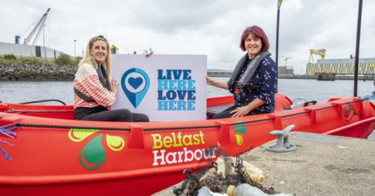
The largest ever coastal clean-up in Northern Ireland is planned for later this month - if enough volunteers turn up.
Live Here Love Here has sent out a call to people to "play their part" in cleaning up their nearest beach on Saturday and Sunday September 18-19.
The `community and civic pride initiative' is holding the event to mark the start of its annual Healthy Oceans, Healthy Minds campaign, in partnership with Belfast Harbour.
Helen Tomb, of Live Here Love Here said while people "feel better when they're near the sea... the benefit is hugely reduced by the presence of litter, which upsets people and makes them really angry".
"Taking direct action enables people to channel those feelings positively. Volunteering, even for a day, enables people to do their bit, meet new friends and gives everyone a real lift."
The Irish News has more here.
Maritime Area Planning Bill is Not Solely Designed “to Help the Offshore Renewable Sector Get What it Needs”, Warns Coastwatch's Karin Dubsky
The new Maritime Area Planning Bill is not solely designed “to help the offshore renewable sector get what it needs”, Coastwatch co-ordinator Karin Dubsky has warned.
The legislation, which marks a first for the State in marine planning, is “for all of us, and we have to watch that there isn’t a shortcut”, Dubsky said.
Her environmental group has called on the Government to specify protection of seagrass beds in the new legislation which comes before the Oireachtas this term.
Seagrass or Zostera marina is the inshore equivalent of coral reefs or tropical rainforests in nurturing habitats for diverse species and helping to filter sediments and keep shorelines stable.
“Seagrass can be found in sandy, muddy areas, such as near the high tide mark in Sligo. Short seagrass lawns have been well studied by the Environmental Protection Authority,”Dubsky said.
“The seagrass meadows rich in molluscs, fish and lobster are more difficult to find and the roots of this grass like to find shelter and clean water,”she said.
“Seagrass is incredibly important for climate change adaptation, and the meadows are totally understudied in Ireland,”she said
“Present legislation is chaotic, so it needs to be listed and mapped for protection,”she said.
“If the new Bill can state that seagrass is protected wherever it occurs, that would be very positive, “she said
Several Irish seagrass habitats are threatened by an invasive species known as “wire weed” or Sargassum muticum, she explained.
“These are some of our most valuable blue carbon habitats”, Dubsky said.
She hosted a special event at St Patrick’s Bridge near Kilmore Quay in Co Wexford last week to highlight the issue.
The new Maritime Area Planning Bill is geared to ensure regulated development of offshore wind farms, but gives local authorities a role in managing inshore coastal areas, she pointed out.
By specifying certain habitats requiring protection, this would empower local authorities to protect seagrass and to remove invasive species like Sargassum muticum, Dubsky said.
Seagrass beds in Co Wexford, in Bantry Bay, Co Cork and at Fenit in Tralee bay, Co Kerry are at risk from the invasive species, which is at its most dense in May and June, she said.
She said the protection needs to be acted upon now, as planned separate legislation on marine protected areas could take some years.
“There is huge potential to get things right, but also a huge potential to miss the boat as there is so much marine and coastal development now,”she said.
Karin Dubsky spoke to Wavelengths below
Marine survival of salmon in the eastern North Atlantic has substantially declined in recent decades, yet little was known about the migratory behaviour and distribution of populations. A new genetic tagging study, just published in the international journal Fish & Fisheries, shows where young salmon gather and begin to migrate during their first summer at sea; migrating along the the continental shelves off Ireland, Scotland and Norway and subsequently aggregating to feed in the Norwegian Sea west of the Vøring Plateau in international waters (those waters outside national jurisdiction). Here they are exposed to potential mortality from major commercial fisheries for other pelagic species.
The genetic analysis of fish caught at sea demonstrates that the salmon stocks that make up this feeding aggregation are unexpectedly not from neighbouring Norwegian rivers, but are predominantly from southern rivers such as those in Britain, Ireland, France and Spain.
This points to fundamental differences in migration behaviours (routes) and likely explains variation in how stocks from Northern and Southern European rivers have been responding to environmental change and critically to recent climate change, and may account for the differences that have been observed among stock groups in marine survival.
 Experimental salmon trawl net being hauled aboard the Celtic Explorer Research Ship, May 2008
Joint senior author of the paper, Prof. Philip McGinnity of UCC and the Marine Institute said, “This report is the culmination of a major logistical and technical effort to synthesise the data from 385 marine cruises, 10,202 individual trawls, 9,269 captured post smolts, spanning three decades and approximately 4.75 million Km2 of ocean and 3,423 individuals assigned to their region of origin.”
Further adding, “A post smolt salmon at 25cm is a very small and rare fish in a very large ocean and so to firstly catch and then assign a couple of thousand fish back to their region and even, potentially, their river of origin is a considerable feat.”
The sampling was largely carried out by research vessels, such as the Marine Institute’s RV Celtic Explorer (pictured), from several European countries and the laboratory analysis by many European labs.
In addition to the large team of international researchers from the UK, Norway, Faroes, Denmark, Russia, France, Spain, Finland, Irish scientists from University College Cork, the Marine Institute, Queen’s University Belfast, the Atlantic Salmon Trust, the Loughs Agency and the Agri-Food and the Biosciences Institute for Northern Ireland were centrally involved.
 Marine Institute's RV Celtic Explorer
Professor Tom Quinn of the University of Washington’s School of Aquatic and Fishery Sciences, a leading world authority on salmon has welcomed the study, saying “This paper is the result of sampling efforts that were vast in space and time, and equally impressive collaboration including research agencies and universities from many nations. The scope of this study alone is most impressive, and the results are of great importance. These scientists have revealed rich variation in the early marine migrations of Atlantic salmon from different regions, and are entirely consistent with a growing body of research using similar genetic methods being conducted on Pacific salmon. It is clear that salmon migrate to distant, stock-specific locations at sea, despite never having been to these regions before, and having no older members of their cohort to lead them. The environmental conditions that they encounter in their respective locations will affect their access to food, hence growth, but also their exposure to predators and intercepting fisheries. Thus migratory routes are of great consequence for the persistence and recovery of salmon stocks, in addition to the marvel of animal orientation that they reflect.”
According to Dr Niall Ó Maoiléidigh of the Marine Institute and a co-author on the paper, “Precise information on migration routes and timing are crucial for research into highly migratory marine species especially as the main factors causing population declines may be unknown.”
Dr Ciaran Kelly, Director of Fisheries and Ecosystem Services at the Marine Institute said, "The Marine Institute is pleased to see the contribution of its scientists and infrastructure to this project come to fruition. The findings of this study are very important for the management and conservation of salmon in the pelagic marine ecosystem."
Link to full paper here
Flotilla on Liffey Highlights Need to Protect Basking Shark
A flotilla is steaming up the river Liffey today in the next stage of a marine wildlife campaign to secure legal protection for basking sharks in these waters.
Over 7,000 people have already voiced support for the Save Our Sharks campaign, which aims to deliver a letter personally to Minister of State Malcolm Noonan.
The letter highlights the need for legal protection of the world’s second-largest shark and fish – known as Liabhán chor gréine, or the “great fish of the sun” – within Irish territorial waters.
In May of this year, Social Democrat TD and former marine biologist Jennifer Whitmore proposed amending the Wildlife Act (1976) to include the basking shark.
This would provide legal protection to the shark in Irish territorial waters.
Scientists signed an open letter to Government last month, explaining that Irish coastal waters are “one of the few places globally” where basking sharks “regularly and predictably occur on the surface close to shore”.
“This surface swimming behaviour is the root of its deep cultural connections with western Irish coastal and island communities,” the scientists said.
The number of breeding individuals has been estimated at approximately 8,000-10,000 worldwide, the majority of which are in the northeast Atlantic.
The scientists believe section 23 of the Wildlife Act should be amended to protect the endangered species.
Celebrating Irish sharks of all shapes and sizes for Shark Awareness Day
Today, 14th July, the Marine Institute is recognising sharks of all shapes and sizes for Shark Awareness Day. Irish waters are home to 71 species of shark, skates and rays, 58 of which have been studied in detail and listed on the Ireland Red List of Cartilaginous fish. Irish sharks range from small Sleeper sharks, Dogfish and Catsharks, to larger species like Frilled, Mackerel and Cow sharks, all the way to the second largest shark in the world, the Basking shark.
Marine biologists have long wondered why some species like the white shark and bluefin tuna are warm-blooded when most fish are not.
Now newly published research led by a Trinity College Dublin (TCD) scientist has concluded that the ability to regulate body temperatures in this way gives these fish a competitive advantage as “elite” predators.
However, the study led by PhD candidate Lucy Harding in TCD’s school of natural sciences also confirms that this advantage doesn’t allow them to live in broader temperature ranges – meaning they are just as vulnerable to climate change.
The research, which is published today (Thurs July 1st) in the journal Functional Ecology (italics), found that white shark, bluefin tuna and other warm-water species can swim approximately 1.6 (one point six) times faster than their cold-blooded counterparts.
Only 35 species of fish are warm-blooded, but this is limited to parts of their bodies, Harding explained.
“Some can warm their brain, or their eyes or muscles or a combination of same – and the reasons for this will involve more research,” she said.
Up till now, it had remained unclear what advantages being warm-blooded provided to the particular fish, she said.
“Some scientists believed being warm-blooded allowed them to swim faster, as warmer muscles tend to be more powerful, while others believed it allowed them to live in a broader range of temperatures and therefore be more resilient to the effects of ocean warming as a result of climate change,” Harding added.
 swimming at the surface with a biologging package attached to dorsal fin. This package records temperature, swimming speed, depth, body movement and video footage. Photo: Diego Camejo (Beneath the Waves).") Tiger shark: A tiger shark (Galeocerdo cuvier) swimming at the surface with a biologging package attached to dorsal fin. This package records temperature, swimming speed, depth, body movement and video footage. Photo: Diego Camejo (Beneath the Waves).
Tiger shark: A tiger shark (Galeocerdo cuvier) swimming at the surface with a biologging package attached to dorsal fin. This package records temperature, swimming speed, depth, body movement and video footage. Photo: Diego Camejo (Beneath the Waves).
The research team assessed these two possibilities by collecting data from wild sharks and bony fish, as well as using existing databases
Biologging devices attached to the fins of animals used in the research collected information such as water temperatures encountered by the fish in their habitats.
The data also recorded the speeds at which the fish swam for most of the day, and the depths of water most frequented.
“We noticed that these warm-blooded animals have the same characteristics – in that they tend to be shaped like a bullet, and have particular fin shapes and tail beats,” Harding said.
TCD assistant professor of zoology Nick Payne noted the faster swimming speeds of the warm-blooded fishes “likely gives them competitive advantages when it comes to things like predation and migration”.
“Additionally, and contrary to some previous studies and opinions, our work shows these animals do not live in broader temperature ranges, which implies that they may be equally at risk from the negative impacts of ocean warming,” he said.
“ Findings like these – while interesting on their own – are very important as they can aid future conservation efforts for these threatened animals,” Payne added.
The research was supported by Science Foundation Ireland.
Marine Minister Says Over 600 Tonnes of Marine Waste Collected by Ireland’s Seafood Sector Since 2015
Minister for Agriculture, Food and the Marine, Charlie McConalogue T.D today paid tribute to the men and women working in Ireland’s seafood sector for their continued efforts to reduce Ireland’s marine waste as part of the Clean Oceans Initiative.
To date, the collaborative efforts of the sector have resulted in more than 600 tonnes of mainly plastic waste being collected at sea and during shore and pier clean-ups.
The Clean Oceans Initiative is being led by Bord Iascaigh Mhara (BIM), Ireland’s Seafood Development Agency, and supported by the European Maritime and Fisheries Fund (EMFF).
Speaking at the pier in Greencastle, Co Donegal, Minister McConalogue commended Irish fishing, aquaculture and coastal communities for their achievements in helping to reduce what he described as “the plastic pollution pervading the marine environment.”
The Minister also highlighted the collective and ongoing work of the sector to better manage gear to prevent it from entering oceans in the first place and their efforts to remove waste from the Marine environment.
He stated, “The Irish seafood sector are a leading example of what can be achieved through collaboration. This collective approach is the key ingredient needed to tackle the plastic pollution pervading the marine environment. I am ever- impressed by the level of ingenuity being taken by the sector and this new focus to address the problem of marine waste is helping to protect Ireland’s marine environment for future generations.”
The Clean Oceans Initiative is being led by Bord Iascaigh Mhara (BIM), Ireland’s Seafood Development Agency, and supported by the European Maritime and Fisheries Fund (EMFF).
Jim O’Toole, CEO BIM spoke of the learnings being gained from the sector’s involvement in the pilot project to better understand the benefits of a circular economy and said, “BIM is proud to support the work of Ireland’s fishers, aquaculture producers and other members of the seafood sector in their continued Clean Oceans Initiative activities. The sector has assumed a leadership role in the protection of the marine environment through marine litter retrieval. BIM will continue to work with industry to ensure they are prepared for new waste management requirements under impending EU legislation.”
Agriculture, Shipping & Fishing Main Sources of Plastic & Microplastic in Marine Environment, GMIT Study Finds
Most plastic and microplastic in the marine environment comes from the agriculture sector, shipping and the fishing industry, a report by Galway-Mayo Institute of Technology (GMIT) researchers says.
Plastic seed coatings; spreading of sludges from wastewater treatment plants and the use of plastic mulching are key pollutants, while the study recorded 1816 containers from ships lost at sea in 2020, along with abandoned, lost, and discarded fishing gear.
Some of the plastic pollution is also a contributor to greenhouse gases, as in low density polyethylene in plastic milk bottles and shopping bags when exposed to solar radiation.
Microplastics - mainly fibres from clothing - threaten the food chain from its plankton base to the largest marine mammals.
 GMIT microplastic researcher Dr João Frias
Unless addressed, 99% of all seabirds will have plastic in their digestive systems by 2050, the study says. All marine turtle species are impacted by plastic pollution through ingestion and/or entanglement.
The report compiled by members of the marine microplastic research team in the Marine and Freshwater Research Centre (MFRC) at Galway-Mayo Institute of Technology (GMIT), and Mal Deegan Productions in Dublin makes a number of recommendations.
 Dr Róisín Nash GMIT microplastic researcher
It points out that the plastic pollution problem is a "complex multi-stakeholder process with many cross-sector linkages which cannot be successfully addressed in isolation".
The study commissioned by European network of marine NGOs Seas at Risk VzW was compiled by GMIT microplastic researchers Dr João Frias, Dr Róisín Nash, Dr Elena Pagter, Sindhura Stothra Bhashyam, and Malcolm Deegani MalDeegan Productions.
It has been published today on GMIT’s repository here
Tuning in to the rhythms of the reef, singing happy birthday to belugas, how polar bears will smell you before they see you, why sharks get a bad press and how it’s more common for surfers than divers to get attacked by them.
That’s a snapshot of an interview for Wavelengths this week with internationally renowned wildlife cameraman Doug Allan.
The Blue Planet, Planet Earth, Life, Human Planet, Frozen Planet, Expedition Iceberg, Forces of Nature are just some of the many documentaries which Allan has to his name.
He has filmed whales transiting from Antarctica up to the Arctic pack ice, life on a coral reef in the Red Sea and Indonesia, and has been nose to nose with mating Right whales in Patagonia
 Doug Allan filming under the ice
Wavelengths was lucky enough to catch him standing still – for a bit – in a quarantine hotel in London after he returned from filming in landlocked Nepal for a number of weeks. Listen to part one of a two-part interview below


 as lead helm, rounds the Fastnet Rock on the way to the overall win in 1987")


