


Displaying items by tag: Rivers
Riverside planting, recreating natural channels and reconnecting groundwater links could help offset high thermal extremes caused by climate change in rivers, a new study recommends.
The study led by the University of Birmingham, along with the University of Nottingham and the Scottish Government’s Marine Directorate, highlights that intense shortwave radiation during hot and dry periods is likely to be the biggest factor in high river water temperatures.
This factor, combined with declining water levels and volumes, and slower flow velocities during droughts, will warm up rivers more quickly, it says.
However, cooling effects from groundwater inputs, channel shading and evaporation can offset high temperatures in certain circumstances, the study published in the scientific journal Hydrological Processes says.
The scientists have identified three primary mechanisms that drive river water temperature increases during droughts.
These are: atmospheric energy inputs; physical habitat influences (shading and river channel shapes controlling flow); and the contributions of different water sources – groundwater tends to cool rivers in summer.
“Rising river water temperatures can have significant and often detrimental implications for aquatic life, impacting both individual species and entire ecosystems,” the study’s co-author, David Hannah, professor of hydrology and UNESCO chair in water sciences at the University of Birmingham, said.
“Drought conditions often coincide with high atmospheric temperatures, and such trends will become more intense and frequent with climate change - with major implications for river water temperatures due to the combination of intense solar radiation and lower (and slower) water flows,” he said.
“However, certain management interventions such as riverside planting and river restoration initiatives – including recreating natural channel forms and reconnecting groundwaters – could help to offset high thermal extremes during droughts if interventions are well targeted,” he said.
Lead author Dr James White, from the University of Birmingham, said the work “ highlights critical future research questions that will help us to better model river water temperature dynamics during droughts – helping river managers to work out how thermal extremes could be better managed through mitigation and adaptation strategies”.
The research was supported by the British Environment Agency, and the paper is here
Stem The Flow of Untreated Sewage: Rivers Trust App Empowers Irish Public to Become Water Guardians
The Rivers Trust has launched the inventive Big River Watch app to coincide with the upcoming World Rivers Day on September 24, 2023.
This online tool aims to unite individuals, organisations, and communities throughout Ireland to protect and conserve the country's waterways. The free and user-friendly app provides a unique platform for citizens to actively participate in monitoring the health of Ireland's rivers and taking meaningful conservation actions.
The Rivers Trust is an environmental charity that inspires and enables communities, businesses, and individuals throughout Ireland, Northern Ireland, and Great Britain to take action for healthier rivers. The organisation works collaboratively to tackle pollution, enhance biodiversity, and promote sustainable water management practices.
Mark Horton, The Rivers Trust All-Ireland Director, highlights the significant pollution levels caused by sewage, plastic, chemical, and nutrient contamination throughout Ireland's rivers. The Big River Watch survey, which is free and open to the public, is a pivotal tool to identify the most prevalent issues and areas of concern.
Dr. Constanze O'Toole, Ireland Development Manager for The Rivers Trust, emphasises that the data collected through the Big River Watch can support policy change, help reduce plastics, and stem the flow of untreated sewage.
The app also provides invaluable information on the best places for river clean-ups and wetland creation.
The Rivers Trust wishes to promote responsible stewardship of natural resources, and the Big River Watch app is a pivotal step towards achieving this objective. By putting the power of river monitoring directly into the hands of the public, the organisation hopes to inspire a new generation of water guardians passionate about preserving and enhancing the health of Ireland's rivers.
With Big River Watch, everyone can participate in the solution by monitoring water quality, reporting pollution, and engaging in vital river conservation work. The organization believes that this collaborative effort will significantly impact the health of Ireland's waterways for generations to come.
The Big River Watch App is available for download on both iOS and Android devices and can be accessed from Google Play for Android and Apple’s App Store.
The App is very easy to use, and you do not need experience or knowledge of river health or environments. You only need a smartphone, the app, and 15 minutes to observe and complete the survey.
You will need to be able to visit a river in person during the weekend of the 22nd and 25th of September. It doesn't matter where you live or whether your local river runs through a city, town, or the countryside as long as you complete the survey while looking at it. Complete the guided survey and tell us about what you see - from wildlife and plants to the water flow speed and whether you can spot any pollution. If you don't know what you're looking at, use our handy in-app ID guides for pollution and wildlife. While the launch is happening this weekend, the survey is open all year, so participants can continue to upload valuable data from multiple sites and in different seasonal conditions.
Mark concluded: “We invite everyone in Ireland to download the free app, enjoy 15 minutes observing their local river and join us in this exciting initiative to safeguard our rivers and create a more sustainable future for our communities.”
Rivers as “the waters of life in Europe” is one of several themes shortlisted by the European Central Bank in a public survey on illustrations for new bank notes.
Seven themes have been selected by the ECB’s governing council for the new euro notes, which will be “high tech” to reduce counterfeiting and environmental impact, it says.
It is running a public survey on the final theme, which is open until the end of August.
Rivers were shortlisted, as “Europe's rivers cross borders”, the ECB says.
“They connect us to each other and to nature. They represent the ebb and flow of a dynamic, ever-changing continent. They nurture us and remind us of the deep sources of our common life, and we must nurture them in turn,”it says.
Birds, European culture and European values mirrored in nature are among the other six themes, along with “The future is yours”, “Hands: together we build Europe”, and “Our Europe, ourselves”.
“The ECB will use the outcome of the surveys to select the theme for the next generation of banknotes by 2024,” it says.
“ After that a design competition will take place. European citizens will again have the chance to express their preferences on the design options resulting from that competition,” it says.
The ECB says it expects to decide on the future design, and on “when to produce and issue the new banknotes” in 2026.
The first euro bank notes were issued in 2002.
The closing date for the survey is August 31st, and the link can be found here
Mandatory downstream river warnings after pollution incidents and stricter controls on treatment of urban wastewater, which affects the marine environment, are among measures proposed by the European Commission to ensure cleaner air and water.
The proposals, which will now be considered by the European Parliament and the Council, will take effect progressively, with different targets for 2030, 2040, and 2050, it says.
This will give industry and authorities time to adapt and invest where necessary, the Commission says.
The proposals are part of the European Green Deal's zero pollution ambition of having an “environment free of harmful pollution by 2050”.
“The quality of the air we breathe and the water we use is fundamental for our lives and the future of our societies,” Commissioner for the Environment, Oceans and Fisheries, Virginijus Sinkevičius, said.
“Polluted air and water harm our health and our economy and the environment, affecting the vulnerable most of all. It is, therefore, our duty to clean up air and water for our own and future generations,” he said.
“The cost of inaction is far greater than the cost of prevention. That is why the Commission is acting now to ensure coordinated action across the Union to better tackle pollution at source - locally and cross-border,” he said.
The revised Urban Wastewater Treatment Directive will “help Europeans benefit from cleaner rivers, lakes, groundwaters and seas, while making wastewater treatment more cost-effective,” the Commission says.
“To make the best possible use of wastewater as a resource, it is proposed to aim for energy-neutrality of the sector by 2040, and improve the quality of sludge to allow for more reuse contributing thus to a more circular economy,”it says.
Obligations to recover nutrients from wastewater, new standards for micropollutants and new monitoring requirements for microplastics are among the new measures.
As 92% toxic micro-pollutants found in EU wastewaters come from pharmaceuticals and cosmetics, a new Extended Producer Responsibility scheme will require producers to pay for the cost of removing them, the Commission says.
“This is in line with the ‘polluter pays' principle and it will also incentivise research and innovation into toxic-free products, as well as making financing of wastewater treatment fairer,”it says.
Building upon the Covid-19 experience, the Commission says it proposes to systematically monitor wastewater for several viruses, including CoV-SARS-19, and anti-microbial resistance.
EU countries will be required to ensure access to sanitation for all, in particular vulnerable and marginalised groups.
EU countries will be required to track industrial pollution at source to increase the possibilities of re-using sludge and treated wastewater, avoiding the loss of resources. Rules on recovering phosphorus from sludge will support their use to make fertiliser, benefiting food production.
The changes are estimated to increase costs by 3.8% (to €3.8 billion a year in 2040) for a benefit of over €6.6 billion a year, with a positive cost-benefit ratio in each Member State.
Based on up-to-date scientific evidence, the Commission is proposing to update lists of water pollutants, and 25 substances with well-documented problematic effects on nature and human health will be added to the lists.
These include:
- PFAS, a large group of “forever chemicals” used among others in cookware, clothing and furniture, fire-fighting foam and personal care products;
- a range of pesticides and pesticide degradation products, such as glyphosate;
- Bisphenol A, a plasticiser and a component of plastic packaging;
- some pharmaceuticals used as painkillers and anti-inflammatory drugs, as well as antibiotics.
The substances and their standards have been selected in a transparent and science-driven process.
Drawing on the lessons from incidents such as the mass death of fish in the Oder river, the Commission proposes mandatory downstream river basin warnings after incidents.
Standards for 16 pollutants already covered by the rules, including heavy metals and industrial chemicals, will be updated (mostly tightened) and four pollutants that are no longer an EU-wide threat will be removed, it says.
NI Calls for Voluntary Ban on Offshore Salmon Fishing
#ANGLING - Northern Ireland's Department of Culture, Arts and Leisure (DCAL) has called on anglers to help protect the North's wild salmon, following new research that shows a significant drop in their numbers.
Fisheries Minister Carál Ní Chuilín told BBC News: "The continued commercial exploitation of wild Atlantic salmon and killing of salmon caught by rod and line in the DCAL jurisdiction is currently untenable."
Annual monitoring of Northern Ireland's salmon rivers has shown a failure to reach targets most years since 2002. The survival rate of salmon in the marine phases has in some cases dropped to as little as 5%.
DCAL has now urged offshore salmon anglers and fishermen to forego applying for 2012 licences, to give time to consider options for the future of salmon fishing.
BBC News has more on the story HERE.
Dwyer's Island ‘A View From Above’

Dwyer is a member of the Irish Cruising Club and has achieved much recognition for his contribution to appreciation of the Irish coastline and countryside.
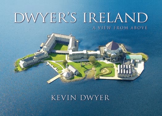
Dwyer's Island 'A View From Above' was published in October 2010 by Collins Press www.collinspress.ie/ and is Priced: €14.99 / £12.99
New Climate Model Will Chart Climate Change on Mayo Rivers
Launching the publication of the final report on RESCALE project, Minister Smith said that the project was a major milestone in our understanding of the effects of climate change on sensitive upland catchments in the west of Ireland. "While global climate change is a worldwide phenomenon, the research findings in this report provide information at the local level that will be invaluable to fisheries and land use managers," said the Minister. "Practical research work such as RESCALE is essential if we are to plan for the future management of our valuable agriculture, fisheries and forestry resources in the west of Ireland."
The project is studying data from an unbroken record of information on water temperature, air temperature, river discharge, rainfall and a host of other factors which exists for the catchment dating back to the 1950s for the Burrishoole river. This information collected at the Furnace facility and the neighbouring Met Eireann synoptic station, is invaluable as a resource, not only for measuring physical change over the past sixty years, but also as a proven yardstick to "ground-truth" any computer-generated models describing the likely effects of global warming. Minister Smith said "I am very impressed with the work being done here in Newport and the high level of collaboration between the Institute and the Universities on marine research and its practical application to real situations to help inform decision making into the future."


 of 70,000 acres on the Corca Dhuibhne peninsula in west Kerry has been welcomed by Irish Lights")


 as lead helm, rounds the Fastnet Rock on the way to the overall win in 1987")

