


#MarineScience - The extensive work carried out jointly by the Marine Institute and Geological Survey Ireland through the INFOMAR programme received substantial exposure and recognition at the 16th Forum for the Exchange of Mutual Multibeam Experiences (FEMME) in Bordeaux last week.
Hosted by the Kongsberg Maritime User Forum and focussing on seabed mapping, FEMME provides an international platform for hydrographic professionals to meet, exchange experiences and ideas, provide inspiration and contribute to improved system performance and the future of underwater mapping technologies.
High-profile attendees include the secretary general of the International Hydrographic Organization (IHO), chief hydrographers from the Service Hydrographique et Océanographique de la Marine (SHOM), and Seabed 2030 leaders.
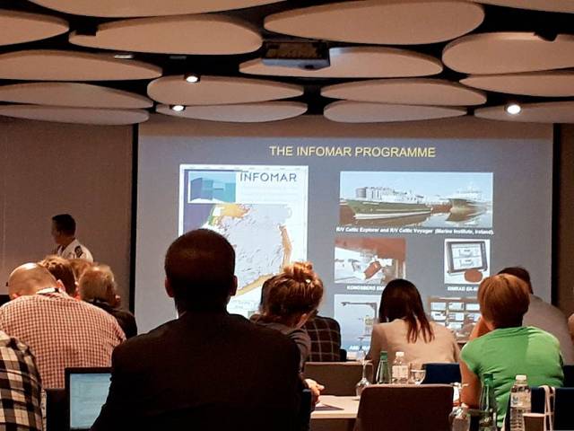
An overview of the Department of Communications, Climate Action and Environment-funded INFOMAR programme was provided by Dr Fabio Sacchetti, who updated the audience on future plans as well as recent achievements of the Irish national seabed mapping initiative.
Dr Sacchetti highlighted 10 case studies featuring multiple applications of multibeam technologies in support of sectors including coastal engineering, marine conservation and marine heritage and tourism.
In addition, a recent high-profile collaboration between INFOMAR and various US and Canadian research institutes was presented by international research partners in attendance.
INFOMAR featured prominently in a talk by Prof John Hughes Clarke (CCOM/University of New Hampshire) when describing research into the impact of internal wave activity on multibeam bathymetry in an Irish/Celtic Sea context, based on work conducted onboard the RV Celtic Explorer.
Prof Clarke has been collaborating with INFOMAR since 2015, and he is particularly focused on using hydrographic and fisheries sonar systems, combined with oceanographic data, to gain a deeper understanding of the dynamics and complexities of the Celtic Sea.
Jose Cordero, of Instituto Hidrografico dela Marina (Spain), demonstrated how improved sound speed control through remotely detecting thermocline undulations can be achieved.
The study was the result of a collaboration carried out in 2017 onboard the RV Celtic Explorer during a routine INFOMAR survey.
Finally, Anand D Hiroji (HSRC/University of Southern Mississippi) showed how unambiguous radiation pattern extraction methods can improve data derived from multisector multibeam Sonars. Once again, this study was carried out using data acquired by INFOMAR onboard the RV Celtic Explorer.
As Ireland continues toward completion of its seabed mapping programme in 2026, the Marine Institute says it is “widely acknowledged internationally” that our best practice approach towards open and integrated data acquisition, integration and exploitation “is a valued model, and one which gives Irish researchers and technology developers a global audience, and market.”


 Michael Murphy Schull Harbour Sailing Club (SHSC), Eric Coogan Heineken Ireland, Mark Murphy, Commodore SHSC, Jack Allen SHSC, Carmel O'Regan SHSC, Cornelious Ndlovu, Schull Harbour Hotel Operations Manager and Derval Murphy SHSC")

