Menu

Ireland's sailing, boating & maritime magazine

Displaying items by tag: GLA

All three General Lighthouse Authorities (GLA) of the UK and Ireland - Trinity House, the Northern Lighthouse Board and Irish Lights - will discontinue their Differential GPS (DGPS) service in March 2022.

The GLAs made this decision after carefully considering the results from an extensive consultation carried out with stakeholders and service users. They will cease transmission of the signal after 31 March 2022.

It was in 1995 that the GLAs introduced DGPS as part of the mix of marine aids to navigation (AtoN) provided to safeguard mariners within their combined waters and to help protect the environment. The system became fully operational in 1997. The system consists of 14 DGPS reference stations, six far-field monitoring sites and three monitoring and control sites. The system is operated as a single AtoN, operated and maintained by the three GLAs.

Dr Alan Grant, GLA DGPS System Director, said: “After careful consideration of the results of the consultation process, the three GLAs have concluded that their DGPS system is now redundant. Today’s GNSS are able to meet all but the most stringent accuracy requirements, and position integrity can be provided by alternative means (RAIM or other visual and electronic aids to navigation).

“The GLAs recognise the need to provide adequate notice and support continuity of service going forward. As such, the DGPS system will remain operational until 31 March 2022, at which point the signals will cease.”

Background

Marine radiobeacon DGPS was developed by the GLAs to counter Selective Availability (SA), a deliberate error added to the civilian GPS service to degrade its positional accuracy. The DGPS correction to the position error meant an improvement in accuracy from approximately 50m to around 5m.

In addition to improving the estimated position accuracy, by assessing whether the error is within a given threshold, the reference station is able to monitor the performance of the GPS constellation and identify any faults. Faulty satellites are removed from the position solution, providing position integrity for the mariner.

SA was discontinued in 2000 and GPS now offers the civilian user a position accurate to around 3-5m. DGPS still improves positional accuracy - now enabling positions in the region of 1-2m - but it is the position integrity function that is most often cited as the main benefit of DGPS.

While marine radiobeacon DGPS is not mandated by the International Maritime Organization for carriage on SOLAS vessels, it is provided for in all maritime receiver standards and the spectrum is allocated internationally.

Consultation 

The infrastructure required to run the service is approaching the end of its design life; the GLAs conducted a stakeholder consultation to assess the requirements for the service going forward, surveying and interviewing stakeholders from across the maritime sector and beyond.

Of the responses received, 86% were from mariners and maritime operators, operating a wide range of vessels including ferries, container ships, tankers, liquid natural gas carriers, bulk carriers and leisure craft.

The survey resulted in a mix of responses, with the majority of mariners reporting that they use the DGPS system for accuracy improvements and integrity, while others reported that they do not use it.

All mariners reported using GPS today with around 40% also making use of GLONASS, and around 9% using Galileo too. From the response received, it is expected that more mariners will move to multi-constellation receivers, making use of GPS, GLONASS, Galileo and BeiDou over the next five to ten years.

Maritime Safety 

Following a change in maritime receiver standards in 2003, all receivers now include Receiver Autonomous Integrity Monitoring (RAIM). RAIM is a means of determining whether the resulting position estimate is safe to use through an algorithm within the receiver.

Differential corrections are also available from other sources, including Satellite Based Augmentation Systems (SBAS), which are primarily provided for aviation users. Work is under way in Europe to introduce a maritime service to EGNOS, the European SBAS. This service is expected to be available around 2022.

Vessels that need high accuracy position and integrity for operations mainly utilise a number of commercial satellite-based services; the decision to discontinue DGPS has no operational impact on these services.

The GLAs advise mariners to consider their use of DGPS and to plan for its discontinuance accordingly. Mariners should check their GNSS receiver(s) to confirm the presence of RAIM and consider upgrading to type-approved SBAS receiving equipment when available.

The GLAs encourage mariners to use all available AtoN - whether visual or electronic - to support their safe passage and the protection of the environment.

To download a PDF copy of the full DGPS article by Dr Alan Grant click here

Published in Lighthouses

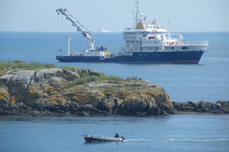
Sailing was not the only activity that took place in Dublin Bay last Saturday as the Northern Lighthouse Board's (NLB) multi-function tender NLV Pharos was busy at work, writes Jehan Ashmore.

The NLB is the Scottish equivalent of the Commissioners of Irish Lights (CIL) and it is not unusual for such vessels to share work duties beyond their respective jurisdictions. The 84m NLV Pharos is equipped with dynamic positioning and a 30-tonne main crane on her 300m2 aft-deck.

Overall she is similar in appearance to Irish lights ILV Granuaile which is based out of Dun Laoghaire. The Irish Lights tender built in Romania in 2000 tends to operate more often off the west coast during the summer months due to the more favourable weather conditions.

The 1,300 (dwt) deadweight tonnes NLV Pharos yesterday returned to her base in Oban from her Irish duties. The west coast base was established in 1904 and is also homeport to the service's smaller NLV Pole Star which is equipped with an 18-tonne crane on her 90m2 aft deck.

The facility in 2000 underwent a £4.2 million redevelopment to turn a buoy yard into a multi functional support base which is computer-linked to the NLB headquarters in Edinburgh.

In addition Trinity House which maintains the service for England and Wales operate the tenders THV Galtea,THV Patricia and the fast-response craft THV Alert from their base in Harwich.

Trinity House forms the trio of the General Lighthouse Authorities (GLA) alongside NLB and CIL. Each member of the GLA co-operate in the allocation of vessel-tender deployment.

Asides the varied and critical role of the tasks performed by the GLA's tenders, they are also available for charter to third parties. Between them the tenders can conduct buoy and chain work, search and rescue, lighthouse re-fuelling, salvage and recovery, towing, hydrographic applications and ROV work.

Published in Lighthouses
Britain is to stop paying towards the cost of funding the Commissioners of Irish Lights (CIL) according to a report in Lloyds List. In an agreement reached between London and Dublin, a formal announcement on the timetable for removing the subsidy is expected shortly.
The Irish Government has agreed to pay for its own lighthouses, buoys and other marine aids to navigation. The UK subsidy is likely to be eliminated during the current parliament if all goes according to plan. That is the pledge made by Mr Penning, UK Minister of Shipping on several occasions in recent months. The phase-out will start in the next financial year.

The total cost of providing these services comes to around £75m ($116.5m) a year, of which Irish Lights accounts for €32m. The UK subsidy to Ireland is between £10m and £12m, with the Irish government contributing some £6m and the balance coming from fees.

All three general lighthouse authorities (GLA) are working on ways to cut costs and improve efficiencies, with a joint strategic board set up to consider how they can work together more effectively.

Published in Lighthouses

Marine Protected Areas (MPAs) - FAQS

Marine protected areas (MPAs) are geographically defined maritime areas where human activities are managed to protect important natural or cultural resources. In addition to conserving marine species and habitats, MPAs can support maritime economic activity and reduce the effects of climate change and ocean acidification.

MPAs can be found across a range of marine habitats, from the open ocean to coastal areas, intertidal zones, bays and estuaries. Marine protected areas are defined areas where human activities are managed to protect important natural or cultural resources.

The world's first MPA is said to have been the Fort Jefferson National Monument in Florida, North America, which covered 18,850 hectares of sea and 35 hectares of coastal land. This location was designated in 1935, but the main drive for MPAs came much later. The current global movement can be traced to the first World Congress on National Parks in 1962, and initiation in 1976 of a process to deliver exclusive rights to sovereign states over waters up to 200 nautical miles out then began to provide new focus

The Rio ‘Earth Summit’ on climate change in 1992 saw a global MPA area target of 10% by the 2010 deadline. When this was not met, an “Aichi target 11” was set requiring 10% coverage by 2020. There has been repeated efforts since then to tighten up MPA requirements.

Marae Moana is a multiple-use marine protected area created on July 13th 2017 by the government of the Cook islands in the south Pacific, north- east of New Zealand. The area extends across over 1.9 million square kilometres. However, In September 2019, Jacqueline Evans, a prominent marine biologist and Goldman environmental award winner who was openly critical of the government's plans for seabed mining, was replaced as director of the park by the Cook Islands prime minister’s office. The move attracted local media criticism, as Evans was responsible for developing the Marae Moana policy and the Marae Moana Act, She had worked on raising funding for the park, expanding policy and regulations and developing a plan that designates permitted areas for industrial activities.

Criteria for identifying and selecting MPAs depends on the overall objective or direction of the programme identified by the coastal state. For example, if the objective is to safeguard ecological habitats, the criteria will emphasise habitat diversity and the unique nature of the particular area.

Permanence of MPAs can vary internationally. Some are established under legislative action or under a different regulatory mechanism to exist permanently into the future. Others are intended to last only a few months or years.

Yes, Ireland has MPA cover in about 2.13 per cent of our waters. Although much of Ireland’s marine environment is regarded as in “generally good condition”, according to an expert group report for Government published in January 2021, it says that biodiversity loss and ecosystem degradation are of “wide concern due to increasing pressures such as overexploitation, habitat loss, pollution, and climate change”.

The Government has set a target of 30 per cent MPA coverage by 2030, and moves are already being made in that direction. However, environmentalists are dubious, pointing out that a previous target of ten per cent by 2020 was not met.

Conservation and sustainable management of the marine environment has been mandated by a number of international agreements and legal obligations, as an expert group report to government has pointed out. There are specific requirements for area-based protection in the EU Marine Strategy Framework Directive (MSFD), the OSPAR Convention, the UN Convention on Biological Diversity and the UN Sustainable Development Goals. 

Yes, the Marine Strategy Framework directive (2008/56/EC) required member states to put measures in place to achieve or maintain good environmental status in their waters by 2020. Under the directive a coherent and representative network of MPAs had to be created by 2016.

Ireland was about halfway up the EU table in designating protected areas under existing habitats and bird directives in a comparison published by the European Commission in 2009. However, the Fair Seas campaign, an environmental coalition formed in 2022, points out that Ireland is “lagging behind “ even our closest neighbours, such as Scotland which has 37 per cent. The Fair Seas campaign wants at least 10 per cent of Irish waters to be designated as “fully protected” by 2025, and “at least” 30 per cent by 2030.

Nearly a quarter of Britain’s territorial waters are covered by MPAs, set up to protect vital ecosystems and species. However, a conservation NGO, Oceana, said that analysis of fishing vessel tracking data published in The Guardian in October 2020 found that more than 97% of British MPAs created to safeguard ocean habitats, are being dredged and bottom trawled. 

There’s the rub. Currently, there is no definition of an MPA in Irish law, and environment protections under the Wildlife Acts only apply to the foreshore.

Current protection in marine areas beyond 12 nautical miles is limited to measures taken under the EU Birds and Habitats Directives or the OSPAR Convention. This means that habitats and species that are not listed in the EU Directives, but which may be locally, nationally or internationally important, cannot currently be afforded the necessary protection

Yes. In late March 2022, Minister for Housing Darragh O’Brien said that the Government had begun developing “stand-alone legislation” to enable identification, designation and management of MPAs to meet Ireland’s national and international commitments.

Yes. Environmental groups are not happy, as they have pointed out that legislation on marine planning took precedence over legislation on MPAs, due to the push to develop offshore renewable energy.

No, but some activities may be banned or restricted. Extraction is the main activity affected as in oil and gas activities; mining; dumping; and bottom trawling

The Government’s expert group report noted that MPA designations are likely to have the greatest influence on the “capture fisheries, marine tourism and aquaculture sectors”. It said research suggests that the net impacts on fisheries could ultimately be either positive or negative and will depend on the type of fishery involved and a wide array of other factors.

The same report noted that marine tourism and recreation sector can substantially benefit from MPA designation. However, it said that the “magnitude of the benefits” will depend to a large extent on the location of the MPA sites within the network and the management measures put in place.

© Afloat 2022