Menu

Ireland's sailing, boating & maritime magazine

Inland afloat headers


Displaying items by tag: lighthouse

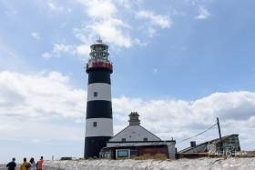
The Old Head of Kinsale Lighthouse, made famous for being the nearest point of land (11 miles/18 km) to where the RMS Lusitania was sunk in 1915, was open to the public this weekend writes Bob Bateman.

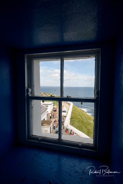
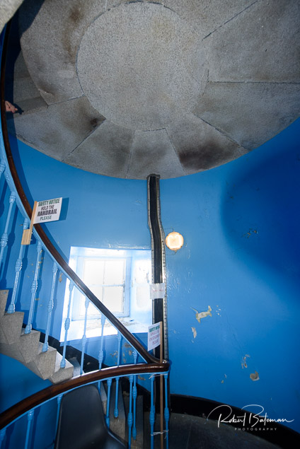
Under the supervision of a lighthouse keeper, visitors were treated to tours of the 100-foot lighthouse that boasts beautiful panoramic views of one of the country’s most scenic peninsulas, which is a highlight for visitors.

old head of Kinsale Lighthouse2

A shuttle bus service brought members of the public to and from the Old Head of Kinsale Signal Tower.

The 200-year-old Signal Tower at the Old Head has been restored to its former glory and is officially open to the public as a Lusitania Museum. The Museum exhibits artefacts recovered from the wreckage of the ship on the top floor.

The bottom floor of the narrow tower hosts an exhibition on the history of the tower itself.

old head of Kinsale Lighthouse2
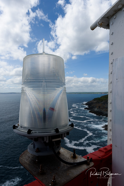
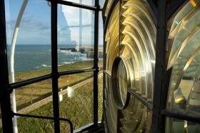
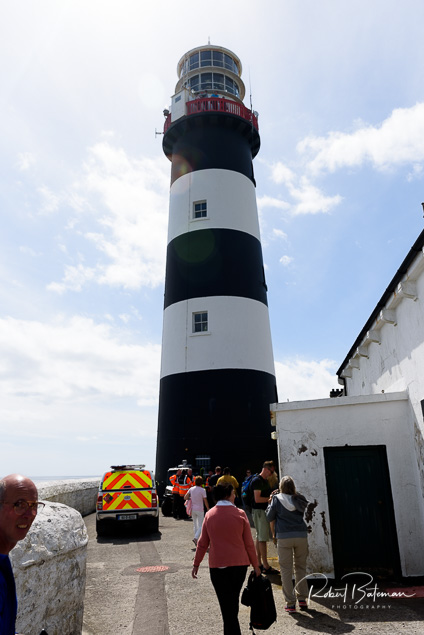
(Above and below) The tower height is 30 metres (98 ft)old head of Kinsale Lighthouse2 
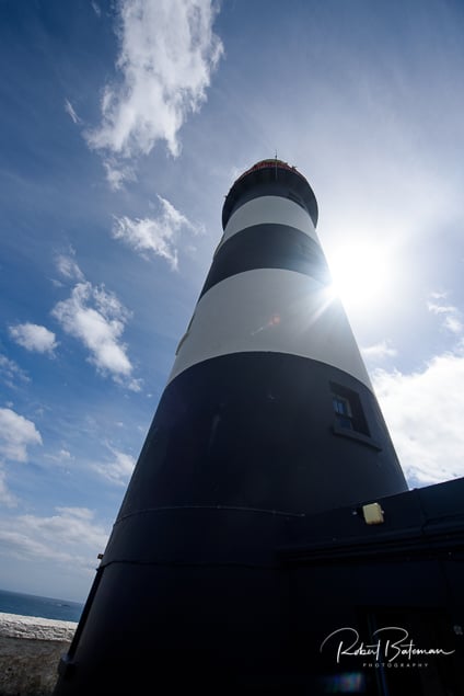
The lighthouse is painted white with black horizontal bands

old head of Kinsale Lighthouse2The lighthouse building is a cylindrical tower with a balcony and lanternold head of Kinsale Lighthouse2
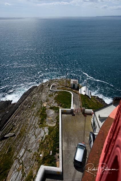
The Old Head of Kinsale Lighthouse is the nearest point of land (11 miles/18 km) to where the RMS Lusitania was sunkold head of Kinsale Lighthouse2
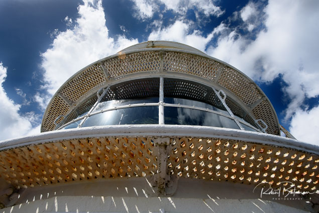
The range of the light is 20 nautical milesold head of Kinsale Lighthouse2old head of Kinsale Lighthouse2old head of Kinsale Lighthouse2
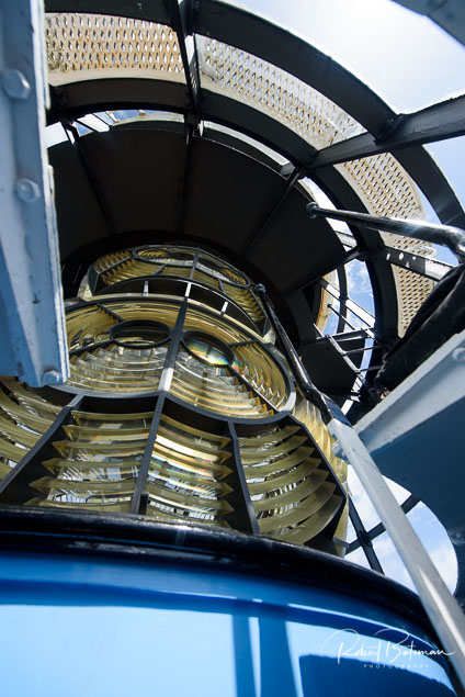
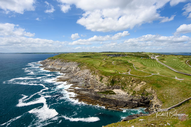
The Old Head of Kinsale is popular with golfers who come to play on its 18-hole golf course that opened in 1997
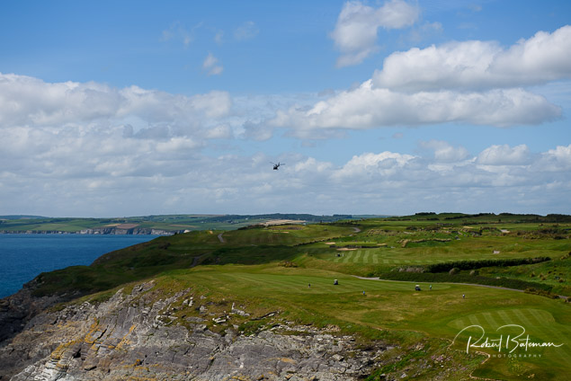
old head of Kinsale Lighthouse2

Published in Lighthouses
Tagged under

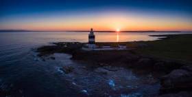
The world’s oldest original operational lighthouse at Hook Head has been developing a series of unusual events. To mark the “beginning of Spring” it celebrates Ireland’s ‘Fire Goddess', by staging the first Imbolc Festival to be celebrated at the 800-year-old lighthouse.

Now it has announced that it will host another unusual event this Good Friday - a Sunset Tour Experience.

Jutting out to sea at the tip of the Hook Peninsula on the corner of Ireland’s Ancient East, there is, the Hook Head Lighthouse people say “no better place to take in the vast seascapes and glorious colours of Ireland’s Celtic Sea.”

They are not short of words or ideas at Hook!

The Sunset Tour Experience will offer visitors the opportunity to take a guided tour up the 115 well-worn steps of the medieval tower and see its heritage come to life as they meet life-sized figures of the Monk who first kept a beacon alight at the site in the 5th century followed by the Knight who built the tower, William Marshal and hear of life as a light-keeper before stepping on to the top floor outdoor balcony to take in the 360degree sweeping views of the Southeast of Ireland as the sun goes down.

“Tours culminate with the spectacular panoramic views of the rolling seas stretching out while visitors savour Irish mead, prosecco, fresh tea and coffee along with Ballyhack smokehouse smoked salmon on homemade brown bread, a selection of homemade canapés and homemade mini desserts in the private lighthouse watch-room and balcony,” according to the announcement.

The Sunset Tours Experience is available by advance booking only. Tickets are €45.00 per person and the organisers say this is an “adult only experience.” Tickets can be booked online at www.hookheritage.ie or by calling 051 397055.

Free facilities at Hook Lighthouse in County Wexford include parking, toilets, garden picnic areas and Wifi.

Published in Lighthouses
Tagged under

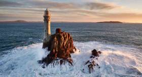
The Fastnet Rock and its lighthouse – the most southerly part of Ireland - make up one of the best-recognised maritime structures in the world writes W M Nixon. Symbol, icon, emblem, signpost of the ocean – you name it, the Fastnet is all of these things. And the slender, beautifully-engineered lighthouse itself is central to the rock’s significance.

Since 1904 – after several previous attempts at placing a light on the rock - the glow of its beam has been moving every night along the glorious coast of West Cork. It is a familiar and much-loved part of that unique region’s heritage. It is impossible to imagine the area without it. And not surprisingly, many people want it to stay totally as it is, an unchanging constant in a changing world, a part of their lives as it was part of their parents’ and grandparents’ world before them

Yet with technology always advancing, inevitably the power source for the Fastnet Rock was becoming long out-dated, and increasingly costly to run. At the Irish Lights base in Dun Laoghaire, a new LED bulb has been developed which will provide a light in a much more economical way. 

Yet if the new system is introduced, while it will still be a very powerful light, it will be one third less powerful than the present antiquated system. Naturally it is causing concern in West Cork. The Irish Times has the story here

Published in West Cork
Tagged under

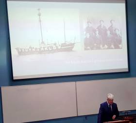
The Irish Lights issued a statement about the South Arklow Lightship that didn’t tell the full story.

Their official explanation that it was missing off station was that it had “disappeared.”

In reality it had been sunk!

Dr. Michael Kennedy of the Royal Irish Academy, who is also Executive Editor of ‘Documents on Irish Foreign Policy’, had a remarkable story to tell when he referred to the “Irish amnesiac condition” which has ignored the importance of the sea around our nation. His example, which has left a strong impression on me, is that the history of the First World War focusses strongly on the big land battles in Europe – but Ireland, the Irish coastline and seafarers were on the front line of that war… as were the men of the South Arklow Lightship.

He told me the story, which hasn’t had a lot of public attention, at a maritime history conference in University College, Cork.

Listen to Dr. Kennedy on the Podcast here and also to a tragic story about 338 sailors lost off Bloody Foreland and the rescue by RNLI of a team playing football.

• Tom MacSweeney presents THIS ISLAND NATION radio programme on local stations around Ireland

Published in Tom MacSweeney

A record number of people visited Loop Head Lighthouse on the Shannon Estuary in County Clare during 2016.

Figures from Clare County Council show that 27,274 people visited the lighthouse during the opening period up to Sunday 2 October compared to 27,010 during the same period in 2015.

The increase in visitors represents the fifth successive annual increase in visitor numbers at the West Clare landmark.

Clare County Council, which manages the Lighthouse in conjunction with the Commissioner of Irish Lights (CIL), first opened the popular visitor attraction to the public in 2011.

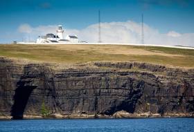
Loop Head Lighthouse, which is steeped in history and rich in maritime heritage with its origins dating back to the 1670s, is a landmark location on the Loop Head Heritage Trail. It is also one of two Signature Discovery Points in County Clare along the route of the Wild Atlantic Way and is one of 12 Great Lighthouses of Ireland that won a Silver award this week at the Responsible Tourism Awards

Published in Lighthouses
Tagged under

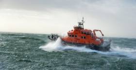
#RNLI - Rosslare Harbour RNLI's volunteer crew launched their all-weather lifeboat at 2am this morning (Wednesday 30 March) on request by the Irish Coast Guard to attend an injured man who was working on the Tuskar Rock lighthouse.

Once on scene, 8km from Rosslare Harbour, the all-weather lifeboat deployed its Y-class rescue boat to reach the landing area on the rock, but due to a heavy swell a landing was not possible.

Lifeboat operations manager David Maloney had anticipated that scenario and had already requested the coastguard helicopter Rescue 117 from Waterford.

The helicopter was quickly on scene and lifted the injured man aboard, flying him to Waterford Airport where an ambulance was waiting to transfer him to hospital.

Apart from a heavy swell, weather conditions at the time were calm with a clear dry night. The lifeboat remained in the area until the airlift was completed and then returned to base at Rosslare Europort.

Commenting after the event, Maloney said: "The lifeboat crew were quite correct in not attempting to land on the rock due to a heavy Atlantic swell. We wish the man a full recovery."

Published in RNLI Lifeboats

Loop Head Lighthouse in West Clare, one of the Great Lighthouses of Ireland, will reopen to the public this Saturday (March 12th 2016).

Clare County Council, which manages the facility in conjunction with the Commissioners of Irish Lights (CIL), says the historic lighthouse will remain open daily (10am-6pm) until October 2nd.

The popular tourist attraction attracted 26,932 visitors during 2015. The figure represents an increase of 6,564 or 32% on 2014 visitor numbers.

Loop Head Lighthouse is a landmark location on the Loop Head Heritage Trail which was named winner of the 'Culture and Heritage' category of the 2015 World Responsible Tourism Awards. It is also one of twelve lighthouses which make up Great Lighthouses of Ireland, a new all-island tourism initiative, and is one of two Signature Discovery Points in County Clare along the route of the Wild Atlantic Way.

Cllr. James Breen, Cathaoirleach of Clare County Council said the lighthouse has become "a key driver" of visitor numbers to the Loop Head Peninsula since it was first opened to the public in 2011.

He added, "Loop Head Lighthouse truly is one of the tourism success stories for County Clare in recent years. It has helped to strengthen the profile, both nationally and internationally, of the wider Loop Head Peninsula and what it has to offer as a tourism destination. Its promotion as a Signature Discovery Point along the route of the Wild Atlantic Way has also ensured that the attraction has been promoted both in Ireland and overseas, which is reflected in the origin of visitors."

Almost half of the total visitor figure during 2015 was represented by Irish visitors, with Germany, North America, UK, France and Italy collectively accounting for more than 42% of the overall figure.

Loop Head Lighthouse, located at the mouth of the Shannon Estuary, is steeped in history and rich in maritime heritage with its origins dating back to the 1670s. The existing tower style lighthouse was constructed in 1854 and was operated and maintained by a keeper who lived within the lighthouse compound. In January 1991, the lighthouse was converted to automatic operation, and today is in the care of an attendant and is also monitored by the CIL.

Admission to Loop Head Lighthouse, which includes the exhibition and guided tour of the site, is Adults (€5), Children (Under 14 - €2) and Family Passes for up to 2 adults + 3 children (€12). Visit www.loophead.ie or www.clare.ie for more information on Loop Head Lighthouse and the Loop Head Peninsula.

Published in Lighthouses
Tagged under

#lighthouses – A "brand new experience to take your breath away", that's the promise from Great Lighthouses of Ireland, a new EU INTERREG IVA funded tourism initiative being launched by the Commissioners of Irish Lights.

Featuring twelve lighthouses in stunning coastal locations, Great Lighthouses of Ireland will offer memorable, enriching experiences that inspire the senses, refresh the spirit and fire curiosity, creating a deep appreciation of the role of the sea, lighthouses, past and present, and the maritime and seafaring story of the island of Ireland.
With a range of services from accommodation to visitor centres and guided tours, visitors from home and abroad will have the chance to explore the distinct experiences offered by the lighthouses, each reflecting its own history and heritage, nature and environment, people and place, with aspects to appeal to people of all ages and interests.

The Great Lighthouses of Ireland project is supported by the European Union's INTERREG IVA cross-border Programme, managed by the Special EU Programmes Body. The ambitious and imaginative cross-border project will include the preservation and conservation of the island of Ireland's important maritime and lighthouse heritage. Great Lighthouses is built on a sustainable economic model and the re-invention of individual lighthouses as visitor attractions and specialist self-catering accommodation that can contribute to local communities in terms of jobs and specialist tourism.

Irish Lights operate over seventy lighthouses around the coast of Ireland. These lighthouses, including the Great Lighthouses of Ireland, still play a vital role in maritime safety.

Great Lighthouses of Ireland partners include the Irish Landmark Trust, the Royal Society for Protection of Birds, Forbairt Fhanada Teoranta (Fanad Community Group), Clare County Council, Ballycotton Lighthouse Tours, Mid & East Antrim Borough Council, Hook Heritage limited, Valentia Island Development Company, Kerry County Council and Clare Island Lighthouse. Great Lighthouses of Ireland is also supported by Tourism Ireland, Fáilte Ireland and Tourism Northern Ireland.

Great Lighthouses of Ireland
St John's Point, Co Donegal
Fanad Head, Co Donegal
Rathlin West Light, Co Antrim
Blackhead, Co Antrim
St John's Point, Co Down
Wicklow Head, Co Wicklow
Hook, Co Wexford
Ballycotton, Co Cork
Galley Head, Co Cork
Valentia Island, Co Kerry
Loop Head, Co Clare
Clare Island, Co Mayo

#lighhousereview – The General Lighthouse Authorities for the UK and Ireland have now completed their latest 5 yearly comprehensive review of Aids to Navigation (AtoN) requirements for the waters around Ireland and the United Kingdom. User Feedback, Automatic Identification System (AIS) traffic analysis, Targeted User Consultation, Navigational Significance Assessments, Risk Assessments and Peer Review were all used to help define ongoing User Requirements. The full document is downloadable below as a pdf document.

The following principles were applied during the review process to ensure consistency:
• Generally having one light in view is acceptable
• Generally a max range of 18 Nautical Miles is considered sufficient for most lights
• If practical there can be a reduction in amount and diversity of flash characters on lighthouse lights
• Leading Lights remain important
• Sectored Lights remain important
• Synchronised and Sequential Buoy lights can be used more
The decisions were made following consultation with users and representative organization's across the whole spectrum of the industry from large SOLAS vessels to leisure users and the fishing sector.
A summary of the changes that Irish Lights will make is as follows:
• Establish RACON at the Foyle Buoy due to increased large vessel traffic
• Open negotiations to upgrade to general AtoN status' Bloody Foreland Light as analysis has shown General Traffic is transiting the area
• Disestablish the Pollock Buoy as the Power South Cardinal has made this Buoy redundant
• Replace the Briggs Port Hand Buoy with a North Cardinal Buoy to provide a clearer indication of the position of the danger
• Establish a Buoy in place of the Unlit Carrigavadra Beacon
• Sequence Buoyage at the entrance to Rosslare
Capt. Harry McClenahan Navigation Manager at Irish Lights said "The rate of technological changes in navigation support systems and materials has had a significant and positive effect on the services that Irish Lights provides to the Mariner, allowing for higher performance yet lower power demands from our stations. We are in the embryonic phase of the evolution of digital systems which are already starting to shape the future of marine navigation and communications. To ensure that safety of persons and property and environmental protection remain as the main focus for future navigation services we use our resources, experience and competency to explore and trial new systems and materials."

The 2015 Aids to Navigation Review was launched yesterday at the Joint Users Consultative Group Meeting in Trinity House London. The changes will be phased in over the coming years and will be fully promulgated in advance by Notice to Mariners. 

Published in Lighthouses
Tagged under

#loophead – Former RTE newsreader and lighthouse enthusiast, Anne Doyle was in West Clare today where she joined Councillor John Crowe, Cathaoirleach of Clare County Council, in launching Loop Head Lighthouse's 2015 tourist season.

The historic landmark commenced its 5th year of operations when it reopened to the public on 03 April last. Clare County Council, which manages Loop Head Lighthouse in conjunction with the Commissioners of Irish Lights (CIL), says the facility will remain open daily (10am-6pm) until 4th October 2015.

Anne Doyle has been captivated by lighthouses since her childhood in Ferns, County Wexford, where she grew up observing the sweeping lights of the Tuskar Rock Lighthouse.

"Ireland's lighthouses hold so much history and are located in some of Western Europe's most scenic settings. Loop Head is no exception and the location of the lighthouse on the tip of the majestic Loop Head Peninsula and at the mouth of the Shannon Estuary makes it extra special," said Ms. Doyle.

Commenting on the launch of the 2015 visitor season, Councillor John Crowe said: "The 19th century West Clare landmark will be looking to capitalise on its designation as a Signature Discovery Point on the Wild Atlantic Way and further promote the economic development of the Loop Head Peninsula."

"Visitor numbers at the lighthouse have continued grow year on year since it was first opened to the public in 2011. During this time the lighthouse has delivered a major boost to economic activity in the wider area and I am confident it will further build on this in the months and years ahead," he added.

Loop Head Lighthouse is steeped in history and rich in maritime heritage with its origins dating back to the 1670s. The existing tower style lighthouse was constructed in 1854 and was operated and maintained by a keeper who lived within the lighthouse compound. Taoiseach Enda Kenny's grandfather was a keeper at the lighthouse. James John McGinley took up duty at the Lighthouse as Principal Keeper on 16th January 1933. He spent 1 year and 10 months at Loop Head. He was transferred from the station in October 1934.

Located to the rear of the lighthouse is an Éire sign etched into the headland, which was used to alert passing Allied aircrews that they were passing over neutral Ireland during World War Two.

In January 1991, the lighthouse was converted to automatic operation, and today is in the care of an attendant and is also monitored by the CIL.

Published in Lighthouses
Tagged under
Page 2 of 5

General Information on using Waterways Ireland inland navigations

Safety on the Water

All users of the navigations are strongly recommended to make themselves aware of safety on the water for whatever activity they are involved in and to read the advice offered by the various governing bodies and by:

The Dept. of Transport, Ireland: www.gov.ie/transport and The Maritime and Coastguard Agency, UK, The RNLI – Water Safety Ireland for information in terms of drowning prevention and water safety.

Registration of Vessels

All vessels using the Shannon Navigation, which includes the Shannon-Erne Waterways and the Erne System must be registered with Waterways Ireland. Only open undecked boats with an engine of 15 horsepower or less on the Shannon Navigation, and vessels of 10 horsepower or less on the Erne System, are exempt. Registration is free of charge.

Craft registration should be completed online at: https://www.waterwaysireland.org/online-services/craft-registration

Permits for use of the Grand and Royal Canals and the Barrow Navigation

All vessels using the Grand and Royal Canals and the Barrow Navigation must display appropriate valid Permit(s) i.e A Combined Mooring and Passage Permit (€126) and if not intending to move every five days, an Extended Mooring Permit (€152).

Permit applications should be completed online at: https://www.waterwaysireland.org/online-services/canal-permits

Passage on the Royal and Grand Canals – Dublin Area

For boat passage through the locks east of Lock 12 into / out of Dublin on either the Royal or Grand Canals, Masters are requested to contact the Waterways Ireland Eastern Regional Office (M-F 9.30am-4.30pm) on tel: +353(0)1 868 0148 or email [email protected] prior to making passage in order to plan the necessary lock-keeping assistance arrangements.

On the Grand Canal a minimum of two days notice prior to the planned passage should be given, masters should note that with the exception of pre-arranged events, a maximum of 2 boats per day will be taken through the locks, travelling either east or west.

Movements in or out of the city will be organised by prior arrangement to take place as a single movement in one day. Boaters will be facilitated to travel the system if their passage is considered to be safe by Waterways Ireland and they have the valid permit(s) for mooring and passage.

Newcomen Lifting Bridge

On the Royal Canal two weeks’ notice of bridge passage (Newcomen Lifting Bridge) is required for the pre-set lift date, and lock assistance will then also be arranged. A minimum of 2 boats is required for a bridge lift to go ahead.

Waterways Ireland Eastern Regional Office (Tel: +353(0)1 868 0148 or [email protected] ) is the point of contact for the bridge lift.

A maximum number of boats passing will be implemented to keep to the times given above for the planned lifts (16 for the Sat / Sun lifts & 8 for the weekday lifts). Priority will be given on a first come first served basis.

On day of lift, boaters and passengers must follow guidance from Waterways Ireland staff about sequence of passage under bridge & through Lock 1, and must remain within signed and designated areas.

Events Held on the Waterways

All organised events taking place on the waterways must have the prior approval of Waterways Ireland. This is a twelve week process and application forms must be accompanied with the appropriate insurance, signed indemnity and risk assessment. The application should be completed on the Waterways Ireland events page at :

https://www.waterwaysireland.org/online-services/event-approval

Time Limits on Mooring in Public Harbours

On the Shannon Navigation and the Shannon-Erne Waterway craft may berth in public harbours for five consecutive days or a total of seven days in any one month.

On the Erne System, revised Bye Laws state that: No master or owner shall permit a vessel, boat or any floating or sunken object to remain moored at or in the vicinity of any public mooring, including mooring at any other public mooring within 3 kilometres of that location, for more than 3 consecutive days and shall not moor at that same mooring or any other public mooring within 3 kilometres of that location within the following 3 consecutive days without prior permission by an authorised official.

Winter Mooring on the Shannon Navigation and Shannon Erne Waterway

Winter mooring may be availed of by owners during the period 1 Nov to 31 Mar by prior arrangement and payment of a charge of €63.50 per craft. Craft not availing of Winter Mooring must continue to comply with the “5 Day Rule”. Winter Mooring applications should be completed online at : https://www.waterwaysireland.org/online-services/winter-moorings-booking

Owners should be aware that electricity supply and water supply to public moorings is disconnected for the winter months. This is to protect against frost damage, to reduce running costs and to minimise maintenance requirements during the winter months.

Vessel owners are advised that advance purchasing of electricity on the power bollards leading up to the disconnection date should be minimal. Electricity credit existing on the bollards will not be recoverable after the winter decommissioning date. Both services will be reinstated prior to the commencement of the next boating season.

Smart Cards

Waterways Ireland smart cards are used to operate locks on the Shannon Erne Waterway, to access the service blocks, to use the pump-outs along the navigations, to avail of electrical power at Waterways Ireland jetties.

Berthing in Public Harbours

Masters are reminded of the following:

  • Equip their vessel with mooring lines of appropriate length and strength and only secure their craft to mooring bollards and cleats provided for this purpose.
  • Ensure the available berth is suitable to the length of your vessel, do not overhang the mooring especially on finger moorings on floating pontoon moorings.
  • Ensure mooring lines, electric cables and fresh water hoses do not create a trip hazard on public jetties for others users.
  • Carry sufficient fenders to prevent damage to your own vessel, other vessels and WI property.
  • Allow sufficient space between your vessel and the vessel ahead /astern (c.1m) for fire safety purposes and /or to recover somebody from the water.
  • Do not berth more than two vessels side by side and ensure there is safe access/egress at all times between vessels and onto the harbour itself.
  • Do not berth in such a way to prevent use of harbour safety ladders, slipways or pump-outs.
  • Do not allow the bow of your vessel to overhang the walkway of a floating mooring thus creating a hazard for others with an overhanging anchor or bow fendering.
  • Animals are not allowed to be loose or stray at any time.
  • Harbour and jetty infrastructure such as railings, power pedestals, fresh water taps, electric light poles, safety bollards, ladders etc are not designed for the purpose of mooring craft , they will not bear the strain of a vessel and will be damaged.
  • At Carrybridge on the Erne System, Masters of vessels are not permitted to use stern on mooring. Masters of vessels must use the mooring fingers for mooring of vessels and for embarkation / disembarkation from vessels.

Passenger Vessel Berths

Masters of vessels should not berth on passenger vessel berths where it is indicated that an arrival is imminent. Passenger vessels plying the navigations generally only occupy the berths to embark and disembark passengers and rarely remain on the berths for extended periods or overnight.

Lock Lead-in Jetties

Lead-in jetties adjacent to the upstream and downstream gates at lock chambers are solely for the purpose of craft waiting to use the lock and should not be used for long term berthing.

Vessel Wake

Vessel wake, that is, the wave generated by the passage of the boat through the water, can sometimes be large, powerful and destructive depending on the hull shape and engine power of the vessel. This wake can be detrimental to other users of the navigation when it strikes their craft or inundates the shoreline or riverbank. Masters are requested to frequently look behind and check the effect of their wake / wash particularly when passing moored vessels, on entering harbours and approaching jetties and to be aware of people pursuing other activities such as fishing on the riverbank.

Speed Restriction

A vessel or boat shall not be navigated on the Shannon Navigation at a speed in excess of 5 kph when within 200 metres of a bridge, quay, jetty or wharf, when in a harbour or canal or when passing within 100 metres of a moored vessel or boat.

Vessels navigating the Shannon-Erne Waterway should observe the general 5 kph speed limit which applies along the waterway. This is necessary in order to prevent damage to the banks caused by excessive wash from vessels.

Vessels navigating the Erne System should observe the statutory 5kt / 6mph / 10kph speed limit areas.

A craft on the Royal and Grand canals shall not be navigated at a speed in excess of 6km per hour.

A craft on the Barrow Navigation shall not be navigated at a speed in excess of 11km per hour except as necessary for safe navigation in conditions of fast flow.

Bank Erosion

Narrow sections of all the navigations are particularly prone to bank erosion due to the large wash generated by some craft. Masters are requested to be vigilant and to slow down to a speed sufficient to maintain steerage when they observe the wash of their craft inundating the river banks.

Unusual Waterborne Activity

Unusual waterborne vessels may be encountered from time to time, such as, hovercraft or amphibious aircraft / seaplanes. Masters of such craft are reminded to apply the normal “Rule of the Road” when they meet conventional craft on the water and to allow extra room to manoeuvre in the interest of safety.

Sailing Activity

Mariners will encounter large numbers of sailing dinghies from late June to August in the vicinity of Lough Derg, Lough Ree and Lower Lough Erne. Sailing courses are marked by yellow buoys to suit weather conditions on the day. Vessels should proceed at slow speed and with due caution and observe the rules of navigation when passing these fleets, as many of the participants are junior sailors under training.

Rowing

Mariners should expect to meet canoes and vessels under oars on any part of the navigations, but more so in the vicinity of Athlone, Carrick-on-Shannon, Coleraine, Enniskillen and Limerick. Masters are reminded to proceed at slow speed and especially to reduce their wash to a minimum when passing these craft as they can be easily upset and swamped due to their very low freeboard and always be prepared to give way in any given traffic situation.

Canoeing

Canoeing is an adventure sport and participants are strongly recommended to seek the advice of the sport’s governing bodies i.e Canoeing Ireland and the Canoe Association of Northern Ireland, before venturing onto the navigations.

Persons in charge of canoes are reminded of the inherent danger to these craft associated with operating close to weirs, sluice gates, locks and other infrastructure particularly when rivers are in flood and large volumes of water are moving through the navigations due to general flood conditions or very heavy localised precipitation e.g. turbulent and broken water, stopper waves. Shooting weirs is prohibited without prior permission of Waterways Ireland.

Canoeists should check with lockkeepers prior entering a lock to ensure passage is done in a safe manner. Portage is required at all unmanned locks.

Canoe Trail Network – "Blueways"

Masters of powered craft are reminded that a canoe trail network is being developed across all navigations and to expect more organised canoeing along these trails necessitating slow speed and minimum wash when encountering canoeists, rowing boats etc

Rockingham and Drummans Island Canals – Lough Key

It is expected that work on Rockingham and Drummans Island Canals on Lough Key will be completed in 2021. Access to these canals will be for non-powered craft only, eg canoes, kayaks, rowing boats.

Fast Powerboats and Personal Watercraft (Jet Skis)

Masters of Fast Powerboats (speed greater than 17kts) and Personal Watercraft (i.e.Jet Skis) are reminded of the inherent dangers associated with high speed on the water and especially in the confines of small bays and narrow sections of the navigations. Keeping a proper look-out, making early alterations to course and /or reducing speed will avoid conflict with slower vessels using the navigation. Personal Watercraft are not permitted to be used on the canals.

Towing Waterskiers, Wakeboarders, Doughnuts etc

Masters of vessels engaged in any of these activities are reminded of the manoeuvring constraints imposed upon their vessel by the tow and of the added responsibilities that they have to the person(s) being towed. These activities should be conducted in areas which are clear of conflicting traffic. It is highly recommended that a person additional to the master be carried to act as a “look-out” to keep the tow under observation at all times.

Prohibition on Swimming

Swimming in the navigable channel, particularly at bridges, is dangerous and is prohibited due to the risk of being run over by a vessel underway in the navigation.

Age Restrictions on operating of powered craft

In the Republic of Ireland, Statutory Instrument 921 of 2005 provides the legal requirements regarding the minimum age for operating of powered craft. The Statutory Instrument contains the following requirements:

- The master or owner of a personal watercraft or a fast power craft shall take all reasonable steps to ensure that a person who has not attained the age of 16 years does not operate or control the craft

- The master or owner of a pleasure craft powered by an engine with a rating of more than 5 horse power or 3.7 kilowatts shall take all reasonable steps to ensure that a person who has not attained the age of 12 years does not operate or control the craft.

Lifejackets and Personal Flotation Devices (PFDs)

Lifejackets and PFD’s are the single most important items of personal protective equipment to be used on a vessel and should be worn especially when the vessel is being manoeuvred such as entering / departing a lock, anchoring, coming alongside or departing a jetty or quayside.

In the Republic of Ireland, Statutory Instrument 921 of 2005 provides the legal requirements regarding the wearing of Personal Flotation Devices. The Statutory Instrument contains the following requirements:

- The master or owner of a pleasure craft (other than a personal watercraft) shall ensure, that there are, at all times on board the craft, sufficient suitable personal flotation devices for each person on board.

- A person on a pleasure craft (other than a personal watercraft) of less than 7 metres length overall shall wear a suitable personal flotation device while on board an open craft or while on the deck of decked craft, other than when the craft is made fast to the shore or at anchor.

- The master or owner of a pleasure craft (other than a personal watercraft) shall take all reasonable steps to ensure that a person who has not attained the age of 16 years complies with paragraph above.

- The master or owner of a pleasure craft (other than a personal watercraft), shall take all reasonable steps to ensure that a person who has not attained the age of 16 years wears a suitable personal flotation device while on board an open craft or while on the deck of a decked craft other than when it is made fast to the shore or at anchor.

- The master or owner of a pleasure craft (other than a personal watercraft) shall take all reasonable steps to ensure that a person wears a suitable personal flotation device, at all times while – (a) being towed by the craft, (b) on board a vessel or object of any kind which is being towed by the craft.

Further information is available at: http://www.irishstatutebook.ie/eli/2005/si/921/made/en/print

Firing Range Danger Area – Lough Ree

The attention of mariners is drawn to the Irish Defence Forces Firing Range situated in the vicinity of buoys No’s 2 and 3, on Lough Ree on the Shannon Navigation. This range is used regularly for live firing exercises, throughout the year, all boats and vessels should stay clear of the area marked with yellow buoys showing a yellow "X" topmark and displaying the word "Danger".

Shannon Navigation, Portumna Swing Bridge Tolls

No attempt should be made by Masters’ of vessels to pay the bridge toll while making way through the bridge opening. Payment will only be taken by the Collector from Masters when they are secured alongside the jetties north and south of the bridge.

Navigating from Killaloe to Limerick on the Shannon Navigation

The navigation from Killaloe to Limerick involves passage through Ardnacrusha locks, the associated headrace and tailrace and the Abbey River into Limerick City. Careful passage planning is required to undertake this voyage. Considerations include: lock passage at Ardnacrusha, water flow in the navigation, airdraft under bridges on Abbey River in Limerick, state of tide in Limerick

Users are advised to contact the ESB Ardnacrusha hydroelectric power station (00353 (0)87 9970131) 48 hours in advance of commencing their journey to book passage through the locks at Ardnacrusha. It is NOT advised to undertake a voyage if more than one turbine is operating (20MW), due to the increased velocity of flow in the navigation channel, which can be dangerous. To ascertain automatically in real time how many turbines are running, users can phone +353 (0)87 6477229.

For safety reasons the ESB has advised that only powered craft with a capacity in excess of 5 knots are allowed to enter Ardnacrusha Headrace and Tailrace Canals.

Passage through Sarsfield Lock should be booked on +353-87-7972998, on the day prior to travel and it should be noted also that transit is not possible two hours either side of low water.

A Hydrographic survey in 2020 of the navigation channel revealed that the approach from Shannon Bridge to Sarsfield Lock and the Dock area has silted up. Masters of vessels and water users are advised to navigate to the Lock from Shannon bridge on a rising tide one or two hours before High Tide.

Lower Bann Navigation

The attention of all users is drawn to the “Users Code for the Lower Bann”, in particular to that section covering “Flow in the River” outlining the dangers for users both on the banks and in the navigation, associated with high flow rates when the river is in spate. Canoeists should consult and carry a copy of the “Lower Bann Canoe Trail” guide issued by the Canoe Association of Northern Ireland. Users should also contact the DfI Rivers Coleraine, who is responsible for regulating the flow rates on the river, for advisory information on the flow rates to be expected on any given day.

DfI Rivers Coleraine. Tel: 0044 28 7034 2357 Email: [email protected]

Lower Bann Navigation – Newferry – No wake zone

A No Wake Zone exists on the Lower Bann Navigation at Newferry. Masters of vessels are requested to proceed at a slow speed and create no wake while passing the jetties and slipways at Newferry.

Overhead Power Lines (OHPL) and Air draft

All Masters must be aware of the dangers associated with overhead power lines, in particular sailing vessels and workboats with cranes or large air drafts. Voyage planning is a necessity in order to identify the location of overhead lines crossing the navigation.

Overhead power line heights on the River Shannon are maintained at 12.6metres (40 feet) from Normal Summer level for that section of navigation, masters of vessels with a large air draft should proceed with caution and make additional allowances when water levels are high.

If a vessel or its equipment comes into contact with an OHPL the operator should NOT attempt to move the vessel or equipment. The conductor may still be alive or re-energise automatically. Maintain a safe distance and prevent third parties from approaching due to risk of arcing. Contact the emergency services for assistance.

Anglers are also reminded that a minimum ground distance of 30 metres should be maintained from overhead power lines when using a rod and line.

Submarine Cables and Pipes

Masters of vessels are reminded not to anchor their vessels in the vicinity of submarine cables or pipes in case they foul their anchor or damage the cables or pipes. Look to the river banks for signage indicating their presence.

Water Levels - Precautions

Low Water Levels:

When water levels fall below normal summer levels masters should be aware of:

Navigation

To reduce the risk of grounding masters should navigate on or near the centreline of the channel, avoid short cutting in dog-legged channels and navigating too close to navigation markers.

Proceeding at a slow speed will also reduce “squat” effect i.e. where the vessel tends to sit lower in the water as a consequence of higher speed.

Slipways

Reduced slipway length available under the water surface and the possibility of launching trailers dropping off the end of the concrete apron.

More slipway surface susceptible to weed growth requiring care while engaged in launching boats, from slipping and sliding on the slope. Note also that launching vehicles may not be able to get sufficient traction on the slipway once the craft is launched to get up the incline.

Bank Erosion

Very dry riverbanks are more susceptible to erosion from vessel wash.

Lock Share

Maximising on the number of vessels in a lock will ensure that the total volume of water moving downstream is decreased. Lock cycles should be used for vessels travelling each way.

High Water Levels:

When water levels rise above normal summer level masters should be aware of:

Navigation

Navigation marks will have reduced height above the water level or may disappear underwater altogether making the navigable channel difficult to discern.

In narrow sections of the navigations water levels will tend to rise more quickly than in main streams and air draft at bridges will likewise be reduced.

There will also be increased flow rates particularly in the vicinity of navigation infrastructure such as bridges, weirs, locks etc where extra care in manoeuvring vessels will be required.

Harbours and Jetties

Due care is required in harbours and at slipways when levels are at or near the same level as the harbour walkways' as the edge will be difficult to discern especially in reduced light conditions. It is advised that Personal Flotation Devices be worn if tending to craft in a harbour in these conditions.

Slipways

Slipways should only be used for the purpose of launching and recovering of water craft or other objects from the water. Before using a slipway it should be examined to ensure that the surface has sufficient traction/grip for the intended purpose such as launching a craft from a trailer using a vehicle, that there is sufficient depth of water on the slipway to float the craft off the trailer before the concrete apron ends and that the wheels of the trailer do not drop off the edge of the slipway. That life-saving appliances are available in the vicinity, that the vehicle is roadworthy and capable of coping with the weight of the trailer and boat on the incline. It is recommended that slipway operations are conducted by two persons.

Caution to be Used in Reliance upon Aids to Navigation

The aids to navigation depicted on the navigation guides comprise a system of fixed and floating aids to navigation. Prudent mariners will not rely solely on any single aid to navigation, particularly a floating aid to navigation. With respect to buoys, the buoy symbol is used to indicate the approximate position of the buoy body and the ground tackle which secures it to the lake or river bed. The approximate position is used because of the practical limitations in positioning and maintaining buoys in precise geographical locations. These limitations include, but are not limited to, prevailing atmospheric and lake/river conditions, the slope of and the material making up the lake/river bed, the fact that the buoys are moored to varying lengths of chain, and the fact that the buoy body and/or ground tackle positions are not under continuous surveillance. Due to the forces of nature, the position of the buoy body can be expected to shift inside and outside the charted symbol.

Buoys and perches are also moved out of position or pulled over by those mariners who use them to moor up to instead of anchoring. To this end, mariners should always monitor their passage by relating buoy/perch positions with the published navigation guide. Furthermore, a vessel attempting to pass close by always risks collision with a yawing buoy or with the obstruction that the buoy or beacon/perch marks.

Masters of Vessels are requested to use the most up to date Navigation guides when navigating on the Inland Waterways.

Information taken from Special Marine Notice No 1 of 2023