


Displaying items by tag: Salmon
New Study Reveals Migration Route of Atlantic Salmon at Sea
A new study published this month by the scientific journal Nature reveals the marine migration route of Atlantic salmon in the North Atlantic, including Irish salmon.
The study in Nature’s open-access Scientific Reports, led by the Arctic University of Norway, comprises cooperative research study by 10 universities and institutions across Europe, including Inland Fisheries Ireland (IFI).
It involved tagging 204 salmon kelts with satellite tags across seven European countries and the east coast of North America — including salmon from the Barrow, Nore, Suir and Blackwater rivers in Ireland — and tracked them during their oceanic migration.
Salmon travelled to oceanic fronts, but with specific patterns, the study says. Norwegian and Danish salmon rapidly migrate north and north-west toward the North Atlantic Ocean between Iceland and Svalbard. In contrast, Irish salmon migrated primarily westward towards south and east Greenland.
Despite the variation in migration patterns among populations, most individual salmon migrated to polar ocean frontal areas, the study says.
One of the authors of the study, Dr Paddy Gargan of IFI, says: “As we know, water temperatures have increased in the north Atlantic over the last few decades. This new research is suggesting that this type of climate change may have greater impact on salmon populations originating further south, like Ireland.
 Patrick Gargan is a senior research officer with Inland Fisheries Ireland
“This is because distances and time required to travel to feeding areas will increase if the boundary between Atlantic and Arctic waters move northward because of ocean warming.”
The study found that salmon released further south tended to cover longer migration distances, with a straight-line distance tracked as far as 2,400km for one salmon tagged from the River Suir.
Tagged salmon spent 80% of their time foraging at the surface and performed occasional dives of up to 870m.
Overall, populations closest in proximity tended to converge in their oceanic feeding area, but taken together the salmon populations exploit a very large part of the ocean.
Given that Atlantic salmon from different geographic locations feed in distinct areas at sea, they experience different temperature regimes. For example, Irish salmon experienced much warmer temperatures, ranging from 5 to 16°C, than Norwegian and Danish salmon which experienced temperatures ranging from 0 to 11°C.
These differences not only contribute to variation in growth and survival across populations, but also are likely to affect Atlantic salmon populations differently with changing climate.
 Map from the study showing that tagged Irish salmon primarily migrated westward towards east Greenland
Southernmost populations, like those of Ireland, are more at risk than northernmost populations as migration distances are likely to become longer, or more variable, thereby decreasing feeding time, with important consequences for the marine survival and productivity of different populations.
Taken together, these findings suggest that a common marine factor responsible for the decline in Atlantic salmon is unlikely. Importantly, this means conservation efforts should be focused locally, such as during the freshwater phase.
Dr Cathal Gallagher, head of research with IFI, explains why the State agency was keen to support the study: “Although the Atlantic salmon is one of the world’s most studied fish, detailed knowledge of its migration route at sea has been limited until now.
“This important large-scale study highlights the vulnerability of salmon populations to climate change and emphasises the need for continued conservation, to protect Atlantic salmon and its habitats.”
The full study — Redefining the oceanic distribution of Atlantic salmon — can be found at Nature.com
Appeal for Reports of Red Skin Disease in Salmon as Cases Suspected in Three Provinces
Reports have emerged of wild salmon showing signs of red skin disease in three provinces, according to Inland Fisheries Ireland (IFI).
Low incidences of red skin disease (RSD) were first documented in 2019 in several European salmon stocks. In Ireland last year suspected incidences of RSD were reported in 113 salmon from 12 rivers throughout the country.
The majority of these reports were in June and July with only occasional incidences reported prior to and after this time.
Salmon affected by RSD have a characteristic red-spotted rash on their underbelly and may appear lethargic or moribund. The rash can either be localised or extend along some or most the length of the fish.
As the disease progresses, skin lesions, signs of bleeding and skins ulcers can develop primarily along the belly area and extend to the head and tail. Secondary fungal infection can further develop which may ultimately result in death of the salmon.
 A salmon from the River Corrib showing early signs of the disease in 2019 | Credit: IFI
The latest reports involve small numbers of individual fresh-run wild salmon encountered in the River Deel, in the Moy Catchment in Co Mayo and in the River Boyne.
IFI staff are continuing to liaise with the Fish Health Unit in the Marine Institute and international colleagues to monitor and respond to the situation.
Anglers and fishery owners are asked to report any incidences of salmon with signs of RSD to IFI to help determine the occurrence of the disease nationally.
Fishers who capture such salmon are advised to follow normal biosecurity procedures and disinfect tackle, waders and equipment. Until the cause of the disease has been determined and the risk of spreading the disease established, affected salmon should not be removed from the water.
IFI is appealing to anglers to forward any reports of salmon with signs of RSD along with photographs and an estimate of fish weight to [email protected] or on IFI’s 24-hour confidential hotline number at 1890 34 74 24 or 1890 FISH 24.
It could be years before a river at the centre of a recent suspected agricultural pollution incident in Co Tyrone is fully recovered, as the Belfast Telegraph reports.
The fish kill in the Aughlish River discovered over the May Bank Holiday weekend covered a five-mile stretch of the Northern Ireland waterway between Dromore and Fintona, with reports of thousands of dead brown trout and young salmon to the Loughs Agency.
Omagh Anglers secretary Terry Smithson said the incident was “devastating”. He estimated that five years of salmon stock had been lost and it could be as many as three years before the waterway recovers.
The Belfast Telegraph has more on the story HERE.
Licences Required to Deal with Cormorants Predating on Salmon Smolts in Northern Ireland, Loughs Agency Advises
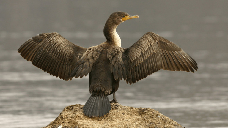
The Loughs Agency says it shares its stakeholders’ concerns about the impact of cormorants predating on juvenile salmon during the annual smolt migration.
Unlike other salmon predators, cormorants are a protected species under Article 4 of the Wildlife (Northern Ireland) Order 1985.
Given the legal protection of this marine wildlife species, the management and population surveys are the responsibility of the Wildlife Section of the Biodiversity and Conservation Science Unit, Northern Ireland Environment Agency (NIEA) and their counterparts in the National Parks and Wildlife Service (NPWS).
Angling clubs and fishery managers in Northern Ireland should be aware of the process to apply for the appropriate licence to assist in managing these birds and other actions, including scaring the birds to move them on, after agreement with wildlife officers from NIEA.
The NIEA advises that under Article 18 of the Wildlife (Northern Ireland) Order 1985, an application can only be legally processed if it can be shown that:
- There is no other satisfactory solution, and;
- The licence is issued to prevent serious damage to a fishery.
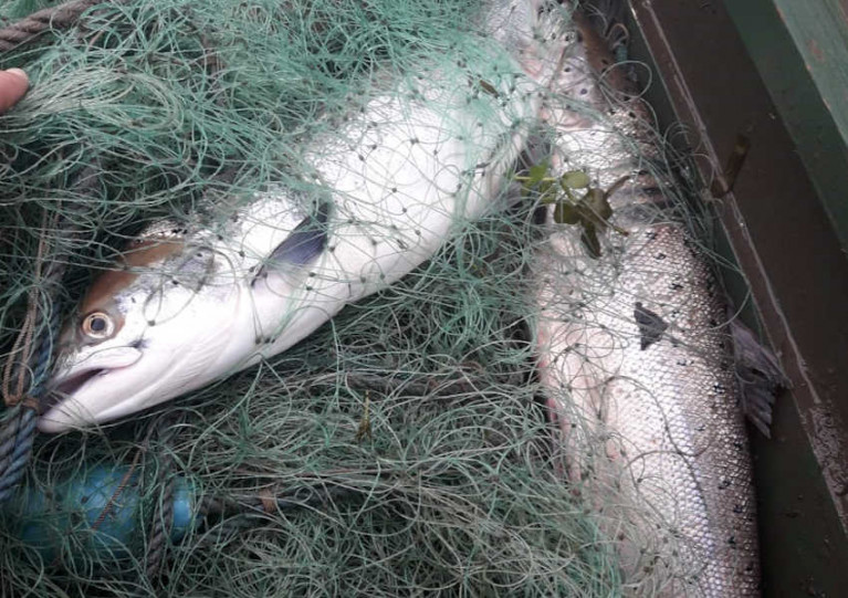
Inland Fisheries Ireland (IFI) recently secured two separate convictions for illegal netting of salmon on the Barrow and Nore rivers respectively.
At a sitting of Kilkenny District Court on Tuesday 23 February 2021, Richie Lennon of New Ross, Co Wexford was fined €300 together with a €500 contribution towards costs following a prosecution taken by IFI.
Lennon pleaded guilty to the offences of illegal netting, the possession/control of four salmon and the refusal to give the name and address of another person when lawfully demanded.
The breaches of fisheries legislation occurred on 22 July 2020 on the River Barrow near Bauck in Co Carlow.
IFI fisheries officers outlined the facts of the case to the court and how Lennon had been observed in the act of illegal netting on the River Barrow, attempting to capture salmon.
Evidence in relation to the offence was given before Judge Carthy. Following the conviction, details of a previous prosecution against Lennon which had been dealt with at Wexford District Court on 15 April 2014 when the Probation Act had been applied was identified.
Judge Carthy made it clear to Lennon that if he appears in court again on similar offences, she will consider a prison sentence.
‘On the River Barrow and the River Nore, salmon stocks are well below their conservation limit and require protection’
On the same day in Kilkenny District Court, Michael Hynes of Ballybeg, Co Waterford was fined €300 together with a €500 contribution after he pleaded guilty to the offences of illegal netting, the possession of seven salmon and the refusal to give the name and address of another person when lawfully demanded.
The breaches of fisheries legislation here occurred on 22 June 2020 on the River Nore, in the townland of Clonamery, Co Kilkenny.
Evidence in relation to the offence was given before Judge Carthy sitting at Kilkenny District Court. IFI officers outlined the facts of the case to the court that Mr Hynes was apprehended and found to be in possession of seven dead salmon in his vehicle.
Lynda Connor, director of the South Eastern River Basin District at IFI, said: “I would like to commend the fisheries officers’ efforts and continuous commitment to protecting salmon.
“On the River Barrow and the River Nore, salmon stocks are well below their conservation limit and require protection. This type of illegal activity can have devastating effects on future stocks of salmon.
“These two convictions highlight the ongoing issue of illegal netting for salmon and IFI’s zero tolerance of this serious misconduct.”
While some anglers enjoyed success on the rivers within Foyle and Carlingford in 2020, the Loughs Agency says it continues to take a precautionary approach in line with national and international trends.
The State of the Salmon Report published by the international lead on salmon management, the North Atlantic Salmon Conservation Organization (NASCO), highlights the worrying and continuous decline in the populations of the Atlantic salmon.
NASCO states: “It now takes about double the amount of eggs to produce one adult (compared to 1990s) that will return to that same river to spawn — an indication of the multiple pressures facing the species throughout its complex life cycle.”
This decline continues to be reflected locally, the Loughs Agency warns, with rivers such as the Finn in Co Donegal failing to reach their conservation targets in 2020 and therefore will continue to operate on a catch and release basis for the 2021 season.
Now the agency is calling on anglers to take steps to ensure sustainability of the fisheries of Foyle and Carlingford. Anglers are encouraged to:
- Update their catch return and fishing effort regularly throughout the season on the eLicence website. This data is used to help Loughs Agency manage the fishery using real-time data.
- Keep the Loughs Agency’s 24hr Response Line telephone number +(0) 44 2871 342100 as a contact on their phone and report any concerns directly and promptly. The Loughs Agency relies on reports of illegal fishing and pollution from the public.
- Practice catch and release. Many anglers already do this, with around 45% of anglers not taking carcass tags when they purchase their licence.
- Implement biosecurity measures to prevent the spread of invasive species.
- For the 2021 season, the Loughs Agency is issuing a maximum of one blue tag for the period 1 March to 31 May and/or a maximum two black tags for the period 1 June to 31 October, depending on the type of licence purchased. Tackle shops have been instructed not to issue more than these maximum quantities for the 2021 season.
The rivers Film and Foyle opened this past Monday 1 March, signalling the start of the salmon, sea trout and wild brown trout angling season. However, game, coarse and sea angling is already available in both catchments.
For still water game anglers, Binevenagh Lake opened on 1 February. The lake lies on a basalt plateau that towers over Lough Foyle and its flanking lowlands below with the famed hills of Donegal beyond.
The 3.2 hectare lake is regularly stocked with rainbow trout by DAERA Inland Fisheries and successful flies include Bibio and Buzzer patterns.
Fly fishing, spinning and worm fishing are permitted and the fishery has a daily bag limit of four trout per rod. A Loughs Agency game rod licence and a DAERA game angling permit are required to fish this water.
Some private fisheries are also operating and offer fishing for rainbow trout including Ballyheather, Altmore, Birchwood, Cashel, Termon, Oaks, Glenowen, and Duncrun Fishery in the Foyle area. In the Carlingford area, Donaghaguy Reservoir is open for trout fishing. A Loughs Agency game licence and a permit from the relevant fishery are required to fish these waters.
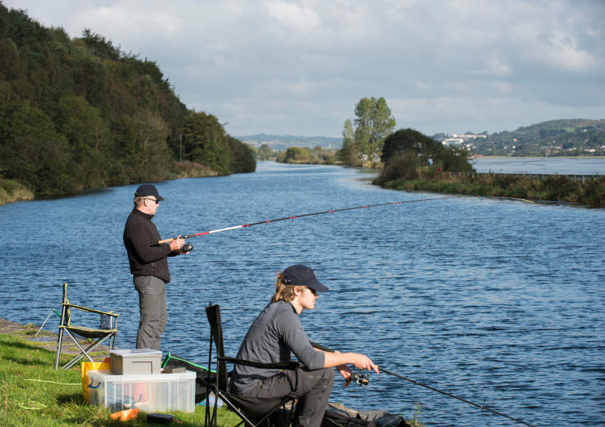 Coarse angling on the Newry Canal | Photo: Loughs Agency
Coarse angling is permitted all year round, but the climate impacts on which species can be targeted. While tench, bream and rudd are active in warmer weather, roach and perch feed in all seasons and make good year round fishing for the coarse angler.
In the Foyle area, coarse fishing is currently available at Aghlisk Lough, Baronscourt Lakes, Enagh Lough, Longvale and Lough Muck near Omagh. In Carlingford, anglers can also fish for roach and perch at Bessbrook, Camlough, Derryleckagh, Drumlough, Greenan Lough, Mill Dam, Milltown Lough and in Newry Canal. A Loughs Agency coarse licence and permission from the relevant fishery owner is required to fish these lakes. In some cases a day ticket must be purchased.
The marine waters in Foyle and Carlingford offer fantastic sea angling with stunning landscapes and seascape backdrops. Flounder, bass, dogfish, dab, rockling, conger, pollock and ray are likely catches for the shore angler.
The Foyle area has over 90 miles of coastline of inlets, beaches, estuaries and rocky shores from which to cast from, while Carlingford offers almost 30 miles of coastline opportunities to fish. No licence is required for sea angling, but if fishing for salmon or sea trout a Loughs Agency game licence is required for the season.
Anglers are reminded to comply with the latest government advice and restrictions to stop the spread of COVID-19. For further information on season dates, licence and permit requirements in the Foyle and Carlingford areas, visit the Loughs Agency website’s angling section HERE.
Drowse Fishery Sees First Specimen Salmon Caught in 36 Years
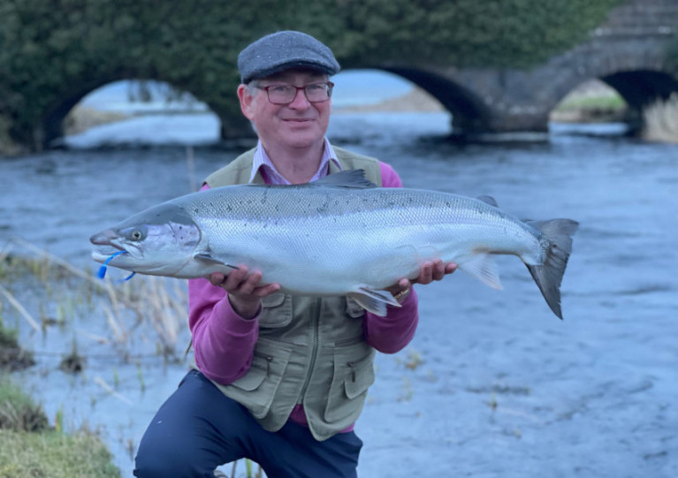
The River Drowse’s first specimen salmon in 36 years has been caught and recorded, as Derek Evans writes in The Irish Times.
Seamus O’Neill from Ballyshannon was the lucky angler to lure the 25lb salmon last Monday (2w February) at the Old Sea Pool in the Drowse Salmon Fishery, which lies on the Donegal-Leitrim border.
The last salmon of comparable size caught on the River Drowse was a 35lb 8oz specimen landed in 1985, says the fishery’s proprietor Shane Gallagher — who was nine years old at the time.
The Irish Times has much more on the story HERE.
Local angler Seamus O’ Neill landed a specimen fish of just over 25lbs shortly after 5pm this evening.The cock fish took a black flying c from the Old Sea Pool. The fish was deeply hooked and after a 35 minute battle was unable to be revived. Scale samples have been sent to IFI. pic.twitter.com/jxh9wI0dYW
— Drowes Fishery (@DrowesFishery) February 22, 2021
Connemara's First Salmon of the Year Caught in Delphi Fishery
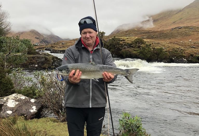
Connemara’s first salmon of the year has been caught on the Delphi fishery, as Covid-19 restrictions keep many anglers away from their favoured riverbanks.
Delphi fishery manager David McEvoy was only angling for ten minutes when he hooked and landed a 6lbs 3 oz salmon in the “Waterfall pool” on the Bundorragha river, using a Willie Gunn tube fly.
Within an hour, the Delphi estate manager Michael Wade also caught a 6lbs fish in the river’s “Rockpool”.
Both catches recorded on February 1st – the first day of the season on the Bundorragha - have now been verified by Inland Fisheries Ireland (IFI).
There is usually keen competition in January to hook the first salmon, and the Drowes in Leitrim - which is one of the few rivers to open earlier than February 1st - has been claiming the honour in recent years.
However, Covid-19 restrictions on travel beyond five kilometres from home have kept riverbanks relatively quiet early this year.
The Delphi catch was the first to be hooked “on the fly”, while a 9.5 lb salmon was landed on rod and line on the Laune in Co Kerry on January 30th by Stephen Jordan.
IFI records the first fish which have been released and doesn’t tend to confirm fish caught which have been killed.
Mr McEvoy explained that as his was a ranched fish, it was killed, while Mr Wade’s fish was wild and was released.
All wild fish are released at Delphi, while ranched salmon – as in fish reared in hatcheries and then released - are removed.
“There is a saying that if the first fish landed is small, there will be a good season, but I think that is a bit of baloney,” Mr McEvoy said.
However, he does believe there will be a good spring run this year for a combination of reasons.
Wild salmon returned in record numbers to rivers in the west last year, but salmon expert Dr Ken Whelan cautioned that “one good salmon season” does not necessarily suggest a positive trend.
“We will really only know what is happening after scientists from Norway, Iceland, Scotland and Ireland meet in the autumn,” he said.
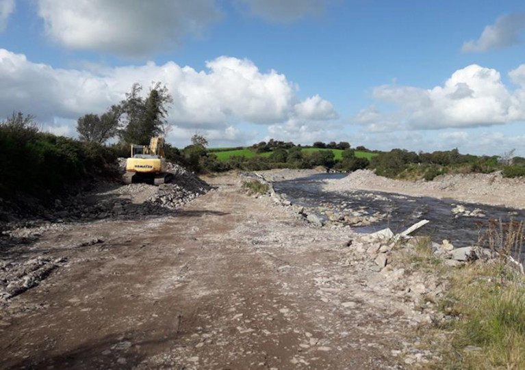
A farmer from Beaufort in Co Kerry was convicted and fined €3,300 plus costs following a prosecution taken by Inland Fisheries Ireland (IFI).
In a hearing at Caherciveen District Court on Thursday 10 December, Judge David Waters convicted Raymond Breen under Section 173 (d) of the Fisheries Consolidation Act 1959 for carrying out works in the Gaddagh River which damaged sensitive spawning beds.
While a charge of obstruction was struck out, Judge Waters commented that he could not ignore the defendant’s behaviour when considering the appropriate penalty.
The Gaddagh River, a tributary of the River Laune and in a Special Area of Conservation (SAC), is an important spawning habitat for Atlantic salmon, a species protected under Irish and European law.
The court heard evidence that an inspection carried out by IFI fisheries officers discovered substantial amounts of spawning gravel removed from the river and stock-piled along a 250m section of bank.
Heavy machinery tracks were recorded across the riverbed, the protected spawning gravels and on both banks.
Evidence was given that the engine of a tracked earth-mover at the site was hot when discovered but the driver could not be located. The scene was described in court as a “working site”.
Sean Long, director of the South Western River Basin District at IFI, said: “This is a serious environmental crime. The removal of gravel from spawning beds will directly impact our already endangered Atlantic salmon stocks by drastically reducing usable spawning gravel.
“We urge all landowners to take responsible action and to contact their advisors or Inland Fisheries Ireland before carrying out any works that may damage watercourses on or adjacent to their land.”
83 Rivers Open for Salmon Angling in 2021
Eamon Ryan T.D., Minister with responsibility for the Inland Fisheries sector has approved legislation that will govern the wild salmon and sea trout fisheries in 2021. These will come into effect from Friday 1 January 2021.
Minister Ryan said, “We are opening 83 rivers for salmon and sea trout fishing in 2021. This will allow careful management of this important natural resource, for which conservation will be to the fore.
In a positive trend, forty-nine of the rivers will be fully open, an increase of 20% on 2020, with a further thirty-four available on a ‘catch and release’ basis. Continued movement in a positive direction is only possible over time and is entirely dependent on everybody redoubling our conservation efforts in the face of environmental, climate and human impacts.”
"In a positive trend, forty-nine of the rivers will be fully open, an increase of 20% on 2020"
To inform the legislation for 2021, Minister Ryan received management advice from Inland Fisheries Ireland in relation to over 140 genetically individual wild salmon stocks in Ireland, which in turn was considered in the light of individual scientific assessments. The assessments were carried out by the Technical Expert Group on Salmon (TEGOS) an all-island independent scientific group comprising experts from a range of bodies.
This advice was also made available as part of a statutory public consultation process during which 33 written submissions from stakeholders were received.
Management advice based on the TEGOS assessment of rivers/estuaries/harbours is that:-
- 49 rivers to be open as a surplus of fish has been identified in these rivers;
- 34 rivers to be classified as open for “catch and release” angling; and
- 64 rivers to be closed as they have no surplus of fish available.
Minister Ryan said, “Ireland is internationally recognised for prioritising the conservation imperative as fundamental to our salmon management efforts and our contribution to the continuing global initiative that is the International Year of the Salmon 2020 has been second to none. Environmental and climate change and human impacts continue to place salmon and other species at risk. I am determined that the innovations of International Year of the Salmon, which continue to bring people together to share knowledge and raise awareness, will endure. This is key to ensuring the resilience of salmon in Ireland and in the entire North Atlantic”.
New Wild Salmon & Sea Trout Fisheries Legislation in 2021
Wild Salmon and Sea Trout Tagging Scheme (Amendment) Regulations S.I. No. 667 of 2020
These regulations provide for, the quotas of fish that can be harvested by commercial fishing engines and rod and line from those rivers identified in Schedule 2. The Regulations also provide for the use of brown tags in specified (low surplus) rivers which are identified in Schedule 4.
Angling Bye-law No. 982 of 2020
This Bye-law prohibits the use of any fish hooks, other than single or double barbless hooks, and also prohibits the use of worms as bait in angling for all species of fish in the waters specified in the Bye-law. This is to avoid the use of hooks and baits which are not conducive to fish survival and to ensure that the objective of C&R fishing is not frustrated.
Conservation of Salmon and Sea trout (Bag Limits) Bye-law No. 983 of 2020
Provides for an annual bag limit of 10 fish being either salmon or sea trout (over 40 cm) per angler and provides for a season bag limit of 3 fish in the period 1 January to 11 May, a daily bag limit of 3 fish from 12 May to 31 August and a daily bag limit of 1 fish from 1 September to the end of the season. The Bye-law also provides for the use of single or double barbless hooks and prohibits the use of worms as bait once the specified numbers of fish have been caught in the specified periods.
Conservation of Salmon and Sea trout (Catch and Release) Bye-law No. 984 of 2020
Provides for catch and release in respect of salmon and sea trout (over 40 cm) in rivers that are meeting at least 50% of their Conservation Limit as mentioned in the Bye-law. The Bye-law also provides for the use of single or double barbless hooks and prohibits the use of worms as bait in angling for salmon and sea trout over 40 cm.
Conservation of Salmon and Sea Trout (River Suir) Bye-law No. 986 of 2020
This Bye-Law provides for catch and release in angling for salmon (any size) and sea trout (over 40cm) in the River Suir (including the waters of the Rivers Clodiagh, Lingaun and Blackwater) and also prohibits the use of worms, prawn, shrimp or any other crustacean, or artificial forms thereof, as bait and any fish hooks other than single or double barbless hooks during the period 17 March to 30 September.
Conservation of Sea Trout Bye-law No. 987 of 2020
This Bye-law provides for a daily bag limit of 3 sea trout (less than 40 cm in length) and provides for the use of single or double barbless hooks and prohibits the use of worms as bait once the specified number of sea trout have been caught.
Conservation of Salmon and Sea Trout (River Slaney) Bye-law No. 985 of 2020
This Bye-Law provides for catch and release in angling for salmon (any size) and sea trout (over 40cm) in the River Slaney and also prohibits the use of worms, prawn, shrimp or any other crustacean, or artificial forms thereof, as bait and any fish hooks other than single or double barbless hooks.
Conservation of Salmon and Sea Trout (Closed Rivers) Bye-law No. C.S. 331 of 2020
Prohibits the taking or attempting to take by rod and line salmon and sea trout (over 40 cm) in the rivers specified in the Bye-law.


 as lead helm, rounds the Fastnet Rock on the way to the overall win in 1987")


 Michael Murphy Schull Harbour Sailing Club (SHSC), Eric Coogan Heineken Ireland, Mark Murphy, Commodore SHSC, Jack Allen SHSC, Carmel O'Regan SHSC, Cornelious Ndlovu, Schull Harbour Hotel Operations Manager and Derval Murphy SHSC")
