Menu

Ireland's sailing, boating & maritime magazine

Inland afloat headers


Displaying items by tag: Dingle

Poor weather off the Kerry coast has put on hold the search for Fungie the dolphin who has been missing from his Dingle home for almost a week, according to the Guardian.

Yesterday, Sunday 18 October, RTÉ News reported that divers from Mallow Search and Rescue has joined the search to explore coves around Dingle Harbour amid growing concern for Fungie’s wellbeing.

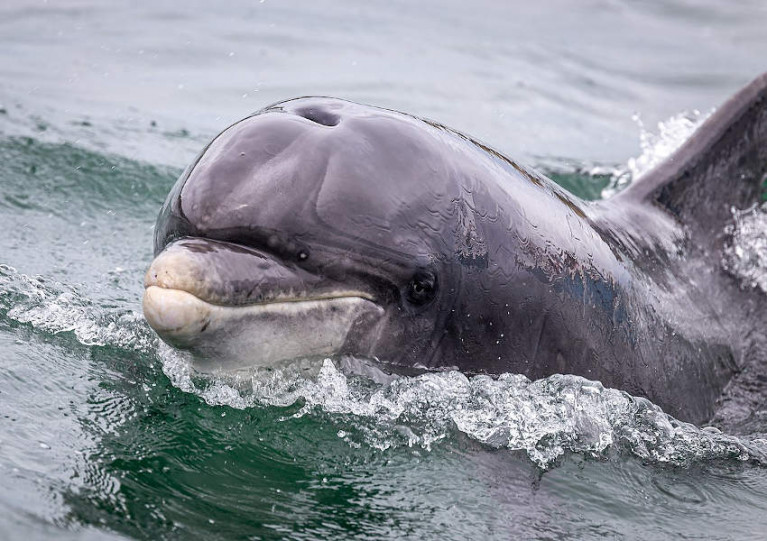
The bottlenose dolphin has been resident in the village harbour since 1983, rarely straying far from its environs — and never for this length of time.

There was an unconfirmed report of a sighting last Thursday, as local fisherman Gary Hand suggested the marine wildlife favourite was feeding with other dolphins further out in Dingle Bay.

That’s one of the theories being shared by local boatmen — some of whom also suggest that the solitary Fungie may be in hiding from dolphin pods and whales encroaching on his usual inshore waters.

“There’s still hope,” said boatman Gary Brosnan. “If Fungie has died there’s a good chance we’d have found him in one of the inlets or caves. No news is good news.”

Published in Marine Wildlife
Tagged under

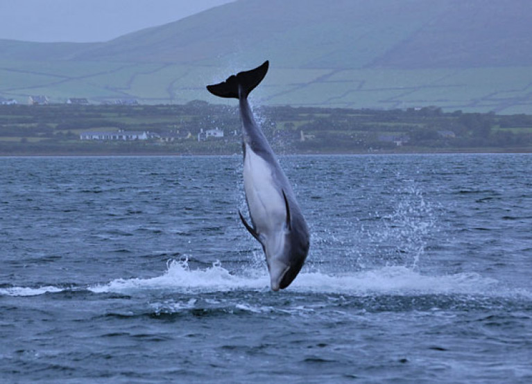
Reports of the disappearance of Dingle’s resident dolphin Fungie this week appear to have been greatly exaggerated, as a cetacean matching his description was spotted by a local fisherman.

Paul Hand tells RTÉ News that he is “one thousand percent certain” the bottlenose dolphin that followed his boat into Dingle Bay yesterday (Thursday 15 October) was Fungie, who has made his home in the Co Kerry village since the early 1980s.

Fungie aroused some concern on Wednesday when he failed to appear as usual in the harbour, with unusual movements said to be “unlike him”.

But Hand suggests the dolphin has simply been following boats out into the bay and staying to feed and spend time with a pod of his own kind — following a lonely summer in the absence of the area’s usual tourist trade.

RTÉ News has more on the story HERE.

Published in Marine Wildlife
Tagged under

The Department of Agriculture, Food and the Marine (DAFM) has confirmed that bathroom and shower facilities at Dingle’s harbour and marina will reopen by the coming weekend.

Marina users had expressed dismay that facilities at the fishery harbour had remained under lock and key, despite reports of no such restrictions on similar service blocks at other marinas frequented by cruisers along the coast.

In a statement to Afloat.ie, DAFM — which operates Ireland’s six Fishery Harbour Centres — said it was “not in a position to open the marina facilities in Dingle until such a time as appropriate cleaning services could be engaged to meet with the current safety guidelines” amid the coronavirus pandemic.

However, the department says the situation has now been resolved and the facilities will be open for the coming weekend.

Published in Irish Harbours

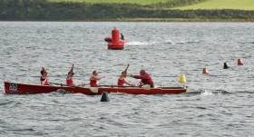
#Coastal Rowing: Myross carried off the senior men’s title at the All-Ireland Coastal Rowing Championships in Dingle. Sneem won the women’s senior title. Kerry club, Workmen’s, did very well in women’s events, as did Kilmacsimon in men’s. Hundreds of crews competed in the event, which was run alongside Dingle Regatta. The Heritage class gave crews from Dublin a chance to shine. The women from St Michael’s and the men from Dalkey won the senior Heritage titles and the mixed title went to Stella Maris.

All Ireland Coastal Rowing Championships (ICRF), Dingle (selected results; winners)

Men

Senior: Myross

Seine Boat: Sneem

Open Classic: Myross.

Heritage, Senior: Dalkey. Inter: Stella Maris. Novice: Sive. Under-18: Valentia.  

Masters: Kilmacsimon Quay

Intermediate: Kilmacsimon Quay

Novice: Templenoe

Junior: Kilmacsimon Quay

Under-21: Callinafercy

Under-18: Templenoe

Women

Senior: Sneem

Heritage Senior: St Michael’s. Under-18: Callinafercy A.

Open Classic: Castletwonbere

Masters: Workmen’s

Novice: Myross

Junior: Fossa

Under-21: Workmen’s

Under-18: Workmen’s A

Mixed

Senior: Workmen’s B

Masters: Templenoe

Heritage: Stella Maris

Published in Coastal Rowing

Dingle Maritime Weekend, an annual event jointly organised by Kevin Flannery of the town’s renowned Oceanworld, and former Harbour Master Captain Brian Farrell (he played a key role in the establishment of the biennial Dun Laoghaire to Dingle Race in 1993), will this weekend offer an intriguing range of sea-related topics in a series of talks and inter-active events – all staged in Oceanworld, and all free writes W M Nixon

With the October Bank Holiday just completed, Dingle – which is Europe’s most westerly port – is seeing a slight change of direction, after a festive long weekend in which the noted Dingle hospitality experience, combined with its musical and entertainment traditions, set a light-hearted tone.

The Dingle Maritime Weekend, while not totally in contrast in that it firmly believes in making visitors welcome, adopts a more educational tone, and gets underway at 1400 hrs on Saturday 3rd November with a talk by Daitihi de Mordha, the former Director of The Blasket Centre from Dun Chaoin in the far west of the Dingle Peninsula, on a shipwreck of 1818 which was the cause of much conflict at the time.

Saturday’s programme is completed at 1530 by piracy historian Des Ekin, whose new book on true-life pirate stories from 30 Irish ports might surprise people as they learn of the murky pasts of what are now notably respectable seaside towns and ports all round our coast.

On Sunday the star speaker at 1130 hrs is noted journalist, broadcaster and local historian Ted Creedon, who presentation will be based around the evolution of the Coastguard Service on the Dingle Peninsula, an area so remote from much of Ireland that inevitably they developed their own very effective ways of dealing with special local conditions.

The still-disputed story of a violent event of the distant past is discussed at 1230 by Dr Conor Brosnan, who has worked as a GP in Dingle for 20 years. “The Massacre at Dun an Oir 1580” was a grisly episode at nearby Smerwick Harbour during the Demond Rebellion in November 1580, and it’s an event which has been analysed in many ways, but is always ripe as the topic for a lively discussion.

It also brings the historical side of the Dingle Maritime Weekend agenda to a close, as the final presentation on Sunday afternoon, 4th November at 1530, is very much for children and about our future, though doubtless, adults will find it of much interest. “How to be an Ocean Hero” by Louise Overy is an interactive talk and multi-themed workshop in which she aims at enticing young people into the exciting world of marine science, which - for the Ireland of today and tomorrow and into the years ahead - becomes ever more important.

Dingle Maritime Weekend 3rd-4th November 2018

All events are at Dingle Oceanworld

Saturday 3rd November 14.00 hrs: DAITHI DE MORDHA: “Bad na nGort nDubh 1818 – Tragedy, Conflict and Loss in West Kerry”.
Saturday 3rd November 15630 hrs: DES EKIN: “The Pirate Trails of Ireland”

Sunday November 4th 1130 hrs: TED CREEDON: "The Evolution of the Coastguard of the Dingle Peninsula, 1821-1922”
Sunday November 4th 1230hrs: Dr CONOR BROSNAN: “The Massacre at Dun an Oir, 1580”

Sunday NOVEMBER 4th 1430 hrs: FOR CHILDREN: LOUISE OVERY: “HOW TO BE AN OCEAN HERO”

Published in Maritime Festivals
Tagged under

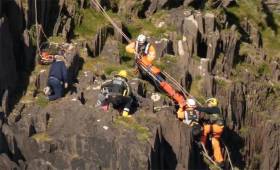
#Coastguard - The Irish Coast Guard’s Facebook page has shared video of a dramatic cliff face rescue near Dingle earlier this week.

Dingle Coast Guard and the Irish Coast Guard’s Shannon-based helicopter Rescue 115 joined paramedics at the scene where a person has fallen around 10 metres down the cliff face on Monday 30 April.

Rescue climbers from the Dingle coastguard unit were able to reach the causality and transfer them to the helicopter for treatment at University Hospital Kerry.

Video of the rescue was captured from the water by Jeannine Masset, a longtime fan of Dingle’s resident dolphin Fungie.

Published in Coastguard
Tagged under

#MarineNotice - Dredging works were set to commence this week at Dingle Fishery Harbour Centre and are expected to be ongoing until the end of February 2018.

The works will involve the dredging of the north/south section of the main navigation channel and an area between the breakwaters off the main quay head.

The vessel Grete Fighter (Callsign: OZLP2) and the jack-up barge Yo Yo will be onsite and will maintain a VHF watch on Channel 16/14.

Three Special Mark (monitoring buoy) Fl Y 2s will be in positions 150 meters east, west and south of the north/south channel within the fishery harbour centre.

The Grete Fighter will be transiting to an approved dumpsite east of Beenban Head marked by four special marks.

Port hand marks and leading lights will be affected during the course of the works.

For safety reasons, mariners are requested to proceed slowly and with caution when in the vicinity of the dredging vessels in the fishery harbour centre and to give the works a wide berth.

Contact details and co-ordinates of the dump area are included in Marine Notice No 53 of 2017, a PDF of which is available to read or download HERE.
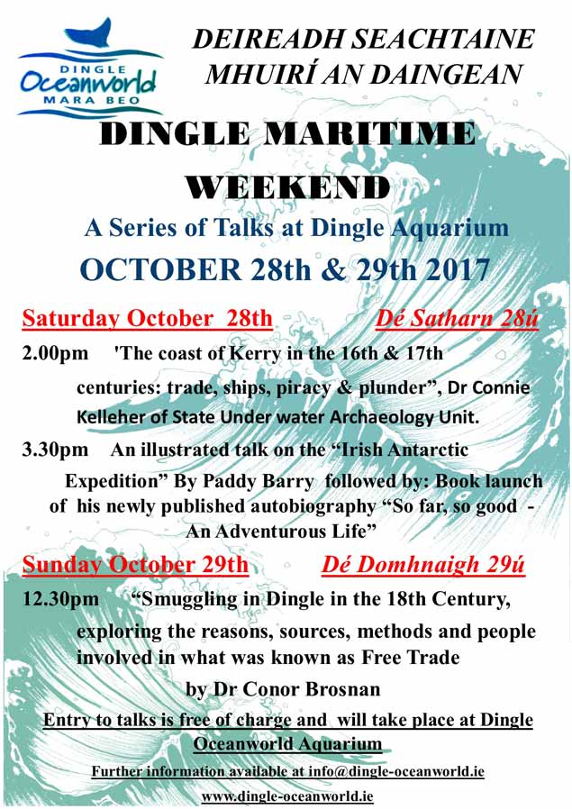
Published in Dredging

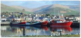
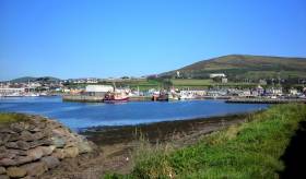
Dingle today is closely associated with superb hospitality, good food, the sporting entertainment of the biennial Dun Laoghaire to Dingle Race, and the eternal sense of the nearby presence of the mighty Atlantic in one direction, and majestic mountains soaring to the peak of Mount Brandon in the other. Thus it is easy to overlook the fact that this remote yet spirited and independent port has a long history of interacting with the sea for fishing, international trade, and other intriguing activities writes W M Nixon.

The annual Dingle Maritime Weekend in the October Bank Holiday Weekend has been running for six years now to increase awareness of Dingle’s often colourful maritime past. It was established by Kevin Flannery of Dingle Oceanworld and former Harbour Master Captain Brian Farrell (whose tour of duty did so much to bring the harbour to its present healthy state), and the idea is to exlore aspects of that rich heritage, and how it relates to Dingle’s fascinating maritime environment today.


dingle poster final2

It’s held at the Oceanworld Aquarium and admission is free for three special talks spread in civilized style between the Saturday afternoon and early Sunday afternoon. Thus it’s a user-friendly format which means you can combine the usual multi-activity Dingle holiday weekend with some digestible maritime information. But of course with the varied audience which it usually attracts, all sorts of post-presentation conversations can happily arise. 

Dingle Maritime Weekend Programme, 28th and 29th October 2017 at Oceanworld Aquarium

SATURDAY 28th OCTOBER 14:00hrs

'The coast of Kerry in the 16th and 17th centuries: trade, ships, piracy and plunder.'
by Dr Connie Kelleher

The talk will draw on sources such as the High Court of Admiralty Papers, State Papers and other contemporary sources to illustrate episodes when the expansion of maritime empires meant that the diversity of goods traded encouraged smuggling, piracy and corruption. It will show that harbours like Dingle, Ventry and Valentia, rather than being remote, formed part of a network central to this global development in commercial shipping, colonial enlargement and associated growth in opportunistic plunder.

DR CONNIE HELLEHER is a member of the State Underwater Archeology Unit in the National Monuments Service Department of Culture, Heritage and the Gaeltacht. Connie is a graduate of UCC with an MA in maritime archaeology and a PhD from Trinity College Dublin on the history and archaeology of piracy in Irish waters in the early 17th century. As a commercially trained diver, her work with the NMS is broad and focuses on the protection of Ireland's underwater cultural heritage. She is visiting lecturer in underwater archaeology in the Archaeology Dept UCC and is a Board member of the international advisory council on underwater archaeology. With several papers and chapters published on piracy in Irish waters, she is currently putting the final edit to her book: “Ireland's Golden Age of Piracy”.

SATURDAY 15:30 hrs
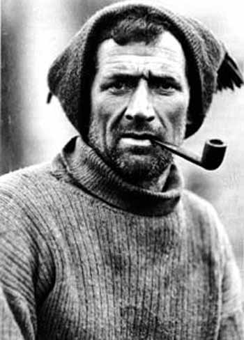
Irish Antarctic Expedition.

PADDY BARRY will give an illustrated talk on the Irish Antarctic Expedition which followed the survival route of Shackleton & Tom Crean by sea in a small boat and then over the mountains of South Georgia.

tom crean3The national hero from the Dingle Peninsula – Tom Crean in the Antarctic.

Tom Crean came from Annascaul on the Tralee to Dingle road, and is one of the Dingle Peninsula’s most internationally-noted historic figures (another is film star Gregory Peck).

Paddy Barry is a Civil Engineer, now retired, who has, during his working life, taken many 'career breaks' to sail to out of the way places, while at the same time somehow maintaining domestic relations on the home front. He lives in Monkstown, Dublin and has worked, apart from Ireland, in the UK, the USA, Malawi and Ethiopia. His first 'big' trip was to America, in the Galway Hooker ' Saint Patrick', followed in the same boat by journeys to Spitsbergen and later to North West Greenland.

paddy barry4
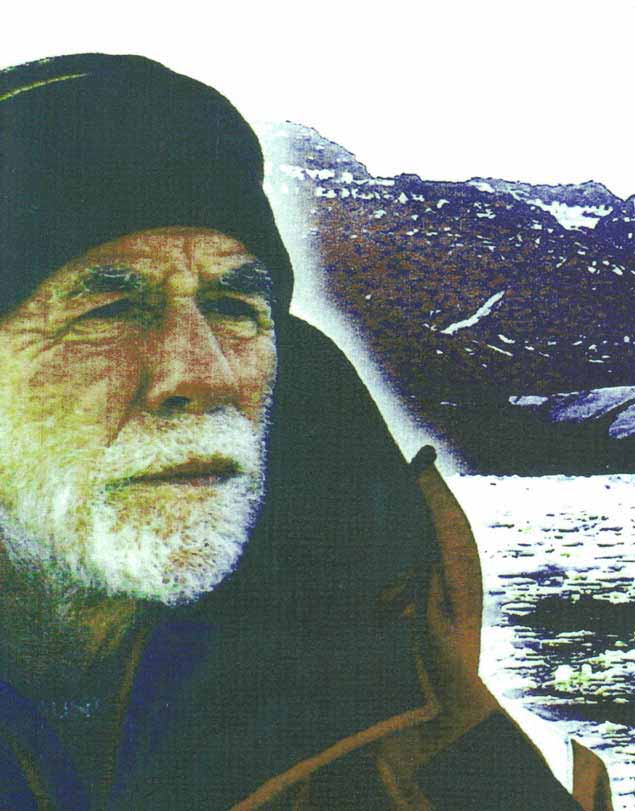
High latitudes voyager and explorer Paddy Barry will celebrate the Dingle Peninsula’s links to Tom Crean

In a very much smaller boat he was Skipper of the Irish Antarctic team which followed in the wake of Shackleton's small boat journey. In 2001 he was Expedition Leader of the team who traversed the North West Passage in the vessel 'Northabout'.

Paddy in his sailing boat Ar Seachrán escorted Camino Thar Sáile on its first year of voyaging across the Irish Sea and the Channel to Europe.

Paddy’s talk will be followed by the Kerry Launch of his newly published autobiography, “So Far, So Good – An Adventurous Life”. Available to purchase here.

SUNDAY 29th October 12:30hrs

Smuggling in Dingle in the Eighteenth Century
Speaker Dr Conor Brosnan

DR CONOR BROSNAN will discuss smuggling in Dingle in the eighteenth century. He will explore the reasons, sources, methods and people involved in what was known as Free Trade. He will talk on the methods the authorities used to suppress smuggling and the legacy it left.

Dr Conor Brosnan is a local GP and a member of Dingle Historical Society. He has a deep interest and knowledge of the Dingle area and its history.

Published in Maritime Festivals

#MarineNotice - Site investigation works are being carried out at Dingle/An Daingean Fishery Harbour Centre in Co Kerry, according to the latest Marine Notice from the Department of Transport, Tourism and Sport.

The works involve the drilling of multiple boreholes at locations, subject to minor variations, as indicated by the co-ordinates and map included in Marine Notice No 37 of 2016, a PDF of which is available to read or download HERE.

Drilling was expected to begin yesterday (Monday 5 September) and will finish on or around Friday 28 October, weather permitting.

A jack-up barge will be moved to the various borehole locations by the tug Samson (Callsign ZQVL6) and will remain on site overnight during the operations.

All appropriate lights will be displayed by the barge at night. Radio navigation warnings will be transmitted on VHF Channel 16 throughout the works.

Published in Irish Harbours

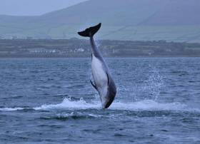
#Fungie - Dingle's resident dolphin Fungie has sustained a significant wound below his dorsal fin, as the Irish Examiner reports.

The deep cut, likely inflicted by a visiting boat's propeller, was noticed yesterday (Friday 3 June) by fans of the popular marine wildlife attraction who's delighted locals and visitors alike in Dingle for more than 30 years.

However, Fungie lovers have been urged not to panic – as the famous bottlenose has healed well from similar injuries before, and has already returned to frolicking with boaters in Dingle Harbour.

The Irish Examiner has more on the story HERE.

Published in Marine Wildlife
Page 2 of 7

General Information on using Waterways Ireland inland navigations

Safety on the Water

All users of the navigations are strongly recommended to make themselves aware of safety on the water for whatever activity they are involved in and to read the advice offered by the various governing bodies and by:

The Dept. of Transport, Ireland: www.gov.ie/transport and The Maritime and Coastguard Agency, UK, The RNLI – Water Safety Ireland for information in terms of drowning prevention and water safety.

Registration of Vessels

All vessels using the Shannon Navigation, which includes the Shannon-Erne Waterways and the Erne System must be registered with Waterways Ireland. Only open undecked boats with an engine of 15 horsepower or less on the Shannon Navigation, and vessels of 10 horsepower or less on the Erne System, are exempt. Registration is free of charge.

Craft registration should be completed online at: https://www.waterwaysireland.org/online-services/craft-registration

Permits for use of the Grand and Royal Canals and the Barrow Navigation

All vessels using the Grand and Royal Canals and the Barrow Navigation must display appropriate valid Permit(s) i.e A Combined Mooring and Passage Permit (€126) and if not intending to move every five days, an Extended Mooring Permit (€152).

Permit applications should be completed online at: https://www.waterwaysireland.org/online-services/canal-permits

Passage on the Royal and Grand Canals – Dublin Area

For boat passage through the locks east of Lock 12 into / out of Dublin on either the Royal or Grand Canals, Masters are requested to contact the Waterways Ireland Eastern Regional Office (M-F 9.30am-4.30pm) on tel: +353(0)1 868 0148 or email [email protected] prior to making passage in order to plan the necessary lock-keeping assistance arrangements.

On the Grand Canal a minimum of two days notice prior to the planned passage should be given, masters should note that with the exception of pre-arranged events, a maximum of 2 boats per day will be taken through the locks, travelling either east or west.

Movements in or out of the city will be organised by prior arrangement to take place as a single movement in one day. Boaters will be facilitated to travel the system if their passage is considered to be safe by Waterways Ireland and they have the valid permit(s) for mooring and passage.

Newcomen Lifting Bridge

On the Royal Canal two weeks’ notice of bridge passage (Newcomen Lifting Bridge) is required for the pre-set lift date, and lock assistance will then also be arranged. A minimum of 2 boats is required for a bridge lift to go ahead.

Waterways Ireland Eastern Regional Office (Tel: +353(0)1 868 0148 or [email protected] ) is the point of contact for the bridge lift.

A maximum number of boats passing will be implemented to keep to the times given above for the planned lifts (16 for the Sat / Sun lifts & 8 for the weekday lifts). Priority will be given on a first come first served basis.

On day of lift, boaters and passengers must follow guidance from Waterways Ireland staff about sequence of passage under bridge & through Lock 1, and must remain within signed and designated areas.

Events Held on the Waterways

All organised events taking place on the waterways must have the prior approval of Waterways Ireland. This is a twelve week process and application forms must be accompanied with the appropriate insurance, signed indemnity and risk assessment. The application should be completed on the Waterways Ireland events page at :

https://www.waterwaysireland.org/online-services/event-approval

Time Limits on Mooring in Public Harbours

On the Shannon Navigation and the Shannon-Erne Waterway craft may berth in public harbours for five consecutive days or a total of seven days in any one month.

On the Erne System, revised Bye Laws state that: No master or owner shall permit a vessel, boat or any floating or sunken object to remain moored at or in the vicinity of any public mooring, including mooring at any other public mooring within 3 kilometres of that location, for more than 3 consecutive days and shall not moor at that same mooring or any other public mooring within 3 kilometres of that location within the following 3 consecutive days without prior permission by an authorised official.

Winter Mooring on the Shannon Navigation and Shannon Erne Waterway

Winter mooring may be availed of by owners during the period 1 Nov to 31 Mar by prior arrangement and payment of a charge of €63.50 per craft. Craft not availing of Winter Mooring must continue to comply with the “5 Day Rule”. Winter Mooring applications should be completed online at : https://www.waterwaysireland.org/online-services/winter-moorings-booking

Owners should be aware that electricity supply and water supply to public moorings is disconnected for the winter months. This is to protect against frost damage, to reduce running costs and to minimise maintenance requirements during the winter months.

Vessel owners are advised that advance purchasing of electricity on the power bollards leading up to the disconnection date should be minimal. Electricity credit existing on the bollards will not be recoverable after the winter decommissioning date. Both services will be reinstated prior to the commencement of the next boating season.

Smart Cards

Waterways Ireland smart cards are used to operate locks on the Shannon Erne Waterway, to access the service blocks, to use the pump-outs along the navigations, to avail of electrical power at Waterways Ireland jetties.

Berthing in Public Harbours

Masters are reminded of the following:

  • Equip their vessel with mooring lines of appropriate length and strength and only secure their craft to mooring bollards and cleats provided for this purpose.
  • Ensure the available berth is suitable to the length of your vessel, do not overhang the mooring especially on finger moorings on floating pontoon moorings.
  • Ensure mooring lines, electric cables and fresh water hoses do not create a trip hazard on public jetties for others users.
  • Carry sufficient fenders to prevent damage to your own vessel, other vessels and WI property.
  • Allow sufficient space between your vessel and the vessel ahead /astern (c.1m) for fire safety purposes and /or to recover somebody from the water.
  • Do not berth more than two vessels side by side and ensure there is safe access/egress at all times between vessels and onto the harbour itself.
  • Do not berth in such a way to prevent use of harbour safety ladders, slipways or pump-outs.
  • Do not allow the bow of your vessel to overhang the walkway of a floating mooring thus creating a hazard for others with an overhanging anchor or bow fendering.
  • Animals are not allowed to be loose or stray at any time.
  • Harbour and jetty infrastructure such as railings, power pedestals, fresh water taps, electric light poles, safety bollards, ladders etc are not designed for the purpose of mooring craft , they will not bear the strain of a vessel and will be damaged.
  • At Carrybridge on the Erne System, Masters of vessels are not permitted to use stern on mooring. Masters of vessels must use the mooring fingers for mooring of vessels and for embarkation / disembarkation from vessels.

Passenger Vessel Berths

Masters of vessels should not berth on passenger vessel berths where it is indicated that an arrival is imminent. Passenger vessels plying the navigations generally only occupy the berths to embark and disembark passengers and rarely remain on the berths for extended periods or overnight.

Lock Lead-in Jetties

Lead-in jetties adjacent to the upstream and downstream gates at lock chambers are solely for the purpose of craft waiting to use the lock and should not be used for long term berthing.

Vessel Wake

Vessel wake, that is, the wave generated by the passage of the boat through the water, can sometimes be large, powerful and destructive depending on the hull shape and engine power of the vessel. This wake can be detrimental to other users of the navigation when it strikes their craft or inundates the shoreline or riverbank. Masters are requested to frequently look behind and check the effect of their wake / wash particularly when passing moored vessels, on entering harbours and approaching jetties and to be aware of people pursuing other activities such as fishing on the riverbank.

Speed Restriction

A vessel or boat shall not be navigated on the Shannon Navigation at a speed in excess of 5 kph when within 200 metres of a bridge, quay, jetty or wharf, when in a harbour or canal or when passing within 100 metres of a moored vessel or boat.

Vessels navigating the Shannon-Erne Waterway should observe the general 5 kph speed limit which applies along the waterway. This is necessary in order to prevent damage to the banks caused by excessive wash from vessels.

Vessels navigating the Erne System should observe the statutory 5kt / 6mph / 10kph speed limit areas.

A craft on the Royal and Grand canals shall not be navigated at a speed in excess of 6km per hour.

A craft on the Barrow Navigation shall not be navigated at a speed in excess of 11km per hour except as necessary for safe navigation in conditions of fast flow.

Bank Erosion

Narrow sections of all the navigations are particularly prone to bank erosion due to the large wash generated by some craft. Masters are requested to be vigilant and to slow down to a speed sufficient to maintain steerage when they observe the wash of their craft inundating the river banks.

Unusual Waterborne Activity

Unusual waterborne vessels may be encountered from time to time, such as, hovercraft or amphibious aircraft / seaplanes. Masters of such craft are reminded to apply the normal “Rule of the Road” when they meet conventional craft on the water and to allow extra room to manoeuvre in the interest of safety.

Sailing Activity

Mariners will encounter large numbers of sailing dinghies from late June to August in the vicinity of Lough Derg, Lough Ree and Lower Lough Erne. Sailing courses are marked by yellow buoys to suit weather conditions on the day. Vessels should proceed at slow speed and with due caution and observe the rules of navigation when passing these fleets, as many of the participants are junior sailors under training.

Rowing

Mariners should expect to meet canoes and vessels under oars on any part of the navigations, but more so in the vicinity of Athlone, Carrick-on-Shannon, Coleraine, Enniskillen and Limerick. Masters are reminded to proceed at slow speed and especially to reduce their wash to a minimum when passing these craft as they can be easily upset and swamped due to their very low freeboard and always be prepared to give way in any given traffic situation.

Canoeing

Canoeing is an adventure sport and participants are strongly recommended to seek the advice of the sport’s governing bodies i.e Canoeing Ireland and the Canoe Association of Northern Ireland, before venturing onto the navigations.

Persons in charge of canoes are reminded of the inherent danger to these craft associated with operating close to weirs, sluice gates, locks and other infrastructure particularly when rivers are in flood and large volumes of water are moving through the navigations due to general flood conditions or very heavy localised precipitation e.g. turbulent and broken water, stopper waves. Shooting weirs is prohibited without prior permission of Waterways Ireland.

Canoeists should check with lockkeepers prior entering a lock to ensure passage is done in a safe manner. Portage is required at all unmanned locks.

Canoe Trail Network – "Blueways"

Masters of powered craft are reminded that a canoe trail network is being developed across all navigations and to expect more organised canoeing along these trails necessitating slow speed and minimum wash when encountering canoeists, rowing boats etc

Rockingham and Drummans Island Canals – Lough Key

It is expected that work on Rockingham and Drummans Island Canals on Lough Key will be completed in 2021. Access to these canals will be for non-powered craft only, eg canoes, kayaks, rowing boats.

Fast Powerboats and Personal Watercraft (Jet Skis)

Masters of Fast Powerboats (speed greater than 17kts) and Personal Watercraft (i.e.Jet Skis) are reminded of the inherent dangers associated with high speed on the water and especially in the confines of small bays and narrow sections of the navigations. Keeping a proper look-out, making early alterations to course and /or reducing speed will avoid conflict with slower vessels using the navigation. Personal Watercraft are not permitted to be used on the canals.

Towing Waterskiers, Wakeboarders, Doughnuts etc

Masters of vessels engaged in any of these activities are reminded of the manoeuvring constraints imposed upon their vessel by the tow and of the added responsibilities that they have to the person(s) being towed. These activities should be conducted in areas which are clear of conflicting traffic. It is highly recommended that a person additional to the master be carried to act as a “look-out” to keep the tow under observation at all times.

Prohibition on Swimming

Swimming in the navigable channel, particularly at bridges, is dangerous and is prohibited due to the risk of being run over by a vessel underway in the navigation.

Age Restrictions on operating of powered craft

In the Republic of Ireland, Statutory Instrument 921 of 2005 provides the legal requirements regarding the minimum age for operating of powered craft. The Statutory Instrument contains the following requirements:

- The master or owner of a personal watercraft or a fast power craft shall take all reasonable steps to ensure that a person who has not attained the age of 16 years does not operate or control the craft

- The master or owner of a pleasure craft powered by an engine with a rating of more than 5 horse power or 3.7 kilowatts shall take all reasonable steps to ensure that a person who has not attained the age of 12 years does not operate or control the craft.

Lifejackets and Personal Flotation Devices (PFDs)

Lifejackets and PFD’s are the single most important items of personal protective equipment to be used on a vessel and should be worn especially when the vessel is being manoeuvred such as entering / departing a lock, anchoring, coming alongside or departing a jetty or quayside.

In the Republic of Ireland, Statutory Instrument 921 of 2005 provides the legal requirements regarding the wearing of Personal Flotation Devices. The Statutory Instrument contains the following requirements:

- The master or owner of a pleasure craft (other than a personal watercraft) shall ensure, that there are, at all times on board the craft, sufficient suitable personal flotation devices for each person on board.

- A person on a pleasure craft (other than a personal watercraft) of less than 7 metres length overall shall wear a suitable personal flotation device while on board an open craft or while on the deck of decked craft, other than when the craft is made fast to the shore or at anchor.

- The master or owner of a pleasure craft (other than a personal watercraft) shall take all reasonable steps to ensure that a person who has not attained the age of 16 years complies with paragraph above.

- The master or owner of a pleasure craft (other than a personal watercraft), shall take all reasonable steps to ensure that a person who has not attained the age of 16 years wears a suitable personal flotation device while on board an open craft or while on the deck of a decked craft other than when it is made fast to the shore or at anchor.

- The master or owner of a pleasure craft (other than a personal watercraft) shall take all reasonable steps to ensure that a person wears a suitable personal flotation device, at all times while – (a) being towed by the craft, (b) on board a vessel or object of any kind which is being towed by the craft.

Further information is available at: http://www.irishstatutebook.ie/eli/2005/si/921/made/en/print

Firing Range Danger Area – Lough Ree

The attention of mariners is drawn to the Irish Defence Forces Firing Range situated in the vicinity of buoys No’s 2 and 3, on Lough Ree on the Shannon Navigation. This range is used regularly for live firing exercises, throughout the year, all boats and vessels should stay clear of the area marked with yellow buoys showing a yellow "X" topmark and displaying the word "Danger".

Shannon Navigation, Portumna Swing Bridge Tolls

No attempt should be made by Masters’ of vessels to pay the bridge toll while making way through the bridge opening. Payment will only be taken by the Collector from Masters when they are secured alongside the jetties north and south of the bridge.

Navigating from Killaloe to Limerick on the Shannon Navigation

The navigation from Killaloe to Limerick involves passage through Ardnacrusha locks, the associated headrace and tailrace and the Abbey River into Limerick City. Careful passage planning is required to undertake this voyage. Considerations include: lock passage at Ardnacrusha, water flow in the navigation, airdraft under bridges on Abbey River in Limerick, state of tide in Limerick

Users are advised to contact the ESB Ardnacrusha hydroelectric power station (00353 (0)87 9970131) 48 hours in advance of commencing their journey to book passage through the locks at Ardnacrusha. It is NOT advised to undertake a voyage if more than one turbine is operating (20MW), due to the increased velocity of flow in the navigation channel, which can be dangerous. To ascertain automatically in real time how many turbines are running, users can phone +353 (0)87 6477229.

For safety reasons the ESB has advised that only powered craft with a capacity in excess of 5 knots are allowed to enter Ardnacrusha Headrace and Tailrace Canals.

Passage through Sarsfield Lock should be booked on +353-87-7972998, on the day prior to travel and it should be noted also that transit is not possible two hours either side of low water.

A Hydrographic survey in 2020 of the navigation channel revealed that the approach from Shannon Bridge to Sarsfield Lock and the Dock area has silted up. Masters of vessels and water users are advised to navigate to the Lock from Shannon bridge on a rising tide one or two hours before High Tide.

Lower Bann Navigation

The attention of all users is drawn to the “Users Code for the Lower Bann”, in particular to that section covering “Flow in the River” outlining the dangers for users both on the banks and in the navigation, associated with high flow rates when the river is in spate. Canoeists should consult and carry a copy of the “Lower Bann Canoe Trail” guide issued by the Canoe Association of Northern Ireland. Users should also contact the DfI Rivers Coleraine, who is responsible for regulating the flow rates on the river, for advisory information on the flow rates to be expected on any given day.

DfI Rivers Coleraine. Tel: 0044 28 7034 2357 Email: [email protected]

Lower Bann Navigation – Newferry – No wake zone

A No Wake Zone exists on the Lower Bann Navigation at Newferry. Masters of vessels are requested to proceed at a slow speed and create no wake while passing the jetties and slipways at Newferry.

Overhead Power Lines (OHPL) and Air draft

All Masters must be aware of the dangers associated with overhead power lines, in particular sailing vessels and workboats with cranes or large air drafts. Voyage planning is a necessity in order to identify the location of overhead lines crossing the navigation.

Overhead power line heights on the River Shannon are maintained at 12.6metres (40 feet) from Normal Summer level for that section of navigation, masters of vessels with a large air draft should proceed with caution and make additional allowances when water levels are high.

If a vessel or its equipment comes into contact with an OHPL the operator should NOT attempt to move the vessel or equipment. The conductor may still be alive or re-energise automatically. Maintain a safe distance and prevent third parties from approaching due to risk of arcing. Contact the emergency services for assistance.

Anglers are also reminded that a minimum ground distance of 30 metres should be maintained from overhead power lines when using a rod and line.

Submarine Cables and Pipes

Masters of vessels are reminded not to anchor their vessels in the vicinity of submarine cables or pipes in case they foul their anchor or damage the cables or pipes. Look to the river banks for signage indicating their presence.

Water Levels - Precautions

Low Water Levels:

When water levels fall below normal summer levels masters should be aware of:

Navigation

To reduce the risk of grounding masters should navigate on or near the centreline of the channel, avoid short cutting in dog-legged channels and navigating too close to navigation markers.

Proceeding at a slow speed will also reduce “squat” effect i.e. where the vessel tends to sit lower in the water as a consequence of higher speed.

Slipways

Reduced slipway length available under the water surface and the possibility of launching trailers dropping off the end of the concrete apron.

More slipway surface susceptible to weed growth requiring care while engaged in launching boats, from slipping and sliding on the slope. Note also that launching vehicles may not be able to get sufficient traction on the slipway once the craft is launched to get up the incline.

Bank Erosion

Very dry riverbanks are more susceptible to erosion from vessel wash.

Lock Share

Maximising on the number of vessels in a lock will ensure that the total volume of water moving downstream is decreased. Lock cycles should be used for vessels travelling each way.

High Water Levels:

When water levels rise above normal summer level masters should be aware of:

Navigation

Navigation marks will have reduced height above the water level or may disappear underwater altogether making the navigable channel difficult to discern.

In narrow sections of the navigations water levels will tend to rise more quickly than in main streams and air draft at bridges will likewise be reduced.

There will also be increased flow rates particularly in the vicinity of navigation infrastructure such as bridges, weirs, locks etc where extra care in manoeuvring vessels will be required.

Harbours and Jetties

Due care is required in harbours and at slipways when levels are at or near the same level as the harbour walkways' as the edge will be difficult to discern especially in reduced light conditions. It is advised that Personal Flotation Devices be worn if tending to craft in a harbour in these conditions.

Slipways

Slipways should only be used for the purpose of launching and recovering of water craft or other objects from the water. Before using a slipway it should be examined to ensure that the surface has sufficient traction/grip for the intended purpose such as launching a craft from a trailer using a vehicle, that there is sufficient depth of water on the slipway to float the craft off the trailer before the concrete apron ends and that the wheels of the trailer do not drop off the edge of the slipway. That life-saving appliances are available in the vicinity, that the vehicle is roadworthy and capable of coping with the weight of the trailer and boat on the incline. It is recommended that slipway operations are conducted by two persons.

Caution to be Used in Reliance upon Aids to Navigation

The aids to navigation depicted on the navigation guides comprise a system of fixed and floating aids to navigation. Prudent mariners will not rely solely on any single aid to navigation, particularly a floating aid to navigation. With respect to buoys, the buoy symbol is used to indicate the approximate position of the buoy body and the ground tackle which secures it to the lake or river bed. The approximate position is used because of the practical limitations in positioning and maintaining buoys in precise geographical locations. These limitations include, but are not limited to, prevailing atmospheric and lake/river conditions, the slope of and the material making up the lake/river bed, the fact that the buoys are moored to varying lengths of chain, and the fact that the buoy body and/or ground tackle positions are not under continuous surveillance. Due to the forces of nature, the position of the buoy body can be expected to shift inside and outside the charted symbol.

Buoys and perches are also moved out of position or pulled over by those mariners who use them to moor up to instead of anchoring. To this end, mariners should always monitor their passage by relating buoy/perch positions with the published navigation guide. Furthermore, a vessel attempting to pass close by always risks collision with a yawing buoy or with the obstruction that the buoy or beacon/perch marks.

Masters of Vessels are requested to use the most up to date Navigation guides when navigating on the Inland Waterways.

Information taken from Special Marine Notice No 1 of 2023