


Displaying items by tag: marine science
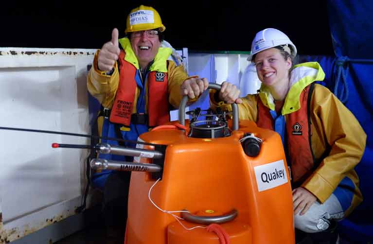
Loss Ness Mometer & Other Seismometers Retrieved by Dublin Institute of Advanced Studies Expedition
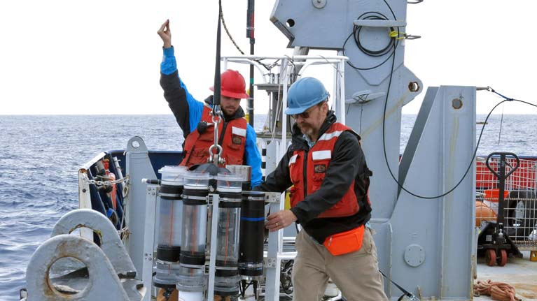
Marine Scientists on the RV Celtic Explorer have collected a network of seismometers recording valuable data over the past 19 months in Irish, British and Icelandic waters.
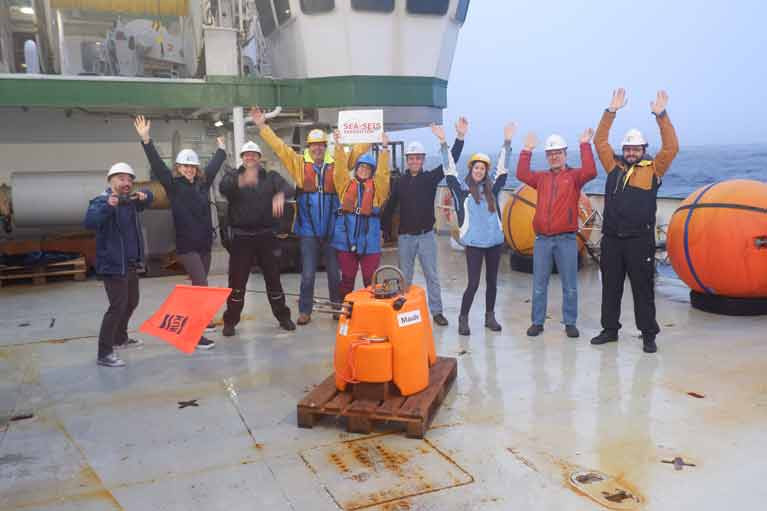
The 18 seismometers had been deployed in 2018 over a 1500 kilometre area from north to south and over 1,000 km of sea from east to west as part of a project run by the Dublin Institute of Advanced Studies (DIAS).
As Afloat previously reported, a “skeleton” team of six scientists and a small crew on the Marine Institute research vessel went to sea last month to retrieve them and returned to Galway this week after three weeks at sea.
Team leader Dr Sergei Lebedev, DIAS seismologist, said the data captured by the seismometers would “shed light on the nature, occurrence, and frequency of earthquakes off our coast, and is fundamental to our understanding of them”.
“The current nature and history of the ocean floor along Ireland's coast is key to our understanding of how the Atlantic evolved and is evolving, and this is important for better understanding both the natural hazards and natural resources offshore," he said.
"For example, slope failures triggered by earthquakes can generate tsunamis in the Irish offshore territory – the data will give us new insights into this hazard,” he said.
The expedition was “time-critical”, as there were fears the data would be lost if the sensors were not retrieved. Physical distancing measures as part of HSE guidelines on the Covid-19 pandemic were in place for the expedition, according to the DIAS team.
"The seismometers have waterproof memory sticks with recordings of earthquakes off the coast of Ireland. To date, these have been poorly understood, but we know they are generally larger than the ones Ireland has onshore. The new data will give us much greater insights into earthquake mechanisms and, also, into the structure of the Earth's interior,” Dr Lebedev said.
"The instruments have made continuous recordings from the last 19 months of the songs of the great baleen whales, including the blue, fin, humpback and North Atlantic right whales. These unique recordings will build our understanding of the migration patterns of the Earth's largest animals and their acoustic environment, known to be crucially important for them,” he said.
Before the seismometers were deployed in 2018, DIAS ran a competition inviting secondary school students to name each one. Suggestions included “The Dude”, “Gráinne”, “Luigi” and “The Loch Ness Mometer”.
During the retrieval expedition, the research team hosted live video links with school classes from St Francis National School in Wicklow, along with St Joseph's College in Tipperary, and a school in Calabria, Italy.
Self Isolating Scientists Head to Sea on Celtic Explorer
A team of scientists who have been self-isolating like astronauts for the past fortnight set sail from Galway at the weekend on an unusual mission.
Six researchers from the Dublin Institute for Advanced Studies (DIAS) and 15 crew on Marine Institute’s Celtic Explorer will retrieve a network of ocean bottom sensors which were deployed across the entire Irish offshore area 18 months ago.
Ireland’s earthquake activity and data on more distant seismic events, along with the movements of migratory whales, were measured by the 18 seismometers, which must now be retrieved from the ocean.
Strict social distancing measures will be applied on the ship, with staggered meal times and no access to the gym or sauna for the first two weeks of the three-week voyage.
The scientists travelled by private bus directly from their individual homes, and will all have separate cabins as part of the protocol to protect against the Covid-19 virus.
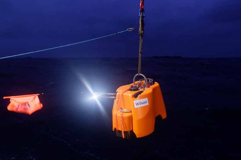 A sensor being deployed in 2018 - The technology aims to record Irish offshore earthquakes
As Afloat reported at the time, the sensors were deployed from the Marine Institute ship in September 2018 by a team led by Dr Sergei Lebedev, a seismologist with the DIAS.
DIAS school of cosmic physics director Prof Chris Bean says the deployment was “by far the most comprehensive in both Europe and the north-east Atlantic”.
“There are specific seismically-active zones where clusters of these types of instruments have been placed before, but this is a first for Ireland,” Prof Bean said.
The sensors aimed to record Irish offshore earthquakes, and research how the earth’s oceans are pressurising the sea floor in really deep water, with big storms possibly triggering submarine landslides and tsunamis.
“The seismometers also have a pressure sensor which can record sound waves in the water – as in whales, dolphins or industrial sounds,” Prof Bean explained.
The deployment was part of the SEA-SEIS project, which aimed to measure movements on the floor of the Atlantic Ocean and register acoustic waves in the water.
“Ninety per cent of Ireland’s territory is offshore, most of it to the west of Ireland. Hidden beneath the waves, there are spectacular mountains, deep valleys, and many extinct volcanoes, similar to those that formed the Giant’s Causeway,”Dr Lebedev said.
The network of seismometers were deployed across an area spanning over 1,500 kilometres from north to south and over 1,000 kilometres from east to west, with some sensors in British and Icelandic and in Ireland’s offshore territory.
“Our mission with this expedition is to retrieve these hugely valuable seismometers, so we can begin the exciting process of analysing the data they have gathered,” Dr Lebedev said.
“This data will shed light on the nature and history of the ocean floor along Ireland’s coast and on the life and movements of the great baleen whales of the North Atlantic,” Dr Lebedev said.
DIAS and the Geological Survey Ireland run the State’s terrestrial network of seismometers to study ground vibrations, ranging from small movements caused by local activities like quarry blasts to large global earthquakes picked up on the Irish network.
The offshore array is a temporary arrangement, Dr Lebedev said.
“This is the first time ever such a large array was deployed, so the data is quite unique and of huge value and that’s why we have to go now.”
Illuminated exits are as useful to fish as to humans in a tight spot.
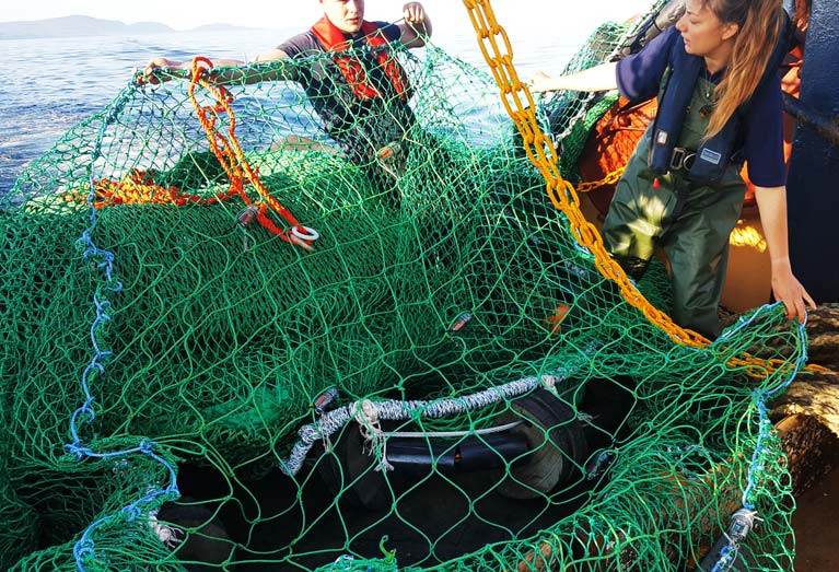
Newly published research has found that artificial light on square mesh panels in nets can help to reduce unwanted bycatch of fish.
The study, published in the Marine Biological Association of the United Kingdom, involved trials with two fishing vessels off the Isle of Man from June to August 2017.
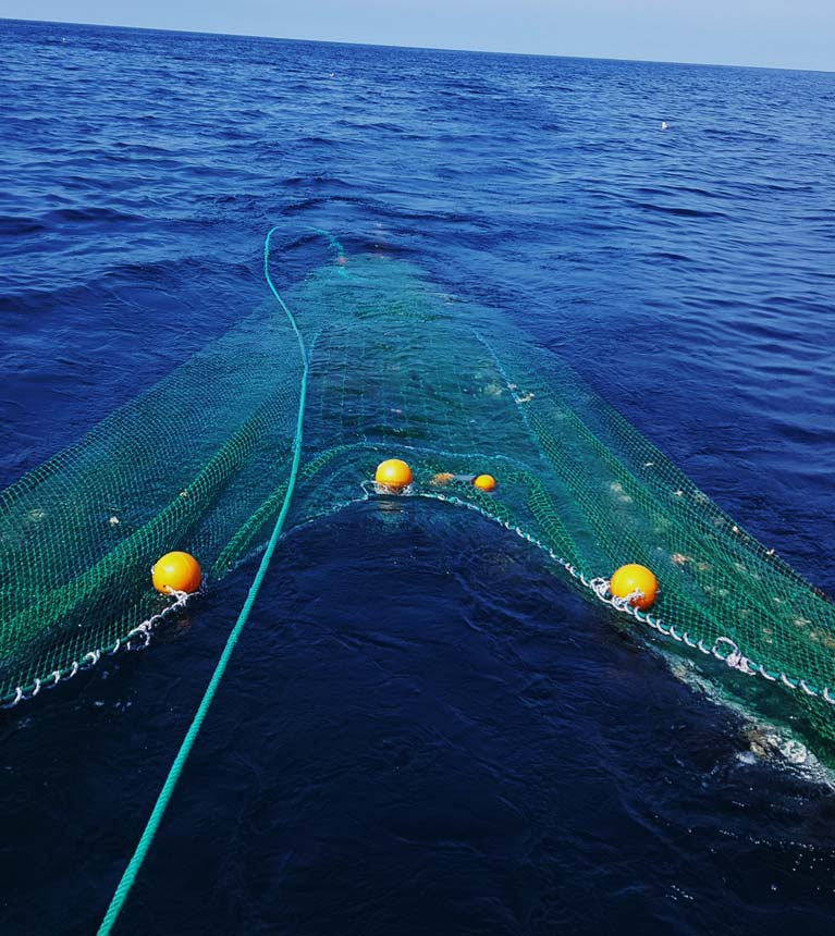 Otter-trawl deployed behind the Queen scallop fishing vessel with a square mesh panel and LEDs inserted into the upper section of the net Photo: Lucy K Southworth
Lead author Lucy K Southworth of Bangor University’s School of Ocean Sciences in Wales notes that use of lights has been tested before, but these trials were particularly successful.
Two 14 metre vessels, Two Girls and Our Sarah Jane, were fitted with a “treatment” and a “control” net which were interchanged between the two after every second day.
 View from one of the Queen scallop fishing vessels during the bycatch reduction experiment. Vessels fish parallel to one another so that catch comparisons can be made. Photo: Lucy K Southworth)
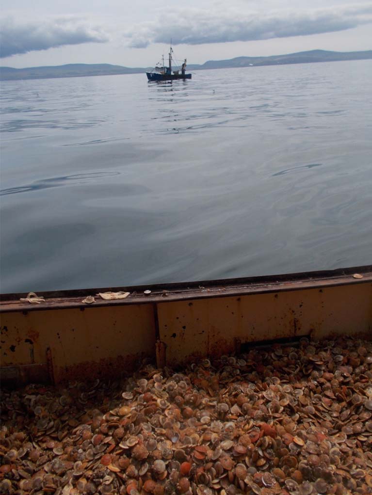
The weight per unit area of all bycatch species caught in the modified nets, fitted with lights, was lower compared with the traditional “control” nets, and there were no significant losses of the target catch of the two vessels - Queen scallop.
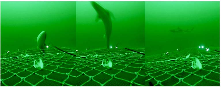 Spurdog (Squalus acanthias) escaping from the illuminated square mesh panel at 29-40m depth. Photo: Lucy K Southworth)
More details are in the April issue of The Skipper magazine.
MORE LIGHT, LESS BYCATCH.
— lucy southworth (@SouthworthLucy) April 17, 2020
In light of the #landingsobligation, @lornasiggins writes in @SkipperEditor about our ? bycatch reduction study using LEDs?
Escape rates for key bycatch species (haddock, whiting, flatfish) differ depending on water depth and light levels...? pic.twitter.com/nauGuzBmDi
Terrifying Nemo - New Study on Impact of Boat Engine Noise on Fish Finds Clownfish Severely Bothered
Everyone who has ever seen the Pixar film Finding Nemo knows what a clownfish looks like, but a new study gives some alarming insight into their response to human behaviour.
A study by international scientists on the impact of motorboat engine noise found that clownfish are so bothered by it that they will hide, skip meals and even attack domino damselfish and other neighbours.
The erratic behaviour is the result of hormonal changes caused by the engine noise, the researchers from France, Chile and Britain state.
Working on the reefs around Moorea in French Polynesia, the scientists exposed 40 pairs of clownfish to recordings of natural reef sounds or motorboat noise for up to two days.
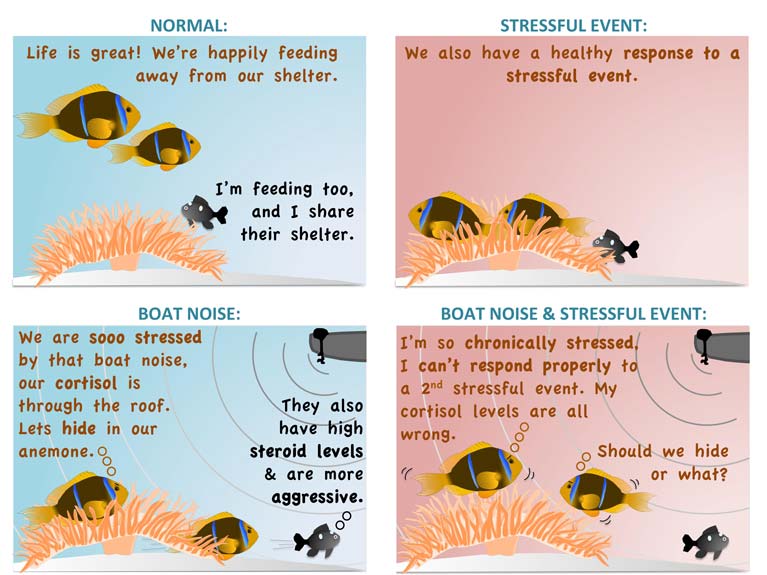
The engine reverberations caused clownfish to “hide in the protective tentacles of their host anemone, move less into open water to feed, and to be more aggressive towards domino damselfish that also reside in the anemone”, they found.
They also found that anemonefish which were also affected by the noise were “unable to respond appropriately to a second stressor, putting them at greater risk from threats such as predators and climate change”.
The study found noise-exposed fish had elevated levels of the stress hormone, cortisol.
They also had higher levels of the reproductive hormones testosterone and 11-ketotestosterone, which corresponded with observed behavioural changes.
“These measurable hormones offer a window into complex behaviours and could be used to develop new noise-mitigation tools,” the scientists state.
Associate professor Suzanne Mills at the École Pratique des Hautes Études (EPHE) PSL Université Paris in France, who is lead author, noted that the high cortisol levels after two days of exposure suggest that clownfish become “chronically stressed by motorboat noise”.
“This compromises the stress response system, leaving clownfish unable to mount appropriate responses to further stressful events. If these stressful events include a predator, motorboat noise could have grave implications,” she said.
“Our new findings highlight the need to control man-made noise in marine protected habitats,” she said.
The paper, entitled Hormonal and behavioural effects of motorboat noise on wild coral reef fish, is published in the journal Environmental Pollution.
Ocean's Ability to Capture Atmospheric Carbon "Drastically Underestimated", Woods Hole Oceanographic Institution Study Finds
The ocean’s biological “carbon pump” has been “drastically underestimated in its ability to capture carbon from the atmosphere, a new study has found writes Lorna Siggins
Scientists with the US Woods Hole Oceanographic Institution (WHOI) have found that the depth of the sunlit area where photosynthesis takes place varies significantly throughout the ocean.
A paper published by WHOI geochemist Ken Buesseler in the journal Proceedings of the National Academy of Sciences explains that this matters because the phytoplankton’s ability to take up carbon depends on the amount of sunlight that’s able to penetrate the ocean’s upper layer.
By taking account of the depth of the “euphotic”, or sunlit zone, and his fellow authors found that about twice as much carbon sinks into the ocean per year than previously estimated.
The paper relies on previous studies of the carbon pump, including his own.
“Is the amount of carbon sinking in the ocean going up or down?"
“If you look at the same data in a new way, you get a very different view of the ocean’s role in processing carbon, hence its role in regulating climate,” Buesseler has said.
“Using the new metrics, we will be able to refine the models to not just tell us how the ocean looks today, but how it will look in the future,” he says.
“Is the amount of carbon sinking in the ocean going up or down? That number affects the climate of the world we live in.”
Buesseler and his co-authors call on their fellow oceanographers to consider their data in context of the actual boundary of the euphotic zone.
“If we’re going to call something a euphotic zone, we need to define that,” he says. “So we’re insisting on a more formal definition so that we can compare sites.”
Rather than taking measurements at fixed depths, the authors used chlorophyll sensors —indicating the presence of phytoplankton— to rapidly assess the depth of the sunlit region. They also suggest using the signature from a naturally-occuring thorium isotope to estimate the rate at which carbon particles are sinking.
Buesseler is a principal investigator with WHOI’s Ocean Twilight Zone project, which focuses on what he calls the “little-understood but vastly important mid-ocean region”.
Buesseler and colleagues have already called on the international marine research community to intensify studies of the twilight zone during the upcoming United Nations Decade of the Ocean (2021-2030).
Increased understanding of the twilight zone ecosystem and its role in regulating climate will lead to global policy to protect the area from exploitation, he and his colleagues state.
Co-authors of the paper include: Phillip Boyd of University of Tasmania, Australia; Erin Black of Dalhousie University, Nova Scotia, and Lamont Doherty Earth Observatory, New York; and David Siegel, University of California, Santa Barbara.
This work was funded by WHOI’s Ocean Twilight Zone project; NASA; the Ocean Frontier Institute at Dalhousie University; and the Australian Research Council.
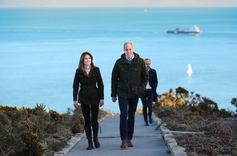
The vital role of the ocean, climate change, and actions to safeguard it for future generations were the focus of conversations between The Duke and Duchess of Cambridge and the Marine Institute during the royal couple’s first official visit to Ireland.
Dr Paul Connolly, CEO of the Marine Institute, Ireland’s state agency for marine research, technology development and innovation, along with All-Ireland Ocean Youth Ambassador, Eimear Manning, met with The Duke and Duchess at Howth, North County Dublin, today.
During a coastal walk of Howth Head, Dr Connolly spoke with Their Royal Highnesses on several subjects that are central to the work of the Marine Institute including the importance of the oceans to coastal communities and climate adaptation. The Marine Institute, through the BlueFish Project, is working with coastal communities in Ireland and Wales on the importance of the ocean to their livelihoods and the impacts of a changing climate.
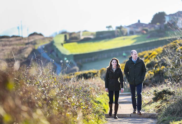 The Royal couple take a stroll on the Hill of Howth, a village and outer suburb of Dublin Photo: Julien Behal
Other topics of conversation included Ireland’s role in exploring and mapping the seabed, international collaboration on ocean research, and the Marine Institute’s role in empowering Ireland and its people to safeguard and harness our ocean wealth.
Eimear Manning is one of 23 All-Atlantic Ocean Youth Ambassadors who are supported by the All-Atlantic Ocean Research Alliance (AORA). She is also an environmental education specialist delivering programmes for a variety of environmental and youth-focused charities and Non-Governmental Organisations.
She spoke with The Duke and Duchess of Cambridge about ways to engage with communities, schools and businesses to introduce behavioural change initiatives and programmes for the marine environment. Working with All-Atlantic Ocean Youth Ambassadors across the globe, she strives to promote sustainable development and stewardship of the Atlantic Ocean.
The Marine Institute’s work aligns with The Royal Foundation of The Duke and Duchess of Cambridge and its aim to unite people to tackle some of today’s biggest challenges.
In January 2020, Prince William launched the Earthshot Prize, an ambitious set of challenges to inspire a decade of action to repair the planet. These challenges will seek answers to the biggest issues currently facing the planet, including climate and energy, nature and biodiversity, oceans, air pollution and fresh water.
2020 signals a ‘super year’ for the environment with crucial summits including the COP26 Climate Change Conference in the UK and the Convention on Biodiversity in China and the UN Ocean Conference. This year, European Maritime Day takes place in Cork City, Ireland, with a two-day event (14-15 May) during which Europe’s maritime community meet to discuss and forge joint action on maritime affairs and sustainable blue growth.
Dr Paul Connolly, CEO of the Marine Institute said, “I was delighted to meet with Their Royal Highnesses, The Duke and Duchess of Cambridge, to talk about shared interests in protecting our oceans and adapting to a changing climate.”
“Our oceans are fundamental to life on earth. They unite us – yet they face a multitude of challenges. Our focus in the Marine Institute is to further our understanding of our changing ocean. Our enhanced knowledge and services help us to observe these patterns of change and identify the steps to safeguard our marine ecosystems for future generations.”
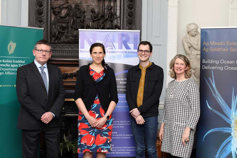
Arctic Researchers Network for Ireland
The Marine Institute in collaboration with the Department of Foreign Affairs and Trade launched the Network of Arctic Researchers in Ireland (NARI) last Friday.
NARI aims to create, maintain and develop an informal all-island network of Arctic researchers in Ireland to facilitate the collaboration of scientific activities linked to the Arctic, and to provide independent scientific advice to the public and policymakers.
Irish sailors have voyaged to both the Arctic and Antarctic in recent times. Last Summer Gary McMahon's restored Ilen project went to Greenland and the Arctic circle. Jamie Young’s Frers 49 exploration yacht Killary Flyer from Ireland's west coast travelled to the Arctic in 2013 and 2019. And this year Round the World Sailor Damian Foxall led a mission to Antarctica.
According to the IPCC Special Report on the Ocean and Cryosphere, the extent of Arctic sea ice is declining and is getting thinner. Glaciers and ice sheets in polar and mountain regions are also losing mass, contributing to an increasing rate of sea-level rise, together with expansion of the warmer ocean. Sea level rise will increase the frequency of extreme sea-level events and warming oceans are disrupting marine ecosystems.
With significant demand for greatly enhanced knowledge and services to observe the changes in our oceans, NARI aims to enhance collaboration and promote Irish-based Arctic research activities, seek international polar cooperation and support the next generation of Arctic scientists.
President of NARI, Dr Audrey Morley of National University of Ireland, Galway said, “The coordination of research efforts on a regional, national and international scale is becoming increasingly urgent in order to address the emerging environmental and societal pressures on the Arctic region, which are of global significance. NARI will support a greater scientific understanding of the Arctic region and its role in the Earth system.”
Dr Audrey Morley will be leading a survey on the Marine Institute’s marine research vessel the RV Celtic Explorer later this year to improve our understanding of marine essential climate variables in the Nordic Seas. The Marine Institute is providing ship-time funding for this research survey and funding Dr Audrey Morley’s Post-Doctoral Fellowship (Decoding Arctic Climate Change: From Archive to Insight) in support of improving our understanding of Arctic climate change and ecosystems.
Dr Paul Connolly, CEO of the Marine Institute said, “As an Arctic neighbour, Ireland is exposed to the effects of a warming ocean, such as rising sea levels, increasing storm intensity and changing marine ecosystems. Scientists based in Ireland can make a real and meaningful contribution to Arctic research, and help to develop and implement adaptation responses from local to global scales. The Marine Institute is delighted to be supporting a network which will foster impactful research into the causes, manifestations and impact of Arctic change.”
Since 2018, the Embassy of Ireland in Oslo and the Marine Institute have sponsored early career researchers to attend the Arctic Frontiers Emerging Leaders. It is an annual program held in Tromsø, Norway, which brings together approximately 30 young scientists and professionals from around the world with interests in Arctic security, Arctic economy and Arctic environment.
 The Marine Institute and Dept Foreign Affairs have launched an informal Arctic researchers network
Ciara Delaney, Regional Director at the Department of Foreign Affairs and Trade, said: “The Department of Foreign Affairs is delighted to host today’s round-table meeting of Irish-based Arctic researchers. Given the impact of climate change and the increasing relevance of strategic developments in the Arctic, the Arctic region is of growing importance to Ireland. A previous roundtable meeting in 2019 demonstrated considerable interest for the establishment of a national network of researchers to identify and take forward areas of common interest on Arctic issues. Building on this initiative, we are delighted to officially launch the new Network, together with the Marine Institute of Ireland. I hope that NARI can contribute to developing a strong, research-led, evidence base for Ireland’s growing engagement with the Arctic region.”
The new all-island network (NARI) brings together multidisciplinary scientists from the National University of Ireland Galway, the University of Limerick, the National Maritime College of Ireland, Cork Institute of Technology, Queens University Belfast, National University of Ireland Maynooth, University College Dublin, Trinity College Dublin and University College Cork.
Marine Institute’s 'Explorers Education Programme' Arrives in Dun Laoghaire Harbour
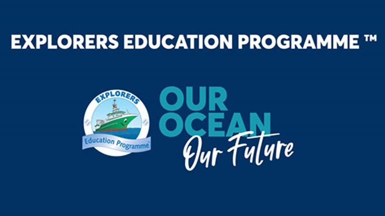
The children from Glenageary Killiney National School (GKNS) are participating in the Marine Institute's Pilot Explorers Education Programme™, hosted by the Irish National Sailing & Powerboat School in Dun Laoghaire this Friday. The programme complements the national school curriculum, presenting children with a deeper understanding of the impact of our ocean, climate change, conservation and a deeper understanding of living things that abound our shores. This programme is a pilot programme funded by the Marine Institute.
‘The children of 5th class in GKNS are delighted and excited to be taking part in this pilot programme, especially this year, as it is very relevant to our attempts to achieve the Green School Biodiversity Flag’ reports Ms Yates, class teacher of fifth class.
The children will participate in a sea safari on the beaches of Salthill and Sea Point in Dun Laoghaire examining marine life and studying the conservation aspects of the shoreline. They will discuss and debate ocean literacy and plan individual and group projects on their findings.
Fifth class hope to participate in The Marine Institute's Explorers Super Hero Pop Art & Creative Writing Competition which was launched by the Marine Institute on the 27 January and is open to all primary schools.
Marine Scientist Running in General Election Criticises "Unrealistic" Green Party Plan to Designate Up to 50 Per Cent of Irish Territorial Waters as Protected
A marine scientist running for the Social Democrats in the general election has described as “unrealistic” a Green Party proposal to designate 50 per cent of Irish territorial waters as marine protected areas writes Lorna Siggins
Wicklow councillor Jennifer Whitmore, who formerly worked for the Marine Institute before spending time in Australia, said her party aims to establish marine protected areas (MPAs) based on “scientific evidence and local community consultation”.
These MPAs would include “no-take zones”, while her party also favours developing a blue carbon strategy for identifying and protecting Ireland’s blue carbon sites, such as seagrass, kelp beds and salt marshes.
The Social Democrats are one of several parties seeking a ban on supertrawlers in Irish waters as part of election manifestos. Sinn Féin has prioritised a ban on supertrawlers but wants to see it extended to an EU-level restriction.
The Green Party also wants to ban offshore salmon farming and switch to “closed-loop” onshore salmon farms. It proposes that all processing plants and fishing vessels over an “agreed size” should be certified as sustainable by the Marine Stewardship Council, and it is seeking a ban on the practice of pair trawling.
The Green Party proposes to end oil and gas exploration and has set ambitious targets for offshore renewable energy.
Fine Gael has committed to ending licensing for oil exploration, and taking a phased approach to gas, while Solidarity-People Before Profit had spearheaded legislation to ban oil and gas exploration. The latter party also wants a ban on supertrawlers and support for conservation and sustainable commercial fishing. At local level, People Before Profit helped to establish the Save our Seafront campaign in Dun Laoghaire in 2002 to oppose commercialisation of the coastal rim.
Fine Gael has one of the lengthiest policies on the marine sector in its manifesto, much of which is drawn from the Government’s “Harnessing Our Ocean Wealth” strategy, including a commitment to “investigating the practicalities and merits” of establishing an offshore maritime area as Ireland’s seventh national park.
Fianna Fáíl priorities safeguarding Ireland’s interest in future EU-UK discussions on fishing, and promises to seek EU “Brexit contingency” funding for fishermen. It also promises to introduce an “Oceans Act “ to protect marine biodiversity and commits to reviewing the contentious Sea Fisheries and Maritime Jurisdiction Act.
Labour promises to set up maritime conservation zones and expand the Naval Service, while Aontú wants to retain the “status quo” in fishing as part of its rural policy.
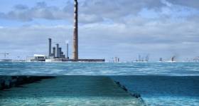
The Irish Times writes, that a catastrophic storm during high tide will leave thousands of homes, businesses and landmark buildings in Dublin under water is inevitable over the coming decades, one of the country’s foremost climate change experts has warned.
Prof Peter Thorne said Ireland had been lucky to “dodge a bullet” until now during major storm events – because they have struck during low or neap tides – but it was only a matter of time until the elements combined for a devastating surge.
The Maynooth University academic, who was lead author on the fifth assessment report of the UN’s Intergovernmental Panel on Climate Change, and is aged 40, said he expected a major high tide flood event in his lifetime.
In the capital this would mean water from Dublin Bay surging into the Liffey while it was in full flow from the Wicklow mountains.
More on this story by clicking here.


 Bureau Veritas.")
 will be interviewed by marine journalist Lorna Siggins at the Borris festival - acknowledged as the coolest literary festival on the island - on Sunday, June 9th at 2.50 pm")


 with his exuberant crew as they celebrate being overall winners of Howth Wave 2024")


