Menu

Ireland's sailing, boating & maritime magazine

Weather Continues to Affect Ships With Temporary Closures Also at Dublin's Great South Wall

23rd February 2021
Adverse weather conditions have led to the temporary closure of Dublin Port's load-on/load-off (lo-lo) terminals, among them the MTL Terminal (also above: the East-Link Bridge) on the south bank quays, close to Ringsend. For updates also on the affected access for pedestrians to the Great South Wall, consult the links below and live weather data from the Dublin Bay Buoy's 'twitter' account. Adverse weather conditions have led to the temporary closure of Dublin Port's load-on/load-off (lo-lo) terminals, among them the MTL Terminal (also above: the East-Link Bridge) on the south bank quays, close to Ringsend. For updates also on the affected access for pedestrians to the Great South Wall, consult the links below and live weather data from the Dublin Bay Buoy's 'twitter' account. Credit: (File photo) Jehan Ashmore

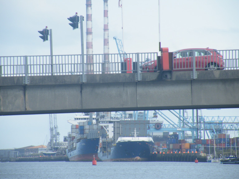
As Afloat reported, Dublin Port Company yesterday announced delays to some shipping activity and pilotage due to bad weather that also led to temporary closure for pedestrians to the Great South Wall (until to Wed 24 Feb, at 4am), writes Jehan Ashmore.

Due to the adverse weather conditions, (continued today) this has indeed affected shipping including the temporary closure of Load-On/Load-Off (Lo-Lo) container handling terminals. The high winds has led to health and safety concerns resulting in these closures at the port's three container terminals. DPC is monitoring the situation and updates will be made via social media channels and on dublinport.ie

In addition for further updates on the Great South Wall (click link above) given the rough seas and high-tides.

Since Storm Darcy's recent battering of Dublin Bay, the inclement weather continues today with Met.ie forecasting gale force ranging 8-9. The juristriction of Dublin Bay is under the remit of DPC and as evident of Storm Darcy, that led also to closing the anchorage to shipping as very strong easterly winds make the bay extremely exposed and pose a danger to ships.

The scene was set when Afloat reported on the Dublin Bay Buoy, see (tweeter account) with live weather data. Whereas at one stage this morning, the buoy, part of a MetOcean /Smart Buoy nationwide network (see Irish Lights), recorded south easterly winds with an average of 28knots and gusts reaching 43 knots. While wave heights reached 2.2m.

In more clement weather conditions, ships calling to the port (and those requiring anchorage) use Dublin Bay. This is where DPC has a dedicated anchorage zone which is divided into quandrants. One ship is allocated a quandrant, so 4 ships can be accommodated with DPC charging an anchorage fee based on those exceeding a week's duration.

During the week of Storm Darcy, there was a big ‘fetch’ up the Irish Sea which promoted a large swell on all east coast anchorages. As Dublin Bay was under such adverse weather conditions, this posed issues of space and safety of vessels in relatively close proximity and potential for difficulties in holding ground at anchorage.

Afloat understands that only one ship, a large bulker during the height of Storm Darcy, was at anchor but was forced to depart Dublin Bay and head off of the Kish Bank. While other ships that were arriving to await a scheduled allocated berth time, mostly took up anchorage on the fringes of Killiney Bay. Some ships rode out the weather by running parallel off the coast but further offshore.

A minority of ships however headed across to the other side of the Irish Sea, to north Wales where anchorage took place off Anglesey. This involved to the south off the Lyn Peninsula and also off Moelfre, on the east of Anglesey which afforded more shelter.

Published in Dublin Port
Jehan Ashmore

About The Author

Jehan Ashmore

Email The Author

Jehan Ashmore is a marine correspondent, researcher and photographer, specialising in Irish ports, shipping and the ferry sector serving the UK and directly to mainland Europe. Jehan also occasionally writes a column, 'Maritime' Dalkey for the (Dalkey Community Council Newsletter) in addition to contributing to UK marine periodicals. 

We've got a favour to ask

More people are reading Afloat.ie than ever thanks to the power of the internet but we're in stormy seas because advertising revenues across the media are falling fast. Unlike many news sites, we haven't put up a paywall because we want to keep our marine journalism open.

Afloat.ie is Ireland's only full-time marine journalism team and it takes time, money and hard work to produce our content.

So you can see why we need to ask for your help.

If everyone chipped in, we can enhance our coverage and our future would be more secure. You can help us through a small donation. Thank you.

Direct Donation to Afloat button

About Dublin Port 

Dublin Port is Ireland’s largest and busiest port with approximately 17,000 vessel movements per year. As well as being the country’s largest port, Dublin Port has the highest rate of growth and, in the seven years to 2019, total cargo volumes grew by 36.1%.

The vision of Dublin Port Company is to have the required capacity to service the needs of its customers and the wider economy safely, efficiently and sustainably. Dublin Port will integrate with the City by enhancing the natural and built environments. The Port is being developed in line with Masterplan 2040.

Dublin Port Company is currently investing about €277 million on its Alexandra Basin Redevelopment (ABR), which is due to be complete by 2021. The redevelopment will improve the port's capacity for large ships by deepening and lengthening 3km of its 7km of berths. The ABR is part of a €1bn capital programme up to 2028, which will also include initial work on the Dublin Port’s MP2 Project - a major capital development project proposal for works within the existing port lands in the northeastern part of the port.

Dublin Port has also recently secured planning approval for the development of the next phase of its inland port near Dublin Airport. The latest stage of the inland port will include a site with the capacity to store more than 2,000 shipping containers and infrastructures such as an ESB substation, an office building and gantry crane.

Dublin Port Company recently submitted a planning application for a €320 million project that aims to provide significant additional capacity at the facility within the port in order to cope with increases in trade up to 2040. The scheme will see a new roll-on/roll-off jetty built to handle ferries of up to 240 metres in length, as well as the redevelopment of an oil berth into a deep-water container berth.

Dublin Port FAQ

Dublin was little more than a monastic settlement until the Norse invasion in the 8th and 9th centuries when they selected the Liffey Estuary as their point of entry to the country as it provided relatively easy access to the central plains of Ireland. Trading with England and Europe followed which required port facilities, so the development of Dublin Port is inextricably linked to the development of Dublin City, so it is fair to say the origins of the Port go back over one thousand years. As a result, the modern organisation Dublin Port has a long and remarkable history, dating back over 300 years from 1707.

The original Port of Dublin was situated upriver, a few miles from its current location near the modern Civic Offices at Wood Quay and close to Christchurch Cathedral. The Port remained close to that area until the new Custom House opened in the 1790s. In medieval times Dublin shipped cattle hides to Britain and the continent, and the returning ships carried wine, pottery and other goods.

510 acres. The modern Dublin Port is located either side of the River Liffey, out to its mouth. On the north side of the river, the central part (205 hectares or 510 acres) of the Port lies at the end of East Wall and North Wall, from Alexandra Quay.

Dublin Port Company is a State-owned commercial company responsible for operating and developing Dublin Port.

Dublin Port Company is a self-financing, and profitable private limited company wholly-owned by the State, whose business is to manage Dublin Port, Ireland's premier Port. Established as a corporate entity in 1997, Dublin Port Company is responsible for the management, control, operation and development of the Port.

Captain William Bligh (of Mutiny of the Bounty fame) was a visitor to Dublin in 1800, and his visit to the capital had a lasting effect on the Port. Bligh's study of the currents in Dublin Bay provided the basis for the construction of the North Wall. This undertaking led to the growth of Bull Island to its present size.

Yes. Dublin Port is the largest freight and passenger port in Ireland. It handles almost 50% of all trade in the Republic of Ireland.

All cargo handling activities being carried out by private sector companies operating in intensely competitive markets within the Port. Dublin Port Company provides world-class facilities, services, accommodation and lands in the harbour for ships, goods and passengers.

Eamonn O'Reilly is the Dublin Port Chief Executive.

Capt. Michael McKenna is the Dublin Port Harbour Master

In 2019, 1,949,229 people came through the Port.

In 2019, there were 158 cruise liner visits.

In 2019, 9.4 million gross tonnes of exports were handled by Dublin Port.

In 2019, there were 7,898 ship arrivals.

In 2019, there was a gross tonnage of 38.1 million.

In 2019, there were 559,506 tourist vehicles.

There were 98,897 lorries in 2019

Boats can navigate the River Liffey into Dublin by using the navigational guidelines. Find the guidelines on this page here.

VHF channel 12. Commercial vessels using Dublin Port or Dun Laoghaire Port typically have a qualified pilot or certified master with proven local knowledge on board. They "listen out" on VHF channel 12 when in Dublin Port's jurisdiction.

A Dublin Bay webcam showing the south of the Bay at Dun Laoghaire and a distant view of Dublin Port Shipping is here
Dublin Port is creating a distributed museum on its lands in Dublin City.
 A Liffey Tolka Project cycle and pedestrian way is the key to link the elements of this distributed museum together.  The distributed museum starts at the Diving Bell and, over the course of 6.3km, will give Dubliners a real sense of the City, the Port and the Bay.  For visitors, it will be a unique eye-opening stroll and vista through and alongside one of Europe’s busiest ports:  Diving Bell along Sir John Rogerson’s Quay over the Samuel Beckett Bridge, past the Scherzer Bridge and down the North Wall Quay campshire to Berth 18 - 1.2 km.   Liffey Tolka Project - Tree-lined pedestrian and cycle route between the River Liffey and the Tolka Estuary - 1.4 km with a 300-metre spur along Alexandra Road to The Pumphouse (to be completed by Q1 2021) and another 200 metres to The Flour Mill.   Tolka Estuary Greenway - Construction of Phase 1 (1.9 km) starts in December 2020 and will be completed by Spring 2022.  Phase 2 (1.3 km) will be delivered within the following five years.  The Pumphouse is a heritage zone being created as part of the Alexandra Basin Redevelopment Project.  The first phase of 1.6 acres will be completed in early 2021 and will include historical port equipment and buildings and a large open space for exhibitions and performances.  It will be expanded in a subsequent phase to incorporate the Victorian Graving Dock No. 1 which will be excavated and revealed. 
 The largest component of the distributed museum will be The Flour Mill.  This involves the redevelopment of the former Odlums Flour Mill on Alexandra Road based on a masterplan completed by Grafton Architects to provide a mix of port operational uses, a National Maritime Archive, two 300 seat performance venues, working and studio spaces for artists and exhibition spaces.   The Flour Mill will be developed in stages over the remaining twenty years of Masterplan 2040 alongside major port infrastructure projects.

Source: Dublin Port Company ©Afloat 2020.