Displaying items by tag: irish sea
Sediment Waves Survey in Irish Sea Resumes With Second Leg Next Weekend
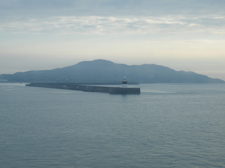
The second leg of the MOVE 2 survey of the mobility of sediment waves and sand banks will be carried out in the Irish Sea off Wicklow and Wexford from next weekend.
As noted previously on Afloat.ie, reporting on the survey in March this year, it will involve the use of multi-beam echo sounders and sub-bottom profilers at various sites, and sediment grabs samples will also be taken.
Survey operations will be carried out on a 24-hour schedule between Saturday 4 and Monday 13 December by the RV Celtic Voyager (callsign EIQN), which will be displaying appropriate lights and signals.
This survey is being carried out in support of ongoing research at the SFI Centre for Energy, Climate and Marine research and innovation (MaREI) and the Irish Centre for Research in Applied Geosciences (iCRAG).
More on the survey including coordinates and contact details can be found in Marine Notice No 63 of 2021, a PDF of which is available to download below.
Installation of the Havhingsten fibre optic telecommunication cable system is planned from Monday 23 August until Thursday 23 September in the Irish Sea outside of the Irish 12-nautical-mile zone.
Works within 12 nautical miles of Ireland’s mainland are planned from December 2021 subject to weather and operational conditions.
There will also be associated rock placement operations post-cable installation at four locations within the western Irish Sea and these works are expected in between October and December, weather permitting.
The entire cable system will comprise marine elements that pass from Denmark to the UK (NE region), and from the UK (NW) to Ireland, with two segments installed into landfalls on the Isle of Man. The cable route for the western Irish Sea region lands at Loughshinny in north Co Dublin.
Installation will be via industry standard burial tools including water jetting and ploughing. Target cable burial depth is 1.5m below seabed level in the region.
It is anticipated that installation operations in UK/Irish waters will occupy up to a maximum 500m width (250m either side of cable). The cable itself will occupy only 40mm of the seabed. Expected speed of installation will be approximately 17km per day.
Works will be conducted by the cable installation vessel CS Recorder (callsign MATL3) which will operate 24 hours a day and will display appropriate day shapes and lights during reduced visibility and night operations.
All vessels operating within its vicinity are requested to keep their distance, and pass at minimum speed to reduce vessel wash.
Full details, including coordinates for the work areas and rock armour placements, are included in Marine Notice No 45 of 2021 which can be downloaded below.
At a distance of 50-miles, a tunnel under the Irish Sea, connecting Wales and Ireland has been suggested UK Secretary of State for Transport Grant Shapps.
In an interview with the Financial Times, Shapps suggested a tunnel between Wales and Ireland as an alternative to Prime Minister Boris Johnson's scheme to link Scotland with Northern Ireland.
When questioned on the idea of linking Northern Ireland with mainland Britain, he said: "Why not?"
The Daily Express reported that the tunnel could be from Holyhead to Dublin and had been previously been priced at £15bn. It would be twice as long as the Channel Tunnel linking Kent and France (see other story on Irish Ferries).
In the Sunday Times, Political Editor Tim Shipman reported that a feasibility study could be launched in the next few weeks.
NorthWalesLive has more on this story.
Following the recent notice of geophysical surveys for the Codling Wind Park comes news of a series of geotechnical surveys in the Irish Sea off Wicklow for the project set to commence tomorrow, Monday 26 April.
Works to characterise the wind park area will be conducted until Saturday 26 June, weather permitting, from the LB Jill (callsign WDH 6208) on a 24-hour basis. The vessel will display appropriate lights and shapes.
As the LB Jill will be restricted in ability to manoeuvre, all vessels operating within the work area are requested to keep their distance, maintaining a safety zone around the geotechnical investigation vessel, and pass at minimum speed to reduce vessel wash.
Further details including coordinates for the survey works are included in Marine Notice No 28 of 2021, which can be downloaded below.
Geophysical Surveys for Codling Wind Park off Dublin & Wicklow
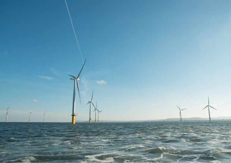
The Department of Transport has been advised that Codling Wind Park Limited intend to conduct a series of geophysical surveys in the Irish Sea off Dublin and Wicklow from Wednesday 14 April to Wednesday 26 May, weather permitting.
This work is intended to provide options for export cable routes to possible landfall options in the areas of Poolbeg, Dun Laoghaire, Greystones and Wicklow.
A total of two vessels will be working on the project. Arctic Ocean (callsign OZGP2) will undertake geophysical operations to characterise the export cable sites (weather permitting). Survey operations will be conducted on a 24-hour basis.
Meanwhile, Faraday (callsign MJZX5) will undertake geophysical operations (weather permitting). Survey operations will be conducted on a 12-hour basis.
Throughout survey operations, the vessels will be displaying the appropriate lights and shapes. As both vessels will be towing survey equipment, they will also require large turning circles and will be restricted in their ability to manoeuvre.
All vessels operating within the work area are requested to keep their distance, maintaining at least the 500m safety zone around the survey vessel and pass at minimum speed to reduce vessel wash.
Further details including coordinated and contacts are included in Marine Notice No 21 of 2021, a PDF of which can be downloaded below.
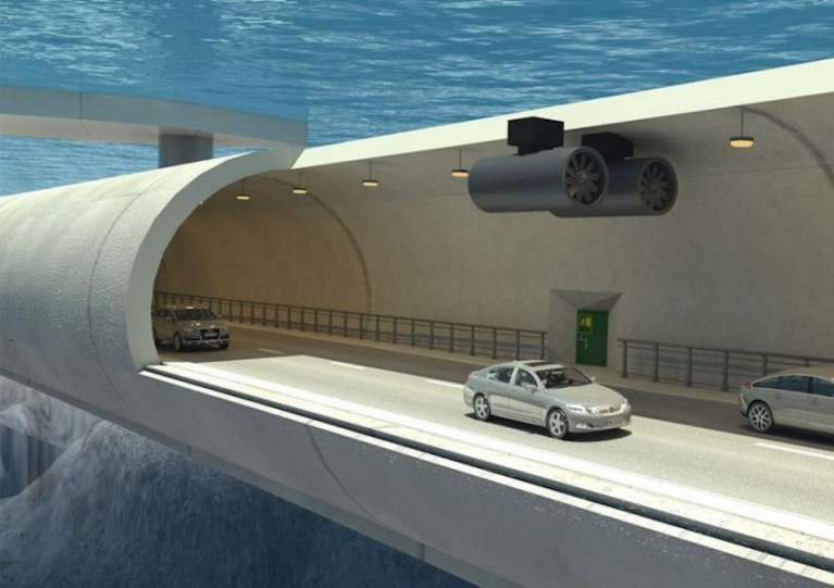
Two ex-presidents of the UK’s Institution of Civil Engineers (ICE) have been tasked with carrying out a study on the feasibility of an Irish Sea crossing between Britain and Northern Ireland.
As industry publication New Civil Engineer reports, Douglas Oakervee and Gordon Masterson have been charged by British Prime Minister Boris Johnson with evaluating the various proposals.
These include an “underground roundabout” beneath the Isle of Man that would connect separate tunnels Northern Ireland, Scotland and England — an idea inspired by a similar project in the Faroe Islands.
Another proposal for a Northern Ireland-Scotland tunnel suggests that it could help create a new “capital cities axis” stretching from Dublin to Edinburgh.
The possibility of a road-rail link between Northern Ireland and mainland Britain returned to the agenda earlier this year following Brexit, with one of the options mooted being a a “floating underwater tunnel” along the sea bed, as previously discussed by our own WM Nixon.
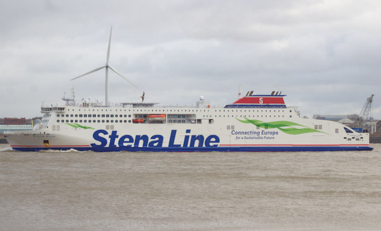
A child has been airlifted to hospital in Liverpool from a ferry in the Irish Sea after what’s been described as a “serious medical emergency”.
The Irish Mirror reports on the incident in the early hours of yesterday (Wednesday 17 March) in which the youngster was taken ill on board the Stena Line vessel Stena Edda near the Isle of Man, while en route from Liverpool to Belfast.
Belfast Coastguard coordinated the emergency medevac response which saw the search and rescue helicopter from Caernarfon in Wales attend and airlift the child and three family members to Alder Hey Children’s Hospital.
NI’s Agriculture Minister has cited “practical difficulties” with the Northern Ireland Protocol in his decision to order a halt on construction of post-Brexit port inspection facilities.
According to Politico, acting DAERA Minister Gordon Lyons has also told NI ports not to levy charges on goods brought into Northern Ireland from Great Britain.
However, the order issued yesterday (Friday 26 February) does not apply to checks at existing infrastructure repurposed for the new trade regime since the end of the Brexit transition period on 31 December 2020.
Lyons’s party the DUP is currently mounting a legal challenge to the Northern Ireland Protocol, which places a de facto trade border in the Irish Sea between GB and NI.
Politico has more on the story HERE.
Football Lost Off Waterford Beach Makes Landfall in Wales a Week Later
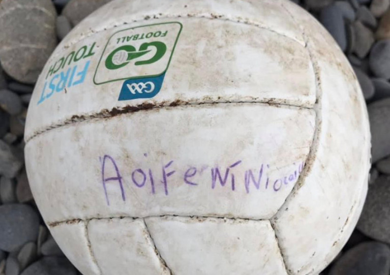
A family in Waterford got a big surprise at the weekend when they learned a football they’d lost in the water was found on the Welsh coast.
As the Irish Examiner reports, Aline Denton was walking on the shore near her Llanrhystud home when she spotted the ball bearing the distinctive GAA logo and the name Aoife Ní Niocaill.
After posting the discovery on her Facebook page, it took on a life of its own — and within hours Aoife’s father has spotted the image and got in touch.
He informed her how the ball had been lost as the tide turned off Woodstown beach on Sunday 10 January.
In the days since, it turns out it had been carried across St George’s Channel and the Irish Sea to the shores of Cardigan Bay.
The Irish Examiner has more on the story HERE.
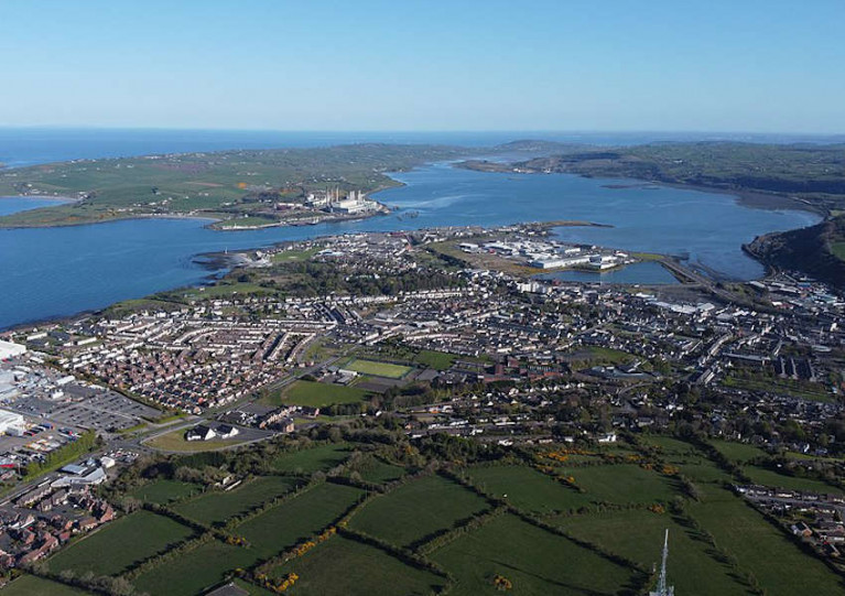
Larne Harbour To Get Post-Brexit Facilities for Checks on GB Imports
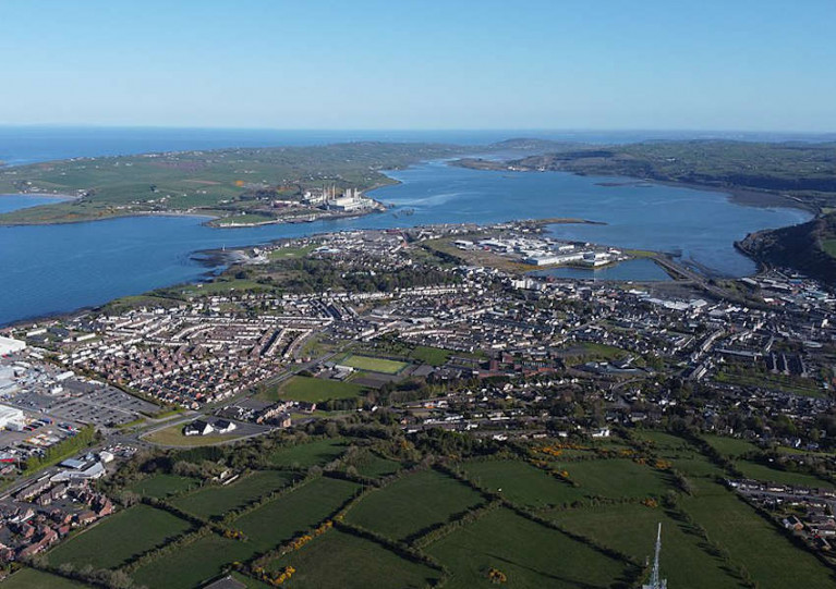
Larne Harbour is set to get dedicated facilities for post-Brexit checks on imports of food and livestock from Great Britain later this year, as the Belfast Telegraph reports.
Currently a team of 12 environmental health officers are working “24/7, in a 365 role on 12-hour shifts” checking documentation on goods shipping across the Irish Sea border established by UK Prime Minister Boris Johnson’s last-minute trade deal with the EU.
The new infrastructure, expected to be in place by September, will allow for physical checks on food imports as well as live animals such as horses as they arrived into Northern Ireland from other parts of the UK.
Meanwhile, veterinarians in Northern Ireland have been helping businesses fill in the required forms to trade across the Irish Sea.
Speaking to a Stormont Committee, NI’s chief vet Dr Robert Huey said his staff have had to help “overwhelmed” hauliers fill in food standards and customs paperwork to comply with the new regulations.
BBC News has more on the story HERE.


