Menu

Ireland's sailing, boating & maritime magazine

Dublin Bay Boating News and Information

The 'Dublin Bay Buoy' Tells It All As Easterly Gales Force Ships Elsewhere

10th February 2021
Storm Darcy's Siberian blast led to disruption of ships forcing some to depart Dublin Bay and one to head over to north Wales. The Dublin Bay Buoy is approximately in the centre of the bay and asides as an aid to navigation for mariners and shipping, also provides frequent weather updates (by twitter). In addition, Dublin Port operates a Vessel Traffic Service (VTS) for the safe and efficient transit of shipping within the port limits while the Buoy acts as a 'roundabout' for vessels operating in and out of country's busiest port. Storm Darcy's Siberian blast led to disruption of ships forcing some to depart Dublin Bay and one to head over to north Wales. The Dublin Bay Buoy is approximately in the centre of the bay and asides as an aid to navigation for mariners and shipping, also provides frequent weather updates (by twitter). In addition, Dublin Port operates a Vessel Traffic Service (VTS) for the safe and efficient transit of shipping within the port limits while the Buoy acts as a 'roundabout' for vessels operating in and out of country's busiest port. Credit: Commissioners of Irish Lights (CIL) -twitter

After Storm Darcy's Siberian easterly gale-force winds and seas battered Dublin Bay, the weather particularly yesterday saw several ships leave anchorage, arrive elsewhere or ride out at sea, writes Jehan Ashmore

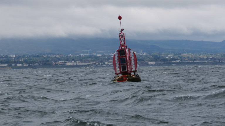
The bad weather yesterday according to the Dublin Bay Buoy (weather by twitter) Afloat consulted in the morning and afternoon, where gusts ranged between 31-37 knots and wave heights of 2m and doubling to more than 4m.

According to Met.ie's shipping forecast, this was for weather conditions of force 5 or 6 and gusty and increasing to force 7 for a time this evening south of Howth Head.

Not surprisingly, masters of ships in Dublin Bay's south-west anchorage quadrant (Q3) closest to Dun Laoghaire Harbour, departed and headed further offshore to waters off Killiney Bay and beyond at the Kish Bank.

A bulk-carrier, Draftzilla which has spent anchorage in Dublin Bay of recent days was forced to head out to sea and take up a position close to the lighthouse.

Afloat also tracked and observe these ships building up yesterday late afternoon as they gathered in relative proximity while off Killiney Bay and likewise passing Bray Head.

The Dublin Port bound ships listed below anchored off Killiney Bay (where some remain this afternoon).

Containership Katherine Borchard from Leixoes, Portugal.

Bulk-carrier YM Advance from Foynes, originally from Indonesia.

Containership Helga from Southampton.

General cargoship Panta Rhei from London/Derry.

Tanker Thun Granite (from Dublin Port) originally from Milford Haven, Pembrokeshire.

This tanker along with fleetmates have notably since last year been frequent anchorage callers off Killiney Bay as they await orders (etc). This led the short-sea tanker to head to Whitegate Refinery in Cork Harbour as consulted today.

In addition containership Arx and cement-carrier Ronez also took to riding out the bad weather yesterday while offshore of Greystones.

Ronez, however was than later forced to the other side of the Irish Sea when off the Llŷn Peninsula, south of Anglesey, where weather also affecting shipping was recently reported.

It transpires as of this afternoon, Ronez is now returning to Irish waters by taking a course heading to Wicklow Head, from where the coaster passed yesterday from the Channel Islands. Afloat will have more on this coaster which since last year has been operating moreso in Irish waters.

Also yesterday afternoon, but from the north-east, off Howth Peninsula, containership JSP Rover was veering towards Killiney Bay from Rotterdam.

In addition from the south, car-carrier Schelde Highway from Zeebrugge was off Bray Head.

Published in Dublin Bay
Jehan Ashmore

About The Author

Jehan Ashmore

Email The Author

Jehan Ashmore is a marine correspondent, researcher and photographer, specialising in Irish ports, shipping and the ferry sector serving the UK and directly to mainland Europe. Jehan also occasionally writes a column, 'Maritime' Dalkey for the (Dalkey Community Council Newsletter) in addition to contributing to UK marine periodicals. 

We've got a favour to ask

More people are reading Afloat.ie than ever thanks to the power of the internet but we're in stormy seas because advertising revenues across the media are falling fast. Unlike many news sites, we haven’t put up a paywall because we want to keep our marine journalism open.

Afloat.ie is Ireland's only full–time marine journalism team and it takes time, money and hard work to produce our content.

So you can see why we need to ask for your help.

If everyone chipped in, we can enhance our coverage and our future would be more secure. You can help us through a small donation. Thank you.

Direct Donation to Afloat button

Dublin Bay

Dublin Bay on the east coast of Ireland stretches over seven kilometres, from Howth Head on its northern tip to Dalkey Island in the south. It's a place most Dubliners simply take for granted, and one of the capital's least visited places. But there's more going on out there than you'd imagine.

The biggest boating centre is at Dun Laoghaire Harbour on the Bay's south shore that is home to over 1,500 pleasure craft, four waterfront yacht clubs and Ireland's largest marina.

The bay is rather shallow with many sandbanks and rocky outcrops, and was notorious in the past for shipwrecks, especially when the wind was from the east. Until modern times, many ships and their passengers were lost along the treacherous coastline from Howth to Dun Laoghaire, less than a kilometre from shore.

The Bay is a C-shaped inlet of the Irish Sea and is about 10 kilometres wide along its north-south base, and 7 km in length to its apex at the centre of the city of Dublin; stretching from Howth Head in the north to Dalkey Point in the south. North Bull Island is situated in the northwest part of the bay, where one of two major inshore sandbanks lie, and features a 5 km long sandy beach, Dollymount Strand, fronting an internationally recognised wildfowl reserve. Many of the rivers of Dublin reach the Irish Sea at Dublin Bay: the River Liffey, with the River Dodder flow received less than 1 km inland, River Tolka, and various smaller rivers and streams.

Dublin Bay FAQs

There are approximately ten beaches and bathing spots around Dublin Bay: Dollymount Strand; Forty Foot Bathing Place; Half Moon bathing spot; Merrion Strand; Bull Wall; Sandycove Beach; Sandymount Strand; Seapoint; Shelley Banks; Sutton, Burrow Beach

There are slipways on the north side of Dublin Bay at Clontarf, Sutton and on the southside at Dun Laoghaire Harbour, and in Dalkey at Coliemore and Bulloch Harbours.

Dublin Bay is administered by a number of Government Departments, three local authorities and several statutory agencies. Dublin Port Company is in charge of navigation on the Bay.

Dublin Bay is approximately 70 sq kilometres or 7,000 hectares. The Bay is about 10 kilometres wide along its north-south base, and seven km in length east-west to its peak at the centre of the city of Dublin; stretching from Howth Head in the north to Dalkey Point in the south.

Dun Laoghaire Harbour on the southside of the Bay has an East and West Pier, each one kilometre long; this is one of the largest human-made harbours in the world. There also piers or walls at the entrance to the River Liffey at Dublin city known as the Great North and South Walls. Other harbours on the Bay include Bulloch Harbour and Coliemore Harbours both at Dalkey.

There are two marinas on Dublin Bay. Ireland's largest marina with over 800 berths is on the southern shore at Dun Laoghaire Harbour. The other is at Poolbeg Yacht and Boat Club on the River Liffey close to Dublin City.

Car and passenger Ferries operate from Dublin Port to the UK, Isle of Man and France. A passenger ferry operates from Dun Laoghaire Harbour to Howth as well as providing tourist voyages around the bay.

Dublin Bay has two Islands. Bull Island at Clontarf and Dalkey Island on the southern shore of the Bay.

The River Liffey flows through Dublin city and into the Bay. Its tributaries include the River Dodder, the River Poddle and the River Camac.

Dollymount, Burrow and Seapoint beaches

Approximately 1,500 boats from small dinghies to motorboats to ocean-going yachts. The vast majority, over 1,000, are moored at Dun Laoghaire Harbour which is Ireland's boating capital.

In 1981, UNESCO recognised the importance of Dublin Bay by designating North Bull Island as a Biosphere because of its rare and internationally important habitats and species of wildlife. To support sustainable development, UNESCO’s concept of a Biosphere has evolved to include not just areas of ecological value but also the areas around them and the communities that live and work within these areas. There have since been additional international and national designations, covering much of Dublin Bay, to ensure the protection of its water quality and biodiversity. To fulfil these broader management aims for the ecosystem, the Biosphere was expanded in 2015. The Biosphere now covers Dublin Bay, reflecting its significant environmental, economic, cultural and tourism importance, and extends to over 300km² to include the bay, the shore and nearby residential areas.

On the Southside at Dun Laoghaire, there is the National Yacht Club, Royal St. George Yacht Club, Royal Irish Yacht Club and Dun Laoghaire Motor Yacht Club as well as Dublin Bay Sailing Club. In the city centre, there is Poolbeg Yacht and Boat Club. On the Northside of Dublin, there is Clontarf Yacht and Boat Club and Sutton Dinghy Club. While not on Dublin Bay, Howth Yacht Club is the major north Dublin Sailing centre.

© Afloat 2020