Menu

Ireland's sailing, boating & maritime magazine

Inland afloat headers


Displaying items by tag: tourism

Lighthouse tourism in Ireland has significantly increased, with a 60% rise in overnight stays in such facilities throughout the country since 2019, according to the Great Lighthouses of Ireland tourism initiative. Last year, over 622,000 people visited lighthouses and lighthouse tourism experiences throughout the country.

The Great Lighthouses of Ireland partnership, established in 2015 and led by Irish Lights, is composed of public, private, and community sector partners, and aims to preserve maritime heritage throughout the country. The partnership will host a three-day conference in Belfast from October 8 to plan future growth for lighthouse tourism throughout the country.

Bobby Kerr, chairperson of the Great Lighthouses of Ireland partnership, said, “Lighthouses have such a special and universal appeal and are located in some of our island’s most breathtaking coastal landscapes. Growing lighthouse tourism has multiple benefits. It’s a positive and sustainable way to preserve our maritime heritage. It can provide income and jobs for coastal communities and increase visitor numbers to the island of Ireland.”

Blackhead Lighthouse in County Antrim Photo: Malcolm McGettiganBlackhead Lighthouse in County Antrim Photo: Malcolm McGettigan

The Great Lighthouses of Ireland partnership has estimated that it provided an economic benefit of €16.8m in under four years and supported over 400 jobs before the COVID-19 pandemic. Irish Lights CEO Yvonne Shields O’Connor stated that the partnership’s recovery is underway and that it is well-positioned for the future.

“We share a vision and collaborate as partners to create truly inspiring and transformative visitor experiences. It’s time now to be more ambitious about what we can achieve together,” said O’Connor.

The Titanic Light, Belfast, is part of the Great Lighthouses of Ireland tourism initiativeThe Titanic Light, Belfast, is part of the Great Lighthouses of Ireland tourism initiative

The conference, which is scheduled for October 8-10, will explore a number of lighthouse-related projects throughout Northern Ireland, with the goal of developing sustainable visitor experiences based on maritime heritage and culture throughout the region.
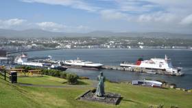
Published in Lighthouses
Tagged under

cruiseship that arrived in Belfast Harbour today marks the final call (Afloat adds Borealis) in a year that Cruise Belfast, the partnership between the port and Visit Belfast is celebrating a strong cruise season with 141 calls made in 2022.

This year’s successful cruise season (April-November), saw more than 50 different ships from 33 cruise lines dock in the city, carrying more than 250,000 visitors who came ashore to explore Northern Ireland’s award-winning tourist attractions.

Among the visiting vessels were 18 ships making their inaugural call to the shores of Belfast, including the ‘Enchanted Princess’ and ‘Island Princess’ from Princess Cruises and the ‘Ambassador Ambience’ from Ambassador, a new British cruise line.

Reflective of Northern Ireland’s increasing popularity as a tourist destination, and Belfast’s position as one of the UK and Ireland’s most vibrant and exciting city ports of call, many cruise liners made a return to Belfast in 2022, including the Disney Cruise Line's 'Disney Magic’ (above) which arrived with some 2,700 passengers and crew on board.

Reflecting on the success of the cruise season, Michael Robinson, Belfast Harbour’s Port Director, said: “This year’s busy cruise schedule signals a comeback for the tourism industry following two difficult years, and we were delighted to have many prestigious cruise lines docking in Belfast. We hosted more than 50 different ships, including 18 vessels on their first call to the city, and there were days over the summer when we had three ships in the Port.

“This is a testament to the appeal of Belfast as a destination, as well as our facilities, support, service and warm welcome".

“Belfast Harbour celebrated our 175th Anniversary this year, and it has been a fantastic opportunity to reflect on the transformation of the Port as well as the wider City over the last few decades. The cruise industry has been key to the growth and development of our tourism industry and the future looks bright for Belfast. We are excited to be working on next year’s schedule, and we hope to welcome even more first time and returning visitors to our shores, further cementing the City’s place as a must-see cruise destination.”

Mary Jo McCanny, Director of Visitor Servicing at Visit Belfast, added: “With our visitor numbers increasing again following the pandemic, this cruise season has been as runaway success as we welcomed both international and first-time visitors to Northern Ireland. Belfast has built a strong reputation as a welcoming and exciting cruise destination and this busy season is reflective of the strong working relationships that Cruise Belfast has with global cruise operators.

“Welcoming over 250,000 passengers to the Port, the visitor services teams worked tirelessly to provide a first-class reception for visitors from around the world and directing them to our wide range of quality tourist experiences.“As we prepare for 2023, we will maintain our ongoing partnerships with Belfast Harbour, supported by Tourism NI, to drive the tourism market in Northern Ireland and continue to promote the award-winning tourist attractions across the region.”

Published in Cruise Liners

International tourists of nearly 900,000 visited Ireland in September, down 9% on the same month in 2019.

New figures from the Irish Tourism Industry Confederation (ITIC) show so far this year, visitor numbers are down 20%.

338,000 people visited from continental Europe last month, down 5% on 2019 - making it the strongest performing market.

Meanwhile, the North American market continued to recover, with 230,000 visitors during the month.

The ITIC said it was concerned that the recovery of the sector would be threatened by soaring cost inflation, the energy crisis and supply constraints.

RTE News has more from the ITIC

Published in News Update

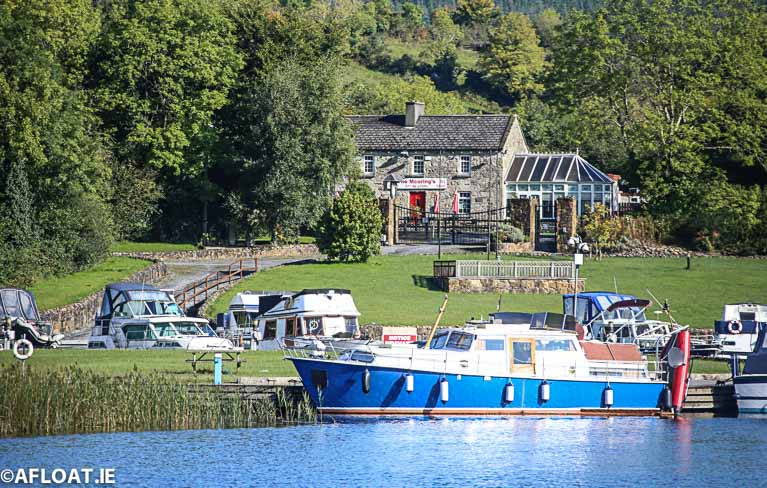
Remote and “tranquil” cabin cruiser moorings, kayak trails, canal walks and greenways form part of a €76.5 million tourism plan for the river Shannon published today.

As Times.ie reports today, the ten-year masterplan is the first such “whole river” approach to the entire Shannon region, according to Minister for Tourism Catherine Martin and Minister for Local Government and Heritage Darragh O’Brien.

The 360km waterway is the longest river in Ireland and Britain, and runs through ten counties – all of which are involved in the strategy drawn up by Fáilte Ireland and Waterways Ireland.

Prone to periodic flooding, the river also has untapped potential as an international and national tourism destination, according to Fáilte Ireland which plans to invest 2.1 million euro in the waterway this year.

As Afloat reported yesterday, the masterplan identifies seven priority areas, and three key themes within Fáilte Ireland’s “Hidden Heartlands” brand  -  “The Shannon, Mighty River of Ireland”, “Shannon Journey’s” and “Adventures and The Natural Timeless Shannon”. 

Redevelopment of Connaught harbour in Portumna, Go Galway; a “canoe step” for access to Lough Derg; a new cycle and walking trail linking Connaught harbour and the Lough Derg “blueway”; and extra cruise berths in several counties and in Athlone, Co Westmeath are among initial projects allocated for funding.

 Fáilte Ireland’s head of product development – activities Fiona Monaghan said that a pilot project to develop “remote” or “tranquillity” moorings for cabin cruisers would focus on three such locations on Lough Derg, three on Lough Ree and three on the upper Shannon.

The plan also involves supporting a number of tourism businesses along the river and the Shannon-Erne waterway.

The entire ten-year plan has been costed at 76.5 million euro, Monaghan said, with a focus on “quality, rather than quantity”, and a sensitive approach to the river’s environment.

Strategic environmental assessments and public consultation have already taken place, she said.

 Minister for Tourism Catherine Martin said that “this unique area is highly valued for its special environmental qualities and biodiversity and is home to many unique species, and native flora and fauna”. 

“ It will be a haven for on-water and off-water experiences offering a range of ways to be active in nature, in a sustainable manner.  The Shannon will invite the visitor to slow down, stay longer and to engage with local communities,” she said.

Martin said the region will be developed as a “model of ecologically sustainable tourism”, with a “leave no trace” code of practice and a “slow travel” approach for visitors. 

Other elements of the plan include the development a water-based “activity hub” at Red Bridge (Ballymahon), Co. Longford,  due to its proximity to Lough Ree, Ballymahon and the Center Parcs complex.

Ten additional cruiser berths will be developed in Roosky, Co Roscommon, and there will be additional car parking, landscaping, and interpretation of the waterways “industrial heritage”.

Read more on Times.ie here

Published in Inland Waterways
Tagged under

Waterways Ireland is continuing its public consultation on its Shannon tourism masterplan but has urged members of the public to respond online.

The cross-border authority has published its draft masterplan and associated environmental report as part of an 18-month strategy to develop tourism along the Shannon corridor over the next decade to 2030.

It is asking members of the public to review documents online and make any submissions through an online survey on link here

The documents online include the executive summary, the draft masterplan, the environmental report, baseline study, appropriate assessment screening and Natura impact reports.

It says that people who wish to review documents in local authority offices should be aware that arrangements may change locally due to the Covid-10 response, and that vigilance is required in relation to physical distancing.

The plan led by Waterways Ireland, with Fáilte Ireland, aims to “reposition the combined Shannon Navigation and Shannon-Erne waterway as a key tourism destination within Ireland’s Hidden Heartlands, identifying world-class visitor experiences based on the region’s natural and cultural assets”.

It involves a steering group and working groups from Cavan, Leitrim, Roscommon, Longford, Offaly, Galway, Tipperary, Clare and Limerick county councils.

The Irish Farmers’ Association (IFA) appealed earlier this month for Waterways Ireland to remember the farming community and the impact of flooding along the river.

The IFA has long appealed for a single management authority for the waterway, stating it would be a "win, win situation" if planning extended beyond tourism.

The public consultation on the Shannon tourism draft masterplan closes on April 22nd at 4 pm.

Tagged under

Over six million visitors to Ireland visited a coastal area last year and almost five million of them took part in a marine-related activity, a study by NUI Galway has found writes Lorna Siggins

Most popular water-based activities were sea swimming, sea angling and different types of recreational boating, the study by NUI Galway’s (NUIG) Socio-Economic Marine Research Unit has found.

The report, which aimed to estimate what proportion of total holiday expenditure was in coastal areas and what proportion was on undertaking marine-related leisure activities, has valued total overseas coastal tourism spend at 1.9 billion euro, with marine activities for overseas visitors generating some €650 million.

Some 76% of overseas visitors to Ireland in 2018 are estimated to have visited a coastal area (as in 6.06 million people) and 61% of them are estimated to have participated in a marine-related activity (4.87 million people).

The average total expenditure per travelling party of overseas visitors in the sample was €1,630, with the average trip lasting seven days. Of this, an estimated €699 was spent in coastal areas.

The survey found that estimated total expenditure per person was €569, with an estimated 244 euro per person in a coastal.

However, the estimated marine-related activity expenditure per person was €82, with only an average of €25 per person being spent on on-water activities.

The survey notes that those individuals in the sample who actively engaged in marine-based activities during their stay had a statistically significant higher total expenditure per trip (€710) than the total sample.

They also stayed on average 1.32 days more per trip compared to the average respondent in the sample, the survey found.

Not surprisingly, the Atlantic seaboard counties of Kerry, Galway and Clare were the most popular for coastal and marine tourism activities.

The survey found that some 69% of the sample were aware of the Wild Atlantic Way and had planned an average of 2.5 days on the route during their visit.

“Tracking overseas visitors’ marine related spending patterns is essential to understand and develop adaptive policy-making strategies that can respond to active tourists’ expectations in terms of leisure and tourism activities in these coastal areas,” Dr Stephen Hynes, co-author of the report and director of SEMRU at NUIG, notes.

The report also notes some challenges to the development of the overseas coastal tourism market and warns of the importance of maintaining competitiveness in relation to the British visitor market after Brexit.

NUIG’s Whitaker Institute director Professor Alan Ahearne said that “with Brexit likely to add to regional imbalances in this county, it is crucial for our economy that we continue to invest in coastal and marine tourism product and infrastructure to attract tourists from abroad”.

The report was released at the Donegal Marine Tourism Conference, which is taking place in Inishowen on September 5th and 6th.

Published in Aquatic Tourism
Tagged under

An Irish and Welsh project is seeking to unlock the cultural potential of the Irish ports of Dublin and Rosslare, and the Welsh ports of Holyhead, Fishguard and Pembroke Dock.

The research according to the NewRossStandard, will explore the cultures, traditions and histories of these ports, so that their cultural heritages can become a driver of economic growth.

The four-year project titled 'Ports, Pasts and Present: Cultural Crossings between Ireland and Wales' is a joint initiative with University College Cork (UCC) and Wexford County Council in Ireland, and in Wales with Aberystwyth University and the Centre for Advanced Welsh and Celtic Studies at the University of Wales,Trinity Saint David.

The project is part funded by the European Regional Development Fund through the Ireland Wales Cooperation programme and is led by UCC.

The Welsh Minister for International Relations, Eluned Morgan said he was pleased to announce the exciting new project which aimes to help turn five Welsh and Irish ports into vibtant tourist destinations in their own right.

For comments from the Welsh Minister and more click here. 

Published in Ferry

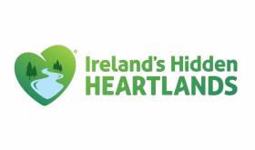
#Tourism - ‘Ireland’s Hidden Heartlands’ is the new tourism brand for the Midlands region, with a particular emphasis on its inland waterways.

More than 10,000 consumers gave their put to Fáilte Ireland on the development of the brand, which hopes to “bring to life the Midlands' rich natural assets including its many lakes, walkways and blueways”.

The River Shannon will be a central focus, with a Shannon Master Plan currently being developed by Fáilte Ireland in partnership with Waterways Ireland to drive tourism opportunities both on and off the water and in surrounding towns.

A series of food networks and trails will also be developed as part of the new brand.

Launching Ireland’s Hidden Heartlands in Athlone last Friday 13 April, Transport Minister Shane Ross said the brand “will significantly enhance the Midlands as a tourism experience and bring growth and jobs to the whole region. 

“We have always been committed to ensuring that Ireland’s success as a world-class tourist destination is shared among the regions. Some of the country’s finest natural assets are in the Midlands, including spectacular lakes, walkways and blueways. Ireland’s Hidden Heartlands will bring these gems to life, offering a unique experience to both domestic and international visitors.”

Ireland’s Hidden Heartlands will cover the ‘heart’ of the country, from Leitrim down to East Clare and extending through Longford, Roscommon, East Galway, as well as parts of Westmeath, Cavan, North Tipperary and Offaly. 

Failte Ireland regions

It will complement Fáilte Ireland’s other key brands in the Wild Atlantic Way, Ireland’s Ancient East and Dublin.

“Ireland’s Hidden Heartlands has been developed after months of extensive market testing both here and overseas,” said Paul Kelly, CEO of Fáilte Ireland. “The overwhelming feedback is that visitors from key markets want the opportunity to explore Ireland’s natural gems and rural communities. 

“There is also a huge appetite out there for tourists to be active in nature through activities like walking, cycling, angling and boating routes – all of which the Midlands can offer in abundance.”

An initial €2 million has been allocated to start the development stage of the brand, with further funding to follow. This first round of investment will help to develop visitor experiences, support industry development and develop marketing campaigns for the region.

Published in Aquatic Tourism

#FerryNews-  The Isle of Man Steam Packet Company has reported an upturn in visitor numbers last year.

Booking data reports Manx Radio from the ferry operator shows an increase of 3.4% in ferry passengers compared to 2016.

It comes in spite of Cabinet Office figures indicating a sharp fall in visitors to the Island last year - findings which have come under doubt from parts of the tourism industry.

Passenger departures from Liverpool, Birkenhead, Belfast and Dublin are all up, with only a small decrease in those coming from Heysham.

Steam Packet Chief Executive Mark Woodward says continued investment in promotion of the Island, as well an increased UK marketing budget, are factors in the continued growth in numbers.

Published in Ferry

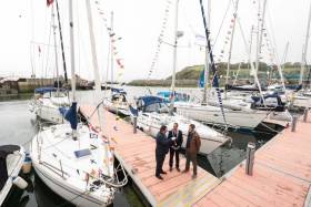
#Tourism - The Port of Cork, Bantry Bay Port Company and the Royal Cork Yacht Club are joining forces to promote marine leisure in Cork at the Southampton Boat Show.

The three organisations are in attendance at Stand J047 from today Friday 15 to Sunday 24 September tasked with promoting their marina facilities to potential visitors.

They will also be targeting the luxury cruisers and motor yacht market to entice further calls to Cork, Crosshaven and Bantry.

In 2009 the Port of Cork implemented the Leisure and Recreation Strategy for Cork Harbour, with the primary focus of the strategy on water-based leisure and recreational activities in and around the harbour.

Speaking about attending the boat show, Sara Mackeown, commercial marketing executive for the Port of Cork, said: “This is great opportunity to showcase Cork as an ideal destination for marine leisure users.

“Our marina facility in the heart of Cork City is unique and having just completed the new Bantry Harbour Marina there is a great connection now between Cork and West Cork. We are delighted to work closely with the Royal Cork Yacht Club, who have huge experience in the field.”

Cork Harbour offers significant potential for further development of the marine recreation sector as an important source of enjoyment and economic gain for the local residents and visitors, and it is anticipated that attending the Southampton Boat Show will help to promote the marine facilities directly to the desired market.

Gavin Deane, general manager of the Royal Cork Yacht Club said: “The Royal Cork Yacht Club are delighted to be collaborating with both the Port of Cork and Bantry Bay Port Company in promoting the region.

“This year we have seen a significant increase in the number of visiting boats to our marina, the majority of whom have travelled from the south coast of the UK.

“We feel that with this growth in visitors, now is the ideal time to showcase everything that Cork has to offer and Southampton Boat Show 2017 is the place to do it.”

Published in Aquatic Tourism
Page 1 of 16

General Information on using Waterways Ireland inland navigations

Safety on the Water

All users of the navigations are strongly recommended to make themselves aware of safety on the water for whatever activity they are involved in and to read the advice offered by the various governing bodies and by:

The Dept. of Transport, Ireland: www.gov.ie/transport and The Maritime and Coastguard Agency, UK, The RNLI – Water Safety Ireland for information in terms of drowning prevention and water safety.

Registration of Vessels

All vessels using the Shannon Navigation, which includes the Shannon-Erne Waterways and the Erne System must be registered with Waterways Ireland. Only open undecked boats with an engine of 15 horsepower or less on the Shannon Navigation, and vessels of 10 horsepower or less on the Erne System, are exempt. Registration is free of charge.

Craft registration should be completed online at: https://www.waterwaysireland.org/online-services/craft-registration

Permits for use of the Grand and Royal Canals and the Barrow Navigation

All vessels using the Grand and Royal Canals and the Barrow Navigation must display appropriate valid Permit(s) i.e A Combined Mooring and Passage Permit (€126) and if not intending to move every five days, an Extended Mooring Permit (€152).

Permit applications should be completed online at: https://www.waterwaysireland.org/online-services/canal-permits

Passage on the Royal and Grand Canals – Dublin Area

For boat passage through the locks east of Lock 12 into / out of Dublin on either the Royal or Grand Canals, Masters are requested to contact the Waterways Ireland Eastern Regional Office (M-F 9.30am-4.30pm) on tel: +353(0)1 868 0148 or email [email protected] prior to making passage in order to plan the necessary lock-keeping assistance arrangements.

On the Grand Canal a minimum of two days notice prior to the planned passage should be given, masters should note that with the exception of pre-arranged events, a maximum of 2 boats per day will be taken through the locks, travelling either east or west.

Movements in or out of the city will be organised by prior arrangement to take place as a single movement in one day. Boaters will be facilitated to travel the system if their passage is considered to be safe by Waterways Ireland and they have the valid permit(s) for mooring and passage.

Newcomen Lifting Bridge

On the Royal Canal two weeks’ notice of bridge passage (Newcomen Lifting Bridge) is required for the pre-set lift date, and lock assistance will then also be arranged. A minimum of 2 boats is required for a bridge lift to go ahead.

Waterways Ireland Eastern Regional Office (Tel: +353(0)1 868 0148 or [email protected] ) is the point of contact for the bridge lift.

A maximum number of boats passing will be implemented to keep to the times given above for the planned lifts (16 for the Sat / Sun lifts & 8 for the weekday lifts). Priority will be given on a first come first served basis.

On day of lift, boaters and passengers must follow guidance from Waterways Ireland staff about sequence of passage under bridge & through Lock 1, and must remain within signed and designated areas.

Events Held on the Waterways

All organised events taking place on the waterways must have the prior approval of Waterways Ireland. This is a twelve week process and application forms must be accompanied with the appropriate insurance, signed indemnity and risk assessment. The application should be completed on the Waterways Ireland events page at :

https://www.waterwaysireland.org/online-services/event-approval

Time Limits on Mooring in Public Harbours

On the Shannon Navigation and the Shannon-Erne Waterway craft may berth in public harbours for five consecutive days or a total of seven days in any one month.

On the Erne System, revised Bye Laws state that: No master or owner shall permit a vessel, boat or any floating or sunken object to remain moored at or in the vicinity of any public mooring, including mooring at any other public mooring within 3 kilometres of that location, for more than 3 consecutive days and shall not moor at that same mooring or any other public mooring within 3 kilometres of that location within the following 3 consecutive days without prior permission by an authorised official.

Winter Mooring on the Shannon Navigation and Shannon Erne Waterway

Winter mooring may be availed of by owners during the period 1 Nov to 31 Mar by prior arrangement and payment of a charge of €63.50 per craft. Craft not availing of Winter Mooring must continue to comply with the “5 Day Rule”. Winter Mooring applications should be completed online at : https://www.waterwaysireland.org/online-services/winter-moorings-booking

Owners should be aware that electricity supply and water supply to public moorings is disconnected for the winter months. This is to protect against frost damage, to reduce running costs and to minimise maintenance requirements during the winter months.

Vessel owners are advised that advance purchasing of electricity on the power bollards leading up to the disconnection date should be minimal. Electricity credit existing on the bollards will not be recoverable after the winter decommissioning date. Both services will be reinstated prior to the commencement of the next boating season.

Smart Cards

Waterways Ireland smart cards are used to operate locks on the Shannon Erne Waterway, to access the service blocks, to use the pump-outs along the navigations, to avail of electrical power at Waterways Ireland jetties.

Berthing in Public Harbours

Masters are reminded of the following:

  • Equip their vessel with mooring lines of appropriate length and strength and only secure their craft to mooring bollards and cleats provided for this purpose.
  • Ensure the available berth is suitable to the length of your vessel, do not overhang the mooring especially on finger moorings on floating pontoon moorings.
  • Ensure mooring lines, electric cables and fresh water hoses do not create a trip hazard on public jetties for others users.
  • Carry sufficient fenders to prevent damage to your own vessel, other vessels and WI property.
  • Allow sufficient space between your vessel and the vessel ahead /astern (c.1m) for fire safety purposes and /or to recover somebody from the water.
  • Do not berth more than two vessels side by side and ensure there is safe access/egress at all times between vessels and onto the harbour itself.
  • Do not berth in such a way to prevent use of harbour safety ladders, slipways or pump-outs.
  • Do not allow the bow of your vessel to overhang the walkway of a floating mooring thus creating a hazard for others with an overhanging anchor or bow fendering.
  • Animals are not allowed to be loose or stray at any time.
  • Harbour and jetty infrastructure such as railings, power pedestals, fresh water taps, electric light poles, safety bollards, ladders etc are not designed for the purpose of mooring craft , they will not bear the strain of a vessel and will be damaged.
  • At Carrybridge on the Erne System, Masters of vessels are not permitted to use stern on mooring. Masters of vessels must use the mooring fingers for mooring of vessels and for embarkation / disembarkation from vessels.

Passenger Vessel Berths

Masters of vessels should not berth on passenger vessel berths where it is indicated that an arrival is imminent. Passenger vessels plying the navigations generally only occupy the berths to embark and disembark passengers and rarely remain on the berths for extended periods or overnight.

Lock Lead-in Jetties

Lead-in jetties adjacent to the upstream and downstream gates at lock chambers are solely for the purpose of craft waiting to use the lock and should not be used for long term berthing.

Vessel Wake

Vessel wake, that is, the wave generated by the passage of the boat through the water, can sometimes be large, powerful and destructive depending on the hull shape and engine power of the vessel. This wake can be detrimental to other users of the navigation when it strikes their craft or inundates the shoreline or riverbank. Masters are requested to frequently look behind and check the effect of their wake / wash particularly when passing moored vessels, on entering harbours and approaching jetties and to be aware of people pursuing other activities such as fishing on the riverbank.

Speed Restriction

A vessel or boat shall not be navigated on the Shannon Navigation at a speed in excess of 5 kph when within 200 metres of a bridge, quay, jetty or wharf, when in a harbour or canal or when passing within 100 metres of a moored vessel or boat.

Vessels navigating the Shannon-Erne Waterway should observe the general 5 kph speed limit which applies along the waterway. This is necessary in order to prevent damage to the banks caused by excessive wash from vessels.

Vessels navigating the Erne System should observe the statutory 5kt / 6mph / 10kph speed limit areas.

A craft on the Royal and Grand canals shall not be navigated at a speed in excess of 6km per hour.

A craft on the Barrow Navigation shall not be navigated at a speed in excess of 11km per hour except as necessary for safe navigation in conditions of fast flow.

Bank Erosion

Narrow sections of all the navigations are particularly prone to bank erosion due to the large wash generated by some craft. Masters are requested to be vigilant and to slow down to a speed sufficient to maintain steerage when they observe the wash of their craft inundating the river banks.

Unusual Waterborne Activity

Unusual waterborne vessels may be encountered from time to time, such as, hovercraft or amphibious aircraft / seaplanes. Masters of such craft are reminded to apply the normal “Rule of the Road” when they meet conventional craft on the water and to allow extra room to manoeuvre in the interest of safety.

Sailing Activity

Mariners will encounter large numbers of sailing dinghies from late June to August in the vicinity of Lough Derg, Lough Ree and Lower Lough Erne. Sailing courses are marked by yellow buoys to suit weather conditions on the day. Vessels should proceed at slow speed and with due caution and observe the rules of navigation when passing these fleets, as many of the participants are junior sailors under training.

Rowing

Mariners should expect to meet canoes and vessels under oars on any part of the navigations, but more so in the vicinity of Athlone, Carrick-on-Shannon, Coleraine, Enniskillen and Limerick. Masters are reminded to proceed at slow speed and especially to reduce their wash to a minimum when passing these craft as they can be easily upset and swamped due to their very low freeboard and always be prepared to give way in any given traffic situation.

Canoeing

Canoeing is an adventure sport and participants are strongly recommended to seek the advice of the sport’s governing bodies i.e Canoeing Ireland and the Canoe Association of Northern Ireland, before venturing onto the navigations.

Persons in charge of canoes are reminded of the inherent danger to these craft associated with operating close to weirs, sluice gates, locks and other infrastructure particularly when rivers are in flood and large volumes of water are moving through the navigations due to general flood conditions or very heavy localised precipitation e.g. turbulent and broken water, stopper waves. Shooting weirs is prohibited without prior permission of Waterways Ireland.

Canoeists should check with lockkeepers prior entering a lock to ensure passage is done in a safe manner. Portage is required at all unmanned locks.

Canoe Trail Network – "Blueways"

Masters of powered craft are reminded that a canoe trail network is being developed across all navigations and to expect more organised canoeing along these trails necessitating slow speed and minimum wash when encountering canoeists, rowing boats etc

Rockingham and Drummans Island Canals – Lough Key

It is expected that work on Rockingham and Drummans Island Canals on Lough Key will be completed in 2021. Access to these canals will be for non-powered craft only, eg canoes, kayaks, rowing boats.

Fast Powerboats and Personal Watercraft (Jet Skis)

Masters of Fast Powerboats (speed greater than 17kts) and Personal Watercraft (i.e.Jet Skis) are reminded of the inherent dangers associated with high speed on the water and especially in the confines of small bays and narrow sections of the navigations. Keeping a proper look-out, making early alterations to course and /or reducing speed will avoid conflict with slower vessels using the navigation. Personal Watercraft are not permitted to be used on the canals.

Towing Waterskiers, Wakeboarders, Doughnuts etc

Masters of vessels engaged in any of these activities are reminded of the manoeuvring constraints imposed upon their vessel by the tow and of the added responsibilities that they have to the person(s) being towed. These activities should be conducted in areas which are clear of conflicting traffic. It is highly recommended that a person additional to the master be carried to act as a “look-out” to keep the tow under observation at all times.

Prohibition on Swimming

Swimming in the navigable channel, particularly at bridges, is dangerous and is prohibited due to the risk of being run over by a vessel underway in the navigation.

Age Restrictions on operating of powered craft

In the Republic of Ireland, Statutory Instrument 921 of 2005 provides the legal requirements regarding the minimum age for operating of powered craft. The Statutory Instrument contains the following requirements:

- The master or owner of a personal watercraft or a fast power craft shall take all reasonable steps to ensure that a person who has not attained the age of 16 years does not operate or control the craft

- The master or owner of a pleasure craft powered by an engine with a rating of more than 5 horse power or 3.7 kilowatts shall take all reasonable steps to ensure that a person who has not attained the age of 12 years does not operate or control the craft.

Lifejackets and Personal Flotation Devices (PFDs)

Lifejackets and PFD’s are the single most important items of personal protective equipment to be used on a vessel and should be worn especially when the vessel is being manoeuvred such as entering / departing a lock, anchoring, coming alongside or departing a jetty or quayside.

In the Republic of Ireland, Statutory Instrument 921 of 2005 provides the legal requirements regarding the wearing of Personal Flotation Devices. The Statutory Instrument contains the following requirements:

- The master or owner of a pleasure craft (other than a personal watercraft) shall ensure, that there are, at all times on board the craft, sufficient suitable personal flotation devices for each person on board.

- A person on a pleasure craft (other than a personal watercraft) of less than 7 metres length overall shall wear a suitable personal flotation device while on board an open craft or while on the deck of decked craft, other than when the craft is made fast to the shore or at anchor.

- The master or owner of a pleasure craft (other than a personal watercraft) shall take all reasonable steps to ensure that a person who has not attained the age of 16 years complies with paragraph above.

- The master or owner of a pleasure craft (other than a personal watercraft), shall take all reasonable steps to ensure that a person who has not attained the age of 16 years wears a suitable personal flotation device while on board an open craft or while on the deck of a decked craft other than when it is made fast to the shore or at anchor.

- The master or owner of a pleasure craft (other than a personal watercraft) shall take all reasonable steps to ensure that a person wears a suitable personal flotation device, at all times while – (a) being towed by the craft, (b) on board a vessel or object of any kind which is being towed by the craft.

Further information is available at: http://www.irishstatutebook.ie/eli/2005/si/921/made/en/print

Firing Range Danger Area – Lough Ree

The attention of mariners is drawn to the Irish Defence Forces Firing Range situated in the vicinity of buoys No’s 2 and 3, on Lough Ree on the Shannon Navigation. This range is used regularly for live firing exercises, throughout the year, all boats and vessels should stay clear of the area marked with yellow buoys showing a yellow "X" topmark and displaying the word "Danger".

Shannon Navigation, Portumna Swing Bridge Tolls

No attempt should be made by Masters’ of vessels to pay the bridge toll while making way through the bridge opening. Payment will only be taken by the Collector from Masters when they are secured alongside the jetties north and south of the bridge.

Navigating from Killaloe to Limerick on the Shannon Navigation

The navigation from Killaloe to Limerick involves passage through Ardnacrusha locks, the associated headrace and tailrace and the Abbey River into Limerick City. Careful passage planning is required to undertake this voyage. Considerations include: lock passage at Ardnacrusha, water flow in the navigation, airdraft under bridges on Abbey River in Limerick, state of tide in Limerick

Users are advised to contact the ESB Ardnacrusha hydroelectric power station (00353 (0)87 9970131) 48 hours in advance of commencing their journey to book passage through the locks at Ardnacrusha. It is NOT advised to undertake a voyage if more than one turbine is operating (20MW), due to the increased velocity of flow in the navigation channel, which can be dangerous. To ascertain automatically in real time how many turbines are running, users can phone +353 (0)87 6477229.

For safety reasons the ESB has advised that only powered craft with a capacity in excess of 5 knots are allowed to enter Ardnacrusha Headrace and Tailrace Canals.

Passage through Sarsfield Lock should be booked on +353-87-7972998, on the day prior to travel and it should be noted also that transit is not possible two hours either side of low water.

A Hydrographic survey in 2020 of the navigation channel revealed that the approach from Shannon Bridge to Sarsfield Lock and the Dock area has silted up. Masters of vessels and water users are advised to navigate to the Lock from Shannon bridge on a rising tide one or two hours before High Tide.

Lower Bann Navigation

The attention of all users is drawn to the “Users Code for the Lower Bann”, in particular to that section covering “Flow in the River” outlining the dangers for users both on the banks and in the navigation, associated with high flow rates when the river is in spate. Canoeists should consult and carry a copy of the “Lower Bann Canoe Trail” guide issued by the Canoe Association of Northern Ireland. Users should also contact the DfI Rivers Coleraine, who is responsible for regulating the flow rates on the river, for advisory information on the flow rates to be expected on any given day.

DfI Rivers Coleraine. Tel: 0044 28 7034 2357 Email: [email protected]

Lower Bann Navigation – Newferry – No wake zone

A No Wake Zone exists on the Lower Bann Navigation at Newferry. Masters of vessels are requested to proceed at a slow speed and create no wake while passing the jetties and slipways at Newferry.

Overhead Power Lines (OHPL) and Air draft

All Masters must be aware of the dangers associated with overhead power lines, in particular sailing vessels and workboats with cranes or large air drafts. Voyage planning is a necessity in order to identify the location of overhead lines crossing the navigation.

Overhead power line heights on the River Shannon are maintained at 12.6metres (40 feet) from Normal Summer level for that section of navigation, masters of vessels with a large air draft should proceed with caution and make additional allowances when water levels are high.

If a vessel or its equipment comes into contact with an OHPL the operator should NOT attempt to move the vessel or equipment. The conductor may still be alive or re-energise automatically. Maintain a safe distance and prevent third parties from approaching due to risk of arcing. Contact the emergency services for assistance.

Anglers are also reminded that a minimum ground distance of 30 metres should be maintained from overhead power lines when using a rod and line.

Submarine Cables and Pipes

Masters of vessels are reminded not to anchor their vessels in the vicinity of submarine cables or pipes in case they foul their anchor or damage the cables or pipes. Look to the river banks for signage indicating their presence.

Water Levels - Precautions

Low Water Levels:

When water levels fall below normal summer levels masters should be aware of:

Navigation

To reduce the risk of grounding masters should navigate on or near the centreline of the channel, avoid short cutting in dog-legged channels and navigating too close to navigation markers.

Proceeding at a slow speed will also reduce “squat” effect i.e. where the vessel tends to sit lower in the water as a consequence of higher speed.

Slipways

Reduced slipway length available under the water surface and the possibility of launching trailers dropping off the end of the concrete apron.

More slipway surface susceptible to weed growth requiring care while engaged in launching boats, from slipping and sliding on the slope. Note also that launching vehicles may not be able to get sufficient traction on the slipway once the craft is launched to get up the incline.

Bank Erosion

Very dry riverbanks are more susceptible to erosion from vessel wash.

Lock Share

Maximising on the number of vessels in a lock will ensure that the total volume of water moving downstream is decreased. Lock cycles should be used for vessels travelling each way.

High Water Levels:

When water levels rise above normal summer level masters should be aware of:

Navigation

Navigation marks will have reduced height above the water level or may disappear underwater altogether making the navigable channel difficult to discern.

In narrow sections of the navigations water levels will tend to rise more quickly than in main streams and air draft at bridges will likewise be reduced.

There will also be increased flow rates particularly in the vicinity of navigation infrastructure such as bridges, weirs, locks etc where extra care in manoeuvring vessels will be required.

Harbours and Jetties

Due care is required in harbours and at slipways when levels are at or near the same level as the harbour walkways' as the edge will be difficult to discern especially in reduced light conditions. It is advised that Personal Flotation Devices be worn if tending to craft in a harbour in these conditions.

Slipways

Slipways should only be used for the purpose of launching and recovering of water craft or other objects from the water. Before using a slipway it should be examined to ensure that the surface has sufficient traction/grip for the intended purpose such as launching a craft from a trailer using a vehicle, that there is sufficient depth of water on the slipway to float the craft off the trailer before the concrete apron ends and that the wheels of the trailer do not drop off the edge of the slipway. That life-saving appliances are available in the vicinity, that the vehicle is roadworthy and capable of coping with the weight of the trailer and boat on the incline. It is recommended that slipway operations are conducted by two persons.

Caution to be Used in Reliance upon Aids to Navigation

The aids to navigation depicted on the navigation guides comprise a system of fixed and floating aids to navigation. Prudent mariners will not rely solely on any single aid to navigation, particularly a floating aid to navigation. With respect to buoys, the buoy symbol is used to indicate the approximate position of the buoy body and the ground tackle which secures it to the lake or river bed. The approximate position is used because of the practical limitations in positioning and maintaining buoys in precise geographical locations. These limitations include, but are not limited to, prevailing atmospheric and lake/river conditions, the slope of and the material making up the lake/river bed, the fact that the buoys are moored to varying lengths of chain, and the fact that the buoy body and/or ground tackle positions are not under continuous surveillance. Due to the forces of nature, the position of the buoy body can be expected to shift inside and outside the charted symbol.

Buoys and perches are also moved out of position or pulled over by those mariners who use them to moor up to instead of anchoring. To this end, mariners should always monitor their passage by relating buoy/perch positions with the published navigation guide. Furthermore, a vessel attempting to pass close by always risks collision with a yawing buoy or with the obstruction that the buoy or beacon/perch marks.

Masters of Vessels are requested to use the most up to date Navigation guides when navigating on the Inland Waterways.

Information taken from Special Marine Notice No 1 of 2023