Displaying items by tag: motorboats
Royal Cork Yacht Club Finds Popularity of Powerboats is Increasing for Exploring Cork Harbour
The oldest yacht club in the world has noted an increase of interest amongst members in motorboating.
The Royal Cork Yacht Club at Crosshaven held a webinar in response to the interest of members in using motorboats to access areas of Cork Harbour which would not be accessible to keelboats. Seventy members took part and the webinar recording has since been viewed on YouTube by 350 people.
 The Royal Cork Yacht Club at Crosshaven held a popular webinar on powerboating in Cork Harbour Photo: Bob Bateman
It was organised by Alex Barry, the club's Chairman of the Membership and Events sub-committee: "We pulled together a list of different spots in Cork Harbour which could be accessed by powerboats. There was good interest. With the impact of Covid and holidays being limited, I think people have an interest in exploring places a bit closer to home and there are areas of the harbour, unique spots that they may not have been to before. I was surprised by some that were identified."
 The unmistakable silhouette of Belvelly Bridge. In order to circumnavigate the Great Island of Cobh, you need to pass under the bridge. Even small craft find carrying a pole useful as it has got very shallow at the eastern side. Photo: Bob Bateman
The webinar audience was mixed, with members who have cruising yachts, motorboats, powerboats, all interested in more usage of their boats with a family and social emphasis.
 Enjoying Cork Harbour in an Aquador motorboat Photo: Bob Bateman
"The session was aimed more towards the 20-foot and under powerboats which could access these smaller nooks and crannies that they may not have previously considered, but it generated wider interest."
 RIBs are a popular motorboat type in Cork Harbour Photo: Bob Bateman
Members who used powers boats of this size in support of dinghy events and coaching their children into sailing were interested, with the restrictions imposed by the pandemic, in finding extra usage for family activity.
 Royal Cork Admiral Colin Morehead's (helming) Boston Whaler runabout that he uses to travel across Cork Harbour from Whitepoint (near Cobh) to the club at Crosshaven Photo: Bob Bateman
"It's all about getting on the water, for leisure and relaxation," said Alex."It is definitely not a replacement for sailing or yachts, but adding to the enjoyment of the water. It is something to encourage. For example being able to get around Great island, where there are bridges to negotiate is a particular example.
 A Jeanneau Leader motorboat cruises past Cobh in Cork Harbour Photo: Bob Bateman
"We have discussed in committee how we can provide more activities for members in these times. There is a segment of the membership with a common interest in motorboats and powerboats and that is something a club can pull together to provide a service for them. It's an addition to sailing, not a replacement. As we go through the phases of Covid restrictions being lifted, this is a good opportunity to do a bit more exploring and enjoy what we have in Cork Harbour."
 Former RCYC Admiral Anthony O'Leary on Race Officer duty in his Nelson motorboat Photo: Bob Bateman
 Sparetime, the Beneteau trawler yacht of former Royal Cork Admiral Peter Crowley Photo: Bob Bateman
On this week's Podcast, I asked Alex Barry how the RCYC had begun this initiative.
Listen to the Podcast here.
Bikini Registered Motoryacht Follows Cruiseship Out of Dublin
As for Cary Ali, she is a 87ft long was built in 2007 by Nordhavn to a design of Jeff Leishman. From her stern flew the flag of the Marshal Islands in the Pacific Ocean. Inside the four-decked vessel there is the main salon, a dining room, galley and three guest staterooms, and a master cabin (click HERE). In total eight people can be accommodated. In addition she has a jacuzzi, fly-bridge and is equipped with a tender and has crew of four.
She has a speed of 24-knots and is equipped with 50hp bow and stern thrusters. To read more about the luxurious motoryacht including facts and figures click HERE.
The Cary Ali had berthed at the 100-berth marina of the Poolbeg Yacht & Boat Club which caters lesiure craft up to 20 metres and is centrally located on the south side of Dublin Port. The facility has accommodated larger motoryachts over the years. Though even larger motoryachts such as Battered Bull, a Feadship 52m has berthed further upriver at Dublin City Moorings.
- motorboats
- Carlingford Lough
- Dublin Port
- Cruise Liners
- Ports and Shipping
- Lough foyle
- Poolbeg Marina
- motor yacht
- Marshall Islands
- Dublin City Moorings
- Cruise ships
- Greencastle Co.Donegal
- Greencastle Maritime Museum
- Hebridean Princess
- Caly Ali
- MY Caly Ali
- Charter motoryachts
- Motor boat news
- Lough Foyle Ferry Company
Largest Vessel Transits Samuel Beckett Swing-Bridge
She remained alongside this berth which is normally used by large commercial ships until the vessel sought a berth much closer to the city-centre. This led to a shift of berths in the evening when the 2003 built vessel headed upriver to the Dublin City Moorings facility at Custom House Quay, but this firstly required transiting through two bridges.
With a beam of 10.6m Fortunate Sun entered through the East-Link toll-lift bridge followed by the Samuel Beckett bridge, the Liffey's newest crossing point which opened in late 2009. The €60m bridge was commissioned by Dublin City Council and designed by the Spanish architect engineer Santiago Calatrava. To read more on the bridge click HERE.
Fortunate Sun is registered in the Caymen Islands and is capable of over 17 knots on a range of 5000 nautical miles. She has a steel hull and an aluminium superstructure and interiors also by Tim Heywood Design. In the early hours of tomorrow morning the vessel built by Oceanfast is to depart through the 5,700 tonnes bridge which was delivered by barge after a five-day voyage from Rotterdam.
There has been previous transits of the bridge notably the annual Dublin Rally organised by the the Inland Waterways Association of Ireland (IWAI). This year's Dublin Rally took place on 1 May when boats travelling on the Royal Canal descended via Croke Park and entered the Liffey at Spencer Dock. This required the Iarnrod Éireann bridge-lift and the water level in Spencer Dock to be lowered so to allow safe clearance under the Sheriff St. bridge.
From there the IWAI flotilla made the short passage downriver to re-enter another inland waterway system at the Grand Canal Dock, marking where the Liffey connects with the city's southern canal. The 2011 Dublin Rally was the first time since 1955 that boats could enter Dublin from the Shannon via the Royal Canal and the first time since 2004 that boats also joined from the Royal Canal.
- powerboats
- motorboats
- inland waterways
- Dublin Port
- Dublin
- Grand Canal
- IWAI
- Royal Canal
- DDDA
- Inland Waterways Association of Ireland
- Dublin City Council
- Spencer Dock
- River Liffey
- Ports and Shipping News
- EastLink Toll Bridge
- Dublin Port news
- Grand Canal Dock
- Dublin Docklands Development Authority
- M.Y. Fortunate Sun
- Tim Heywood Design
- Lifffey
- Dublin City Moorings
- Custom House Dock
- Powerboat news
- Motoryachts
- Sir John Rogerson Quay
- Inland Waterways news
- Dublin Rally
- Ianrod Eireann
- Oceanfast
- Scottish Western Isles
Howth Lifeboat Rescues Three Vessels
The Inshore Lifeboat (ILB) was just returning to the safety of the harbour with two motorboats in tow, when the larger All Weather Lifeboat (ALB) was requested to the aid of a fishing trawler that had also experienced technical failure.
The second motorboat under tow by the voluntary ILB crew suffered engine failure whilst attempting to assist the first stricken craft. They had just reached the harbour mouth when the alarm was raised by a fishing trawler in similar circumstances.
The voluntary crew then transferred to the ALB and went to the rescue of the fishermen. All vessels were towed safely back to Howth harbour.
Patrick Brown, voluntary crewmember for Howth RNLI said:
"Luckily weather conditions were fair this evening, allowing for a speedy recovery of the boats that were in difficulty. However the light was fading at the time of the incidents, highlighting the importance of having safety flares for both commercial and pleasure craft alike. Charitable donations from the public make it possible for the RNLI to continue rescuing those in danger at sea"
Related Safety posts
RNLI Lifeboats in Ireland
Safety News
Rescue News from RNLI Lifeboats in Ireland
Coast Guard News from Ireland
Water Safety News from Ireland
Marine Casualty Investigation Board News
Marine Warnings
Cruising Association's MedNet Goes Global
The Cruising Association has just launched a new internet and email based net, which lets members cruising various regions of the world arrange meets, ask questions and receive answers about ever-changing local facilities and regulations.
It all started in 2000 as Mednet, a service for some 85 members cruising yachts and motorboats in the Mediterranean. MedNet 1 allowed one-to-one email communication but soon members wanted more, especially the ability to see the answers to other members' questions.
So MedNet 2 was born in Spring 2001, providing wider access to conversations. By Autumn 2003 MedNet 2 had moved to Yahoo Groups, but as membership increased mail traffic became too heavy for slow and expensive internet connections on boats. As a consequence MedNetLite was introduced for those with low bandwidth connections. By now 250 users were exchanging news about lay-up sites, marinas, restaurants, anchorages, provisioning, boatyards, itineraries and regulatory changes. But a good long-term record of all this data was missing.
So MedNet 3 was introduced in 2006, working as an email based forum within MyCA, the Cruising Association members-only intranet. There were still shortcomings. The system was passive, collecting e-mails and displaying them online. Inputs were only by email. By now, users had grown to 350, 10% of the Cruising Association's membership. Members cruising in other regions began asking for their own networks.
The time had come to upgrade so Version 4 was developed by a group of Cruising Association members with IT skills. This has just been launched for four regions; Mediterranean, Baltic, European Inland Waterways and 'Blue Water'. Members can join as many as they wish. They post and respond online, or by email. They can receive full or lite email messages or opt for no email, just tuning in online when they have Internet access. A full record of all these discussions is maintained online, making it easy to research topics and keep the Cruising Association's many members-only publications right up-to-date.
On MedNet recent discussions have included:
• The need for grey water holding tanks in Turkey
• The cheapest way of making cash withdrawals
• Marina costs in western Italy
• Recommendations for a rigger in Preveza
• How to watch British TV in the Med
• Places for winter storage ashore
It will be interesting to see the sorts of topics that the wider use of MedNet technology brings!
Inland Boating and Sailing Holidays in Ireland
Inland Boating and Sailing Holidays
Experience the freedom of the Shannon and Erne waterways. Captain your own cruiser and discover the hidden corners of Ireland. Over 800 kilometres of navigable waterways are awaiting your arrival, with rivers to explore, towns and villages to discover and acres of lakes to relax on.
Heritage and cultural sites are around every corner, from ancient standing stones, castles, sixth century universities, cathedrals, round towers, monasteries and industrial archaeology sites. Witness at first hand the engineering marvels of Ireland’s canal systems and experience time travel through a forgotten age, at a leisurely pace.
Discover the country and the local culture, admire the passing scenery and experience traditional music and arts.
Engage in a variety of active pursuits from golf, walking, cycling, archery to horse riding and trekking. Why not do some relaxed fishing as you travel through the centre of Ireland.
Freedom to come and go as you please. An inland waterways holiday allows you to set the pace. Stop and take a break when you want, see the sights, put the rod in the water and fish a little or hit a golf ball.
Relaxation, stretch your legs on a forest walk or simple put your feet up and watch the world pass by.
Slow tourism – the eco-friendly way to tour With our modern boat fleet equipped with the latest diesel engines you and your family can still cruise the Lakelands and inland Waterways of Ireland, visit new and exciting venues, engage in active pursuits yet leave only a small carbon footprint.
Clean Boating Charter to ensure that your holiday is as green and ecofriendly as possible the Irish Boat Rental Association members have introduced a Clean Boating Charter. See www.boatholidaysireland.com for details.
Experience the Unique With over 800 kilometres of navigable waterways the Shannon-Erne system of lakes and rivers offer the visitor one of the longest but least crowded waterways in Europe.
With a minimum of locks, a simple but comprehensive navigation system, the Shannon Erne Waterway offers the discerning boat cruiser a trouble free holiday and a safe cruising environment in which to enjoy the unspoilt natural amenity which is the Shannon Erne. The waterway system is a boat holiday cruising paradise, unmatched throughout the world for beauty, heritage and the unique culture of the area. Ireland’s waterways can be a place of absolute solitude and peace, or a lively holiday region where activity opportunities abound – the choice is yours.
Ireland’s waterways give you the choice and freedom to do as you please at what ever pace you want to go. The hundreds of moorings, quiet harbours, marinas, bustling towns and tranquil villages along the way provide you with the opportunity to tie up and enjoy the unique cultural experience that is Ireland.
If you are looking for a 'get away from it all' boating holiday, to float in isolated tranquillity surrounded by breathtaking scenery and fascinating heritage, you will find it in Ireland.
Lough Erne in the North, Lough Ree in the Midlands and Lough Derg in the South offer vast cruising grounds with rarely another boat in view. However, if you should want a lively choice the Upper Shannon offers you idyllic cruising waters with great waterside pubs and restaurants, nightlife and a chance to meet other cruising parties who are enjoying a boat holiday in Ireland.
Weave together a perfect holiday through the Heart of Ireland
The interconnecting rivers and lakes stretch from Belleek, the most northerly point of the vast Lower Lough Erne to Killaloe, the southern-most navigation point on Lough Derg.
The Shannon Erne Waterway can be divided into three sections;
• Lower and Upper Lough Erne. Lough Erne is connected to the River Shannon via the Shannon/Erne Waterway.
• The Upper Shannon from Carrick on Shannon to Athlone including Lough Ree and Lough Key.
• The Lower Shannon, the area from Athlone to Killaloe which includes Lough Derg.
Lower Lough Erne
Above this handsome lake the Cliffs of Magho provide a rugged contrast with wooded islands, sheltered bays and open waterways. West of the Broad Lough the hills of Donegal are a reminder of the Atlantic Ocean beyond. 29 kilometres of varied navigation meander between Belleek, the Erne system’s western most port at the Atlantic’s gate above the town of Ballyshannon and Enniskillen, the fortified island town at the heart of the Erne lakes.
Upper Lough Erne
Around Upper Lough Erne the intricacies of combining land and water work very well together. The woods, forests and farmland are in harmony with the river in this extensive inland navigation. There is a sense of privacy and individuality. Exploring the many inlets and islands is a boating enthusiast’s dream and a wonderful destination for nature lovers.
The Shannon Erne Waterway
The waterway is an intriguing region with boating and angling in abundance and history and folklore at every turn. This modern waterway is based on the line of the old Ballinamore and Ballyconnell Canal, with automated locks and other user friendly refinements reflecting the investment and planning that have gone into re-connecting the Shannon and Erne waterway systems. It leaves Upper Lough Erne through the Woodford River near Belturbet and heads southwest and then west to Leitrim Village and the Upper Shannon. The waterway has opened up an area of Ireland that was relatively unknown and this tranquil link with its gentle pace has grown in popularity.
Lough Allen and Lough Key
Lough Key and Lough Allen are both inland seas but are very different to each other. Lough Key is an islandstudded lake, while Lough Allen is determinedly rugged with the iron mountain of Sliabh an Iarainn to the east, the old coal hills of Arigna along its western shore. Lough Allen is a majestic lake, 12 kilometres long and almost 6 kilometres across on the wide northern shore. Lough Key is arguably the most beautiful lake on the Shannon System with the fine town of Boyle at its western corner. The Curlew Mountains along the lake’s northern shore seem like high mountains rising above the lush countryside and ancient woods which reach down to the shore line.
Carrick-on-Shannon to Tarmonbarry
The lordly Shannon, the longest river in Britain and Ireland, is beginning to get a sense of itself as it meanders south through Carrick on Shannon, the northern capital of this history laden waterway. The prosperous county town of Leitrim is a thriving boat centre and a welcoming place with a real buzz and an active cultural life. South of Carrick the river’s long stretches of water weave between pretty towns. On through the picturesque towns of Jamestown and Drumsna, the river widens through Lough Boffin past Dromod and narrows again through the busy town of Roosky before flowing through Tarmonbarry and onwards to Lough Ree.
Lough Ree
Lough Ree is one of the Shannon’s three main lakes, 32 kilometres long and gradually widening to 10 kilometres across. This much indented lake has a generous scattering of islands and although it is the geographic centre of Ireland, it maintains an attractive air of remoteness. The shoreline varies – in the relatively unpopulated northeast of the lake along the Longford shore there is quality bogland. Along the eastern shore, County Westmeath has lush farmland and thriving woodland. The south of the lake is very much a water playground for the large town of Athlone. To the western shoreline lies Roscommon and the quiet town and harbour of Lecarrow, reached from the lake by its own small canal.
Mid Shannon
South of Athlone the Shannon enters its most distinctive phase becoming a wide stream moving silently under a vast sky. For 50 kilometres the river falls through river meadows, the Callows to Portumna at the head of Lough Derg. The regular flooding of the Callows is a vital part of the ecosystem, enriching the water and sweetening the land. The rising ground at Clonmacnois, 20 kilometres downstream of Athlone, had prominence along the river and throughout Ireland. This was the site of the great monastery which became a university and the ancient Christian capital of Ireland. Although it was raided by the Vikings, it has endured as the greatest of the monuments along the Shannon.
The Shannon continues to meander south to Shannon Harbour where the Grand Canal connects Dublin and the east coast with the Shannon. You are now on the old water borne trading route connecting the capital of Ireland with a series of midland and Shannon towns such as the Georgian town of Banagher and then on to Limerick via Lough Derg.
Lough Derg
Lough Derg is a handsome inland sea set in an attractive blend of mountain and hillside, woodland and farm. The mountains surrounding this fine stretch of water have their own beauty and variety. The shoreline has many small sheltered harbours at strategic intervals. There are 13,000 hectares of spectacular waterway, ideal for all kinds of watersports. The beautiful countryside around the lakeshore is perfect for walking, cycling, horse riding and other visitor pursuits. Lough Derg is contemporary in outlook, yet comfortable with its traditions. It is a place blessed by nature for sport and recreation. The extensive shoreline changes wonderfully in its nature between three large counties – Galway to the northwest, Clare to the west and southwest and Tipperary along the entire eastern shoreline. The lake is big enough to provide total seclusion yet there is always a bustling spot nearby.
Captain your own cruiser
Experience is not necessary and no licence is required. Training will be provided by our experienced staff.
When you book your boat holiday in Ireland your operator will send you a 'Captains Handbook' which will contain details of all you need to know about operating your cruiser.
The handbook contains details on how to prepare for your cruise, vital information on how the boat works, navigational information and how to pass through a lock.
On arrival at your operator’s base you will be shown a training video and then given on-the-water training by a fully trained, experienced instructor.
Many of our customers choosing a boat holiday in Ireland have never handled a boat before. Mastering the controls of your cruiser and understanding the navigation is quickly learnt. All of our cruisers are fully equipped with the necessary safety equipment and navigational charts to ensure that you have a safe holiday cruise.
Our fleet of modern cruisers offer accommodation from two to twelve adults.
Our operators have a boat to suit your boat holiday needs. As you will spend more time in your boat than you would in a traditional holiday cottage we recommend that you book a boat that has more space/berths than the number of people in your group. This will give you more space to live and relax in. Our operators have extensive fleets of different classes of cruisers all with their own individual characteristics and designed to suit the needs of parties of two, four, six or eight people and we can even supply boats for up to parties of twelve.
All the cruisers that are offered by our operators are designed for the Irish waterways and are fitted out to the highest standards to ensure maximum cruising comfort. We have illustrated a typical Shannon cruiser here to give you an indication of the accommodation layout, but it is important to check with the operator of your choice the exact specification of the cruiser that you book.
Courtesy of the Irish Boat Rental Association and Tourism Ireland
Midwest Powerboat Club
 A Powerboat Racing Club based in Killaloe, Co. Clare, home of the famous Féile Brian Ború. We have members from all over Ireland and we are looking forward to an exciting season in 2009; with a full calendar of National Racing. It takes a team to make it all happen and we would love to hear from anyone interested in joining Midwest Powerboat Club.
Midwest Powerboat Club is dedicated to the development of Powerboat Racing in Ireland. Last year we ran Irelands first ISA sanctioned Closed Cell Immersion Test and first F'2 F'4 and P750 Powerboat Event. Both were held in Killaloe, Co. Clare We are planning to host two more National Powerboat Races this year and to have the Immersion Test at the first of these events.
Act now and become part of this exciting sport. Drop us a line at [email protected] and let us know how you would like to participate.
(Details and image courtesy of the Midwest Powerboat Club)
Midwest Powerboat Club, c/o Brian Brosnan, Maglass, Ballymacelligott, Tralee, Co Kerry. Tel: 086 82 55 782, email: [email protected] (website inactive as at 7/10/09)
Have we got your club details? Click here to get involved
Achill-Belmullet Powerboat Club
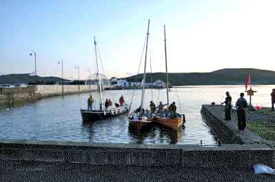 Our Powerboat club, which is based on Achill Island, Co. Mayo, was established in June 2008.
In May of that year a group of boating enthusiasts from the Achill and Belmullet areas came together to take part in a local fun boating weekend on Achill, which was organised by a local enthusiast.
From the success of this event and the huge interest shown and also considering the increasing amount of boating activity around the island, it was clear that Achill would be a prime location for the establishment of a Powerboat Club.
After liaising with and receiving a substantial amount of advice and help from Denis Dillon (National Powerboat Officer) for the ISA, our club ‘Achill-Belmullet Powerboat Club’ was born!
Our aim is to provide powerboat users in the west and others in the vicinity with the following facilities:
To come together and enjoy their mutual interest through participating in organised fun-filled events and outings.
To share their knowledge and experience with others.
To extend their expertise in boating through taking part in various training days that are organised within our club.
To plan and develop a Clubhouse with mooring and marina facilities as to cater for all types of leisure craft.
To plan for the future of boating for the West Coast of Ireland.
(Details courtesy of Achill-Belmullet Powerboat Club)
Achill-Belmullet Powerboat Club
Have we got your club details? Click here to get involved


