Displaying items by tag: marine research
French Research Schooner Tara Researching European Coastlines in Galway This Week
The impact of the current marine heatwave on Ireland’s coastline is being recorded by international researchers who are taking a “snapshot” of the European coast where land and sea meet.
As The Irish Independent reports, the Traversing European Coastlines (TREC) involves both land and sea-based researchers undertaking simultaneous sampling.
The 36-metre schooner Tara is currently in Galway, working with a mobile laboratory for land work.
 The 36-metre schooner Tara in Galway Port
Scientists can analyse samples even as they voyage across 46 different European regions extending from the Mediterranean to Scandinavia.
The baseline information on coastal ecology gathered will serve as an invaluable reference point to measure coastal climate change impacts.
Over 150 research teams from over 70 institutions in 29 European countries are involved, and the TREC project is being co-ordinated by the European Molecular Biology Laboratory( EMBL), working with local partners such as the Marine Institute in Galway.
The schooner, which is based in Lorient, France, is ice-strengthened to work in polar regions.
It is financed through a mixture of private and public funds with French designer Agnes B one of the main sponsors.
It has an “excellent chef”, but also everyone on board “gets to clean the toilets”, chief scientist Emmanuel Boss told the newspaper.
 Chief scientist Emmanuel Boss(left) and captain Martin Hertau on board the French research schooner Tara in Galway Docks
“It doesn’t matter if you are chief scientist or captain of the boat – everyone has to do their chores as part of a roster,” he said.
“This makes for “far better relations” and no hierarchy, Boss said – “the relationship between crew and scientists is tighter than on any other boat I have been on,”he said.
The Marine Institute’s director of marine environment and food safety Joe Silke said the research being conducted “addresses crucial issues such as pollution, biodiversity loss, and invasive species, expanding on, and directly relevant to the Marine Institute’s work in Ireland's coastal habitats”.
The schooner, Tara, is open to the public today (Sunday, September 10th) in Galway docks from 10am to 6pm.
There is also a travelling exhibition, a reality game-based workshop and public workshops in the Galway City Museum and other venues next week.
Read The Irish Independent here
Galway Statement Ten Year Celebration Marking Decade of Marine Research Cooperation Across the Atlantic Ocean
Yesterday, the Marine Institute, along with the Department of Foreign Affairs and the European Commission, co-hosted a high-level celebration in Iveagh House, Dublin, marking ten years of the Galway Statement - a decade of marine research cooperation across the Atlantic Ocean.
The milestone event, entitled "10 Years of the Galway Statement. Celebrating a decade of marine research cooperation along and across the Atlantic Ocean - Our Shared Resource" will continue today and Thursday at the Marine Institute and the University of Galway.
The Galway Statement is a landmark agreement signed by representatives of the European Union, the United States and Canada who agreed to join forces on Atlantic Ocean Research. The goal was to better understand the Atlantic Ocean and promote the sustainable management of its resources. The Agreement aimed to connect the ocean observation efforts of the three partners. The work also studied the interplay of the Atlantic Ocean with the Arctic Ocean, particularly in relation to climate change.
This celebration showcases and reflects on the achievements of the All-Atlantic Ocean Research and Innovation Alliance (AAORIA), which has grown to become truly all-Atlantic - from East to West, North to South, and from the Arctic to Antarctica. The event also focused on the coming years, through high-level dialogue and intergenerational discussion, on this model for science diplomacy.
Yesterday’s event programme included presentations on discoveries and achievements from the past decade, while looking to the future with discussion on the future of AAORIA.
The Marine Institute coordinated the Atlantic Ocean Research Alliance Coordination and Support Action up to 2020, partners in many of the Mission Ocean initiatives and looks forward to playing a pivotal role in the implementation of the All Atlantic Research and Innovation Alliance. The Marine Institute has recently launched its new five-year corporate strategy (2023-2027) which sets out eight strategic priorities centering on transforming the Institute’s knowledge, advice and services to benefit people, policy and planet. Ocean Knowledge that Informs and Inspires sets out a roadmap to enable Ireland to deliver on national and EU policy goals on sustainable seafood production, ocean science and management, environment and biodiversity, maritime transport, offshore renewable energy and climate action.
Commenting on the event, Minister for Agriculture, Food and the Marine, Charlie McConalogue said “As an island nation, bordering the Atlantic Ocean, Ireland’s culture, heritage and identity are intrinsically linked to the Ocean surrounding it. The Galway Statement has been instrumental in fostering a decade of marine research cooperation. It has led to the development of numerous collaborative projects and initiatives in which Ireland will continue to play a significant role over the next decade.
Michael Gillooly, Interim CEO of the Marine Institute said, “The Galway Statement and AAORIA have delivered an exemplary example of science diplomacy. The Marine Institute is proud to have contributed to this important work and we look forward to continued cooperation with the other members of the alliance”.
Further sessions are planned over the next two days showcasing the profound impact of the past decade's marine research collaboration. A significant program highlight will be the intergenerational discussion session to engage with Early Career Ocean Professionals, contributing to the AAORIA.
UCC Researchers Part of EU Project to Tap Oceans for New Medicines
New antibiotics in the world’s oceans and the curative properties of marine animals like sponges will be explored in a European project involving researchers at University College Cork (UCC).
The EU has awarded a total of €7.5 million under its Horizon 2020 programme to the research into the largely unknown potential of the world’s oceans in protecting people, animals and crops from disease.
The Marine Biodiversity as Sustainable Resource of Disease-Suppressive Microbes and Bioprotectants for Aquaculture and Crop Diseases project, as it is officially known, has been given the name “Marbles”.
The research team will look specifically for new antibiotics and anti-fungals as well as microbes that can serve as “bio-protectants” in agriculture and aquaculture.
Synthetic chemicals currently used in pharmaceutical, agriculture and aquaculture have a devastating impact on marine life and this research is looking for sustainable solutions, according to the UCC research team.
The project will assess the potential of microorganisms derived from marine sponges, microalgae and fish for disease suppression.
They explain that “disease-suppressive” microorganisms will be drawn from "microbiomes", the complex collection of microorganisms that live in and around their marine hosts.
The world’s growing population and the current climate and biodiversity crises are driving the need to harness new compounds with pharmaceutical and nutritional applications sustainably, the UCC team says.
Prof Alan Dobson and Dr David Clarke from the UCC School of Microbiology and the Environmental Research Institute said that they were particularly excited about collaborating with the other 13 European partners from both academia and industry.
One project they hope to focus on involves isolating and genetically characterising disease suppressive microorganisms from the microbiome of Atlantic salmon.
These may then be generated into cocktails of microbial consortia, which could then be used either within fish feed as probiotics, or applied externally to boost the skin’s immune response in the salmon, they state.
This will improve disease control and overall fish health, and should decrease the dependency of using antibiotics in fish aquaculture systems while also reducing the potential spread of antimicrobial resistance in aquatic ecosystems, they state.
NUI Galway Study Resolves Enigma of Oceanic Squids
Lineages among oceanic squids which have been said to puzzle researchers for over a century have been resolved by scientists at NUI Galway (NUIG).
A team at the NUIG Ryan Institute has been able to name the different family groups and says this provides important clues as to how squid evolved.
The findings have been published in the Zoological Journal of the Linnean Society.
Lead study author Dr Fernando Angel Fernández-Álvarez at NUIG's School of Natural Sciences spent five years collecting tissue from squid during oceanic cruises and when sampling from commercial trawlers.
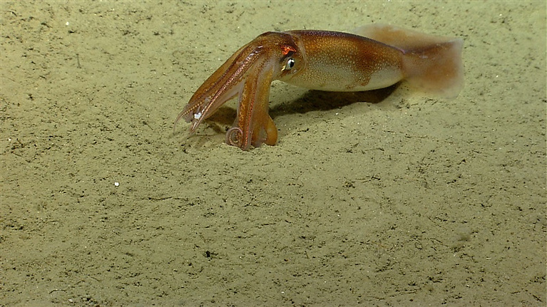 Oceanic squid on the bottom of the ocean floor with relatively close-up view of tentacles and suckers. Photo: NOAA OKEANOS Explorer Progra, 2013 Northeast U. S. Canyons Expedition
“The aim was to solve the relationships among this amazing group of animals. I believe this study is an important milestone for the field and a good starting point for performing in-depth studies on the evolutionary trends that shape the huge diversity of oceanic squids,” he said.
“Our research could also be useful as we try to understand how our oceans will respond to ever-increasing pressures from human activities,” he added.
The research team used a method known as genome skimming to reveal the full sequence of DNA and identify relationships among squid.
Each of the discovered groups was named based on the rules dictated by the International Code of Zoological Nomenclature, the team says.
It suggests that scientists will have a way to accurately identify and describe the biodiversity of these marine creatures in the future.
Oceanic squids are a highly significant part of the marine food web.
They are voracious predators and provide the main meal of toothed whales and other endangered megafauna.
They include the largest group of commercially fished cephalopods, the flying squids.
The researchers also discovered what they say are "unexpected and as yet, unexplained, relationships".
"For instance, delicate deep-sea glass squids are more closely related to powerful muscular Humboldt squids and to the unusual monogamous diamondback squid, than to other oceanic squids," the NUIG team states.
“How these remarkable changes in form came about is not yet understood," Prof Louise Allcock of NUIG's School of Natural Sciences, Ryan Institute, explained.
 An oceanic squid resting on the seafloor, changing colour as it sits on its elbows to breathe. Photo: NOAA OKEANOS Explorer Program, 2013 Northeast U. S. Canyons Expedition
“Oceanic squids are an amazingly diverse group of cephalopods – molluscs with arms and tentacles like squid, octopus and cuttlefish - with fascinating adaptations to their watery environment," she said.
" For example, glass squids use their body cavity as a fluid-filled buoyancy chamber, while chiroteuthids develop fishing lures at the end of their tentacles," she said.
“This study also highlights the importance of public scientific collections in addressing long-standing scientific issues," Prof Allcock added.
"We supplemented the material we collected ourselves with samples from various museums including the Smithsonian Institution in the USA, the Biological Reference Collection of the Marine Science Institute in Spain and the Australian Museum, allowing us to have a truly comprehensive oversight of oceanic squids globally,“ she said.
The study was funded by the Irish Research Council through the Government of Ireland Postdoctoral Fellowship Awards.
Read the full study in Zoological Journal of the Linnean Society here
Solution to Europe's "Broken" Rivers Identified in Research Involving UCC
Europe has some of the "most fragmented" rivers in the world with at least 1.2 million instream barriers, according to a newly published study.
An EU project involving University College Cork (UCC) team of researchers has identified thousands of large dams and a myriad of weirs, culverts, fords, sluices and ramps as the "main culprit of fragmentation".
It calculates that there are at least 0.74 barriers per kilometre of stream in Europe, and has recorded same in what it describes as the "first comprehensive pan- European barrier inventory".
The Amber Barrier Atlas shows the extent of this fragmentation is "much higher than anyone had anticipated", according to river geomorphologist Barbara Belletti who is now based at the CNRS, the French National Centre for Scientific Research.
Amber co-ordinator Carlos de Garcia de Leaniz said that many of the barriers are obsolete, and removing them "provides unprecedented opportunities for restoration".
The project results will feed into the EU's new biodiversity strategy and will help to reconnect at least 25,000km of Europe's rivers by 2030, he said.
UCC research professor Prof Philip McGinnity said that the project involved attempting to identify those areas of a river where Atlantic salmon are "stressed, in distress or excluded".
UCC Environmental Research Institute director Prof Sarah Culloty said the impact of the river barriers identified would be exacerbated by global warming.
The data would be critical to managing future risk, prioritising action and co-ordinated responses, she said.
UCC's head of the school of biological, earth and environmental sciences Prof Andy Wheeler said he was very concerned that recent Environmental Protection Agency reports showed that the ecological quality of Ireland's surface waters continued to decline, with nearly half of the water bodies in Ireland failing to meet objectives set in the EU Water Framework Directive.
Restoring connectivity by removing obsolete barriers would make an "important contribution in helping to improve conditions", he said.
The Amber project, funded under the EU's Horizon 2020 research and innovation programme, has developed tools and simulations to help water companies and river managers make the most of barriers and minimise ecological impacts.
It has improved fish migration at the Poutes dam in France using "adaptive management strategies" as one of a number of initiatives. A citizen science app to recover river barriers in Europe has also been developed, known as the Barrier Tracker.
More here
Irish Arctic Charr at Serious Risk of Extinction As a rResult of Climate Change - New Study
The warming of lake temperatures across Ireland and central Europe poses major risk to rare Arctic charr fish populations which date back to before last Ice Age.
A new study led by Centre for Environmental and Freshwater Science at Dundalk Institute of Technology (DkIT), in conjunction with the Marine Institute, has undercovered new evidence that identifies climate change as a a major risk to the increasingly rare populations of Arctic charr found in Irish lakes and other regions across Europe.
The Arctic charr is a cold-water fish in the family Salmonidae which is native to alpine lakes and Arctic and subarctic coastal waters. The species is remarkable because it has the most northerly geographic distribution of any freshwater fish and can survive in lakes high in the Arctic circle, even living under ice for up to 9 months of the year. It is therefore curious that it is also found at warmer, southern regions, including here in Ireland.

The research project which is co-funded under the BEYOND2020 and WATExR projects, included international collaboration between climate scientists and fish biologists. It examined a selection of lakes across Ireland, Britain, France and Swizerland, located near the southern extent of the Arctic charr's native range. The study found that winter temperatures in critical spawning habitats are warming rapidly and impacting potentially on critical spawning habitats of this species. The study used multiple, established models of the Earth's climate system and accounted for different levels of future atmospheric greenhouse gas emissions to find out how much additional warming might occur and what temperature risks would be posed to sensitive developing charr eggs following spawning.
"The results are sobering", says Dr Seán Kelly, post-doctoral research fellow with the Centre for Environmental and Freshwater Science in Dundalk Institute of Technology working on the BEYOND 2020 project, and lead author of the study.
"Unless greenhouse gas emissions are reduced considerably, winter warming of up to 4 degrees is likely to occur in these lakes in spawning habitats, rendering them highly unsuitable for the development of charr eggs. Furthermore, unlike many marine species, these lake populations have very little opportunity to migrate to more suitable, cooler lakes and establish new spawning grounds and are therefore at risk of extinction from these lakes unless they can quickly adapt to such warmer conditions."
Along with lake-resident populations in Britain and in Alpine regions of central Europe, the Irish Arctic charr is considered a glacial relict, a secretive fish left behind after the glacial retreat at the end of the last Ice Age, about 10,000 years ago. As these regions warmed, the charr populations left behind could survive only in sufficiently cold, deep lakes and are usually found in mountainous areas. One of the last remaining Irish populations of Arctic charr is found in Lough Bunaveela, a small lake in the Nephin Beg mountains, at the top of the Burrishoole catchment in County Mayo.
Dr. Elvira de Eyto, biologist with the Marine Institute adds "Occurrences of charr in Bunaveela have been recorded in the records of the Marine Institute since the early 1980s, albeit in small numbers. These records form part of the long term monitoring program run by the Marine Institute in the Burrishoole catchment, Co. Mayo."
The study indicated that climate model scenarios which limited global warming to "below 2°C, if not 1.5°C", as pledged in the Paris Agreement, supported future spawning habitat temperatures that may allow charr populations to persist. However, the fact that global emissions have not yet been sufficiently curbed to align with this 'best-case' scenario, and are currently tracking the more severe emissions scenario, certainly does not bode well for the fate of Arctic charr and the authors warn that we are at risk of losing this emblematic fish entirely from our lakes within the next hundred years. These charr population may persist only if they can adapt to warmer winter conditions; whether they can do this, and at a rate faster than lake warming, remains to be seen and should be a focus of future research.
#MarineResearch - The Marine Institute has announced a €2m Marine Infrastructure Call for 2017 with awards of between €20,000 and €200,000.
Applications are invited from legal entities (higher education institutes, public research institutes, small-medium enterprises, etc) on the island of Ireland with the appropriate scientific and technical qualifications and research expertise.
Marine Minister Michael Creed launched the initiative earlier this week at the Marine Institute’s Dublin office, where he also met some of the researchers successful in winning research funding through last year’s call: such as the national ship-time programme, the National Biodiscovery Laboratory, and research on ocean acidification.
“The range of projects funded by the Marine Institute through the Marine Research measure shows that Ireland’s marine researchers are carrying out cutting edge research to tackle national and global societal challenges,” he said.
“This funding builds on the national research capacity established through previous initiatives such as the Sea Change Strategy. It is helping to deliver on ‘Ireland’s Integrated Marine Plan – Harnessing Our Ocean Wealth’ by investing in researchers and organisations that are developing expertise and networks to address national policy objectives.”
Minister Creed added: “With our strategic location on the edge of the Atlantic, we are investing in key projects at the cutting edge of ocean research. During 2016, I am delighted that €10.7 million was awarded by the Marine Institute through the Marine Research Measure. This was a significant increase in the level of investment in marine research in recent years.
“The investment reflects both the opportunities the ocean presents as well as the huge responsibility we have to understand and protect the ocean, which we know is a key life support system for our planet. The funding supports a total of 32 research positions, including 20 marine research jobs announced in January by An Taoiseach Enda Kenny.”
All information on the call – including Guidelines for Applicants and Terms of Reference – can be found on the Marine Institute website HERE.
The application closing date is Thursday 15 June. Any queries or clarifications should be submitted by email to [email protected]
Marinas, Yacht & Boat Berths – Has Failte Ireland Been Lost at Sea In Recent Years?
#marinetourism – Yet another Failte Ireland Marine Research initiative is taking shape to examine the coastal infrastructure for leisure sailors of all kinds, and how facilities might be developed to attract visitors from abroad, while better serving the home fleets. In view of this new research programme, W M Nixon returns to the topic of Dunmore East's potential for development, and sets it in the national context.
Every port in Ireland should be so lucky as to have someone like Harry McLoughlin as Harbour Master. Down in Dunmore East, he's passionate about fulfilling the potential of his picturesque harbour. And it's no easy task, as Dunmore is trying to cope with meeting the demands of a growing home port fishing fleet, while the numbers seeking berths can fluctuate rapidly with visiting boats.
At the same time, the peak summer months will see leisure craft arrive in unpredictable numbers, keen to avail of any sheltered berthing to be had in a port whose strategic usefulness will be obvious to anyone with experience of cruising the Irish coast. And on top of that, from time to time cruise liners will call by, anchoring off and seeking to disembark passengers via their ship's tenders in this characterful little port, where virtually every inch of quayside and pontoon space is already taken by a wide variety of boats.
This provides a colourful and crowded scene, which makes it even more attractive for visitors who might be jaded by the usual big port/cruise liner berthing routine. But it's a headache for a harbour master who has to juggle the often conflicting requirements of different boat interests.
Last week's series of photos gave a snapshot of a few moments in a Dunmore East summer afternoon which well illustrate the challenges that Harry McLoughlin constantly faces. The reality is that the new industrial-style 40 metre pontoon along the East Pier under the lighthouse is a multi-purpose facility. Certainly it has been installed with leisure visitors in mind. But thanks to the welcome growth in the Dunmore East fishing fleet in the last couple of years, there are times when the dedicated pontoons for smaller fishing craft in the southwest corner of the harbour become impossibly crowded. The main quays have to be left clear for large trawlers unloading their catches and their other berthing requirements. So when there's so much pressure on space, some smaller fishing boats are sent across to the Visitors' Pontoon if it happens to be clear, and no visitor is expected.
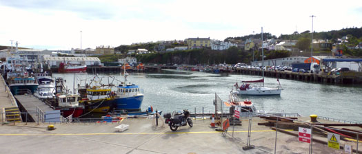
No room at the inn.......an unannounced and unexpected cruising boat finds no space available when pressure is on the berthing at the small craft pontoon. Photo: W M Nixon
It has to be confessed, though, that some of us when cruising are oddly reluctant to call ahead to the Harbour Office when approaching a new port. We prefer just to come in round the pierhead, hoping to be able to choose our own favoured berth without any communication with officialdom at all. It's part of the attraction of cruising when you can do this, as it adds to the sense of freedom which commanding your own small boat is supposed to confer. But the reality is that in a place like Dunmore East, you just have to call ahead, and that is what last week's photos, in the final analysis, seem to be all about.
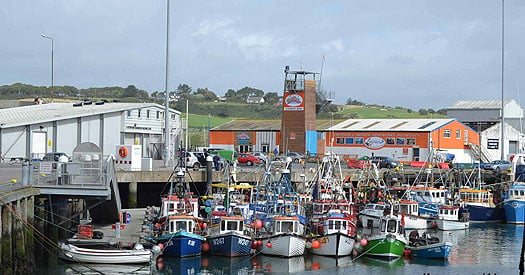
When they pack them in at Dunmore East, they do it big time. A notably trim fleet of smaller craft crowded at their own pontoon. Photo: Aileen Egan
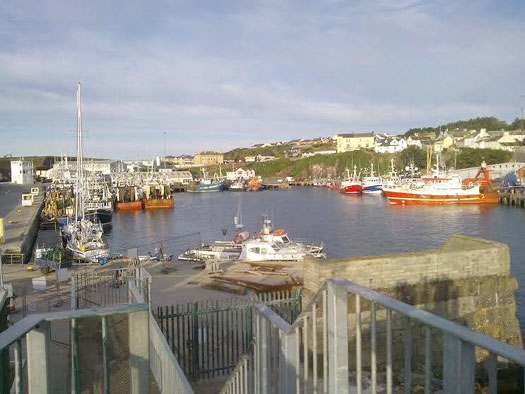
The big boys are in town. Quay space has to be kept available at all times for the comings and goings of larger trawlers. Photo: Harry McLoughlin
But with so much pressure on space, how can Dunmore also cope with the special demands of cruise liner passengers – many of them far from the first flush of youth – disembarking from ship's tenders? Well, in the spirit of community which keeps Dunmore going, the secret is the cruise liner passengers are allowed to come ashore on the usually hallowed territory of the RNLI pontoon.
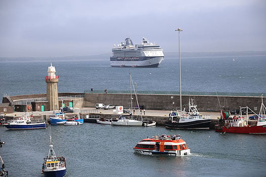
An example of a port harnessing different activities and working together with yachts, trawlers and, in the foreground, cruise line passengers disembarking at Dunmore East. Photo: David O'Brien
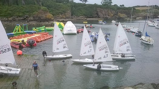
The extended slipway at Dunmore East, which has an abundance of younger sailors who would benefit greatly from an improved harbour. Photo: Harry McLoughlin
That such a temporary re-allocation of resources is necessary from time to time reinforces the genuine demand for improved facilities at many of Ireland's key ports. It will be interesting to see how the priorities are high-lighted by the international research programme which is being implemented under a new Failte Ireland initiative, with an advisory panel of Norman Kean, who researches and edits the Irish Cruising Club Sailing Directions for both the book and on-line versions, Paal Janson the General Manager of Dun Laoghaire Marina, representing the Irish Marine Federation, and Gail MacAllister of the ISA.
We could be forgiven for being a bit bewildered about some of this. Exactly seventeen months ago, in this blog on Saturday April 13th 2013, we were welcoming an up-coming report for Failte Ireland, titled: A Review of Tourism Policy Regarding the Funding of Marina and Berthing Facilities in Ireland. Ultimately known as the Fisher Report and resulting from the work of an agency from outside Ireland, it has since been gathering dust on some shelf. Now, that dust has apparently congealed into aspic with the realisation that the report was so vague and general that it didn't provide any sufficiently clearcut conclusions and proposals to form the basis of a policy.
The questionnaires which are being developed will be targeted at Irish, British, French and German markets. Making a point of ensuring that Irish leisure sailors are included in the equation strikes me as essential, for not only are we often sailing visitors in our own country, as our island's coastlines are long enough and sufficiently varied to make this the case, but visitors from abroad are attracted by the vibrant Irish sailing scene. Thus anything which provides better facilities for our own sailors will be beneficial in a much wider context.
The guidance of someone as experienced in cruising as Norman Kean will be invaluable, as the framing of the questions is vital in producing a worthwhile result. Then too, Norman is at the heart of the Irish sailing and boating scene, both with his key role in the internationally-praised Cruising Club Sailing Directions, and the fact that he is based at Courtmacsherry in West Cork, a friendly port which has shown it knows a thing or two about how to make visiting cruising boats feel welcome, and wish to come back again.
So we can be sure that the doughty Norman will accurately and eloquently represent the views and requirements of the Irish boating community, whose enthusiastic approach to sailing in all its forms is an important part of the package for boating visitors. This is all-too-frequently overlooked by the powers-that-be, who are so keen to tot up numbers of new visitors that they overlook the existence and needs of Ireland's large home sailing community, all of whom are more than willing to be personal hospitality managers when visiting boats come to call.
But in any case, regarding the ultimate value of market research, we should remind ourselves of Henry Ford's opinion on it, as we did back on April 13th 2013. The great car pioneer and manufacturer said that when starting out in business, if he'd asked his potential customers what they wanted, they'd have demanded a faster horse...
It seems that with the Fisher Report, we didn't even get a slow horse, we got a lame duck. So for the moment, instead of setting up a ponderous set of questions, Afloat.ie will simply dream on. What do we want for good cruising in Ireland? Well, setting aside those who insist that a giant astrodome should be installed to cover the entire country before they'll come near the place, we have a wish list that begins with good sailing which is sometimes sufficiently challenging to make the completion of each passage a satisfying experience. And all of it to be done with a background of attractive coastal scenery.
As for making safe passages, and then getting the best from each haven at the end, we'll know that the Irish Cruising Club Sailing Directions are an indispensable guide. Ideally, we'll be in an area with an abundance of natural anchorages where we can put down our own anchor without fear of fouling abandoned moorings or other detritus on the seabed. If there are reliable and regularly-serviced visitors moorings, that's fine and welcome too. But we who cruise the Irish coast, and the western seaboard in particular, do so in the knowledge that any proper cruising vessel will have her own more-than-adequate ground tackle.
If we happen to be sailing along an Irish coastline which lacks an abundance of natural harbours, we would like handy artificial harbours – preferably with marinas – at about 35 mile intervals or even less, as 35 nautical miles seems to be the magic distance which is easily attainable in one day, yet its completion really does make you feel you've moved on.
This sense of needing to move on is part of what cruising is all about. It satisfies some hidden genetic urge which most of the time is dormant in us, but given half a chance, there is indeed a gypsy in our soul. However, having satisfied our wanderlust by the modest total of 35 or so miles made good, what will we expect to find ashore?
Your complete dyed-in-the-wool cruising person is often content simply to stay on board enjoying the natural grace which is provided by a boat lying comfortably to her own anchor. Be sure, though, to choose a spot where your pride-and-joy won't be uncomfortably tide-rode, which so often turns out to be the case in what looked to be a snug if narrow inlet.
In their wellnigh perfect anchorage, these traditional cruising folk will be happy to dine aboard. At such times, you realise that a good sea cook is a pearl beyond price, much more valuable – in this age of sensitive auto-helms – than a top helmsman for the general welfare of the crew and the success of the cruise.
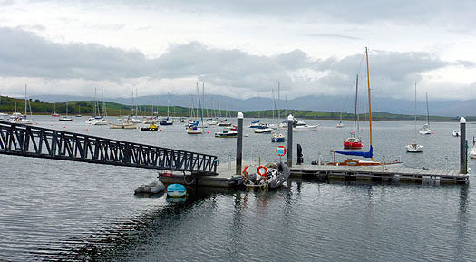
Mayo SC's landing pontoon at Rosmoney on Clew Bay is an impressive piece of work. Photo: W M Nixon
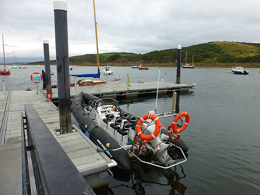
The attractive facilities at Mayo SC bring in a membership from all over North Connacht. Photo: W M Nixon
Such traditional cruising people, if they do go ashore, are quite happy to scramble up some awkward foreshore for a bracing hike on nearby moorland, or even climb a mountain or two. But the vast majority of us – and an increasing majority as newcomers arrive in cruising – prefer to get easily ashore from an anchored boat via the dinghy onto a good jetty, and ideally a landing pontoon - such as you see at civilised places like Mayo Sailing Club on Clew Bay – is both much safer, and more convenient.
However, let's face it, when cruising you're on your holidays. After a perhaps slightly rugged day at sea, there's no doubting the benefits conferred by a comfortable marina berth. Apart from the safety and security, there's the simple sense of freedom. While there are those who enjoy the restricted and aromatic confines of a cruising yacht, for many it can quickly become claustrophobic, and the freedom of personal movement which a marina confers on the cruising crew can be vital for preserving harmony. And it greatly broadening the options of what to do once ashore, because unlike the crew from an anchored boat reliant on one dinghy, crews in marinas can come and go as they please.
Perhaps it's the fact that they have this choice is one of the reasons why, by and large, cruising crews tend to stay as a group when they are ashore – they may even be celebrating the fact that they're still friends, and a marina can help in this.
As to what's needed ashore, basically it's good hospitality facilities within easy walking distance. The "easy walking" requirement cannot be over-emphasised. Once you're into a cruise, you're moving at a different speed in a different frame of mind, and too much walking on tarmac or cobblestones or whatever becomes simply tiresome. In fact, you'll have noticed that some experienced cruising folk are surprisingly willing to take a taxi if there's anything other than a short walk involved. For they also know that, coming off a boat, you're out of sync with road traffic – a cruising crew ambling along a busy road can be a hazard to themselves and a distracting menace for other road users.
So we're beginning to get the picture of our cruising crew's Irish dream port. It has to be colourful, characterful, and compact. Ideally, all facilities for every possible need, including repair, fuelling and re-storing, should be within easy reach from a marina berth with full-sized walkways and proper pontoons – you might be a bit rocky on your pins after a rough day at sea, and sea legs need something better than a cogglesome thin little finger pontoon.
From all this, it is clear that Kinsale is the Irish cruising port par excellence, even if the Yacht Club marina does get over-crowded betimes, and even if, when the ebb is running hard and there's a strong sou'easter blowing, the boats rafted along the outer berths have a bumpy time of it. Despite all this, Kinsale has so much to offer we can learn from it, and from other top cruising visitor places like Dingle and Howth while the new harbour at Greystones on the Wicklow coast is a fascinating example of a port in active transition from a small boat mini-haven to a proper harbour with marina and full facilities for multiple uses.
But equally there has to be fresh thinking about making the best of existing ports. In other words, the old notion that some ports should be exclusively designated as Fisheries Harbours is patently nonsense when those harbours are located in key positions with ready-made characterful port towns and villages as part of the package.
There still is some residual resistance in a few ports to the very notion of a marina being installed. But it should be seen in the broader context as an indicator of attractive peace and prosperity, every bit as much as a facility for visiting boaters who will be keen to spend their holiday money ashore. I was recently in Ballycastle in the far northeast corner of Ireland, and in going up the town we noticed a welcome air of prosperity. Buildings had been painted and generally spruced up. This was even more marked in the area down beside the little harbour, where there's a small but very useful marina, and the regular ferry leaves from its much-improved berth for Rathlin Island six miles away. We still think of it as the "new harbour and marina" at Ballycastle, although it has been around for some time now. But such facilities are put in for the long haul, and it is now that Ballycastle harbour's attractive sense of purpose and prosperity has had this beneficial spinoff for the mood of the town.
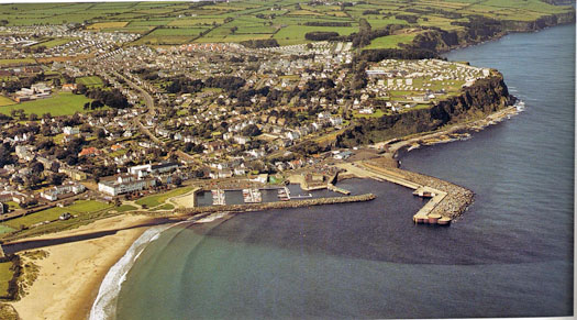 The small but convenient and very useful marina at Ballycastle has played a part in the North Antrim town's improved perception of itself. Photo Kevin Dwyer courtesy Irish Cruising Club
Elsewhere in the north, one of our favourite ports is Ardglass, where one of the most strategically useful marinas on the entire Irish coast was slotted into a spare corner of what had formerly been a decidedly rugged "fishing-and-fishing-only" place, and the mood has been pleasantly lightened as a result.
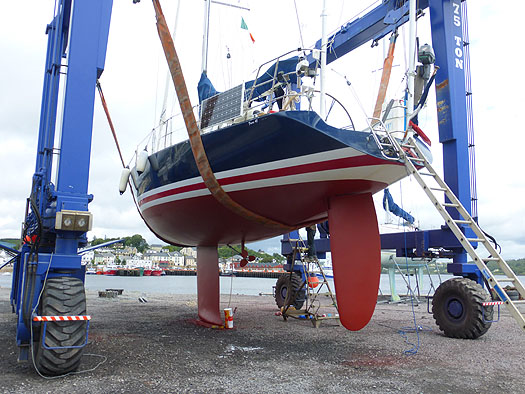 A handsome and obviously fast perfomance cruiser in the hoist at an Irish port – but where is it? Photo: W M Nixon
But for pure rugged essence of total fishing port, you just couldn't beat the Wild West atmosphere of Killybegs in Donegal. The fishing has been mighty, and there are now at least 23 multi-millionaires in the Killybegs area whose wealth has been drawn from the sea. Yet in recent years, the Killybegs attitude has softened slightly. The place has tidied itself up, and as one of the best natural harbor in the entire northwest of Ireland, it has put out some visitors' mooring for leisure craft, while serious cruising men visiting this challenging but rewarding area find that the Mooney Boats quayside yard with its massive travel hoist is a real boon.
Killybegs does have space where a marina could be installed to be handy to the town while not interfering with fishing boat needs, and judging by the quality boats flying foreign ensigns on the visitors moorings, its usefulness as a crew-change port is a particular asset, as the international airport at Knock isn't so very
far away.
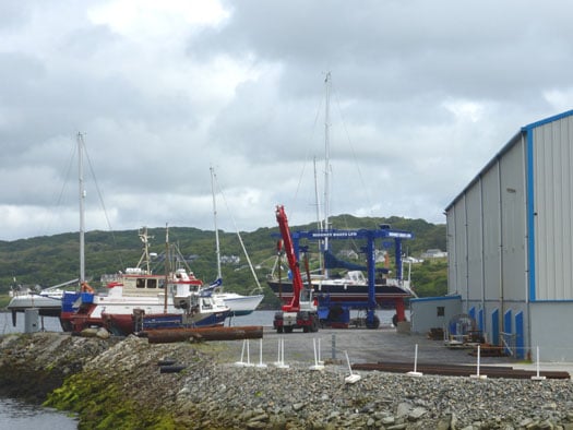
Killybegs is the answer, with Mooney Boats a boon for boat visitors to Donegal. Photo: W M Nixon
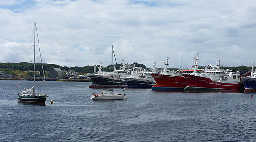
Once upon a time, Killybegs was fishing, just fishing, and only fishing. But now the deep sea trawlers are well used to sharing their harbour with visiting yachts, in this case a couple of Dutch boats. Photo: W M Nixon
So if Killybegs can take aboard the idea of a marina, maybe the other mega-fishing-port of Castetownbere in southwest Ireland can do so too. That said, there is a hugely popular little marina already well established at the other end of Bere Island at Lawrence Cove, but a convenient facility at the western end of Bere Haven would improve cruising options.
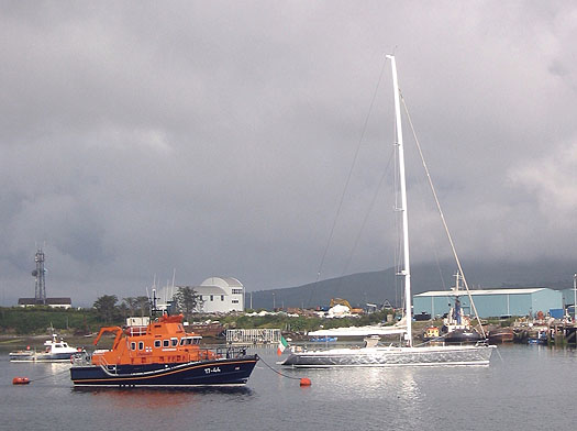
The 78ft cruiser-racer Whisper contrasts vividly with the lifeboat in Castletownbere, a fishing port which might be able to find space for a marina. Photo: W M Nixon
In the cruising heartlands of West Cork, we can expect new movement on the long-proposed marina at Schull, which would greatly help in rationalizing pier use. But in bustling Baltimore there may be more of a challenge in creating a proper marina, as waterfront space beside the village is limited. As it is, the current berthing pontoon which juts straight out into the harbour can be a mixed blessing when there's a serious wind from the west, with the pitching and banging of boats and pontoon sections being a nuisance at best, and a real hazard at its worst.
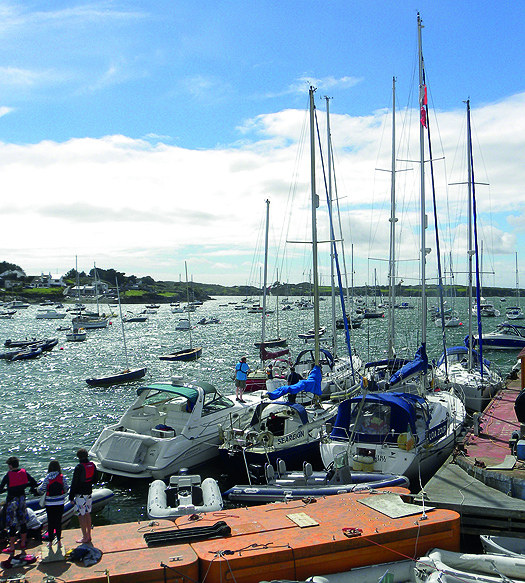
The berthing pontoon at Baltimore can become a decidedly exposed place when the wind is fresh from the west.
But all these places already have something of a range of choices, in Dunmore East there's just this one little bit of a harbour, and everyone wants a piece of it. I make no excuses for dragging out the dog-eared rough sketch of what a marina might look like if there was to be a realistic separation of fishing and leisure use, for while we do suggest that places which were originally exclusively fishing ports can be usefully modified to be partially leisure ports as well, there's no doubting the primary need of clearly defined boundaries between the two within the harbour confines.
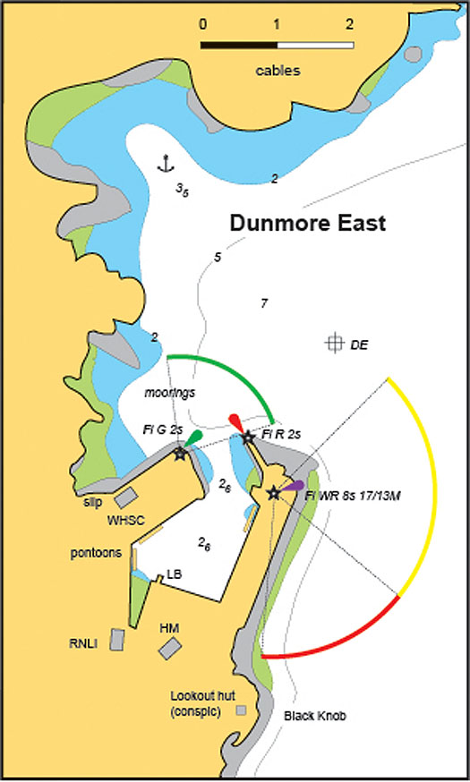
Dunmore East as it is today, and surely ripe for development
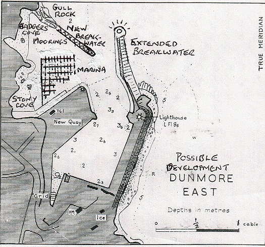 The possibilities for a marina at Dunmore East are suggested in this rough sketch
For there's no doubt we all wish the very best for Dunmore East. It very much wants to be a hospitable port, and can do it very well too, given half a chance. Harry McLoughlin was talking enthusiastically about some of the fine boats and great sailing people he has welcomed since he took over as Dunmore's Harbour Master in the Spring of 2013, and from 2014 he best remembers the great Jim Mottram.
Jim cruises alone in his pretty little Elizabethan 23 Reservation out of Christchurch in Dorset just outside the west entrance to the Solent, and over the decades he has logged some formidable voyages, down to Spain, and round Britain three times. But as his boat has a lifting keel which reduces the draft to 2ft 6ins, for 2014 he decided that a cruise to Ireland with a spell on the inland waterways would make for a change.
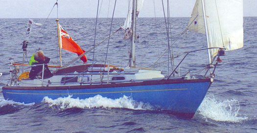
The most senior sailor – Dunmore East visitor Jim Mottram has cruised thousands of miles in his Elizabethan 23 Reservation.
So he arrived into Dunmore East early in the season, intending to go up the Barrow, across Ireland on the Grand Canal, then back to the sea again via the Shannon through Limerick. But after going up to Waterford from Dunmore, he reckoned the early-season surge down the River Barrow would make things unnecessarily difficult, so he cruised right round the south coast of Ireland and went up the Shannon Estuary to Limerick. There, he unstepped his mast, and motored north through Lough Derg and into the Grand Canal at Shannon Harbour, then right across Ireland to swoosh down the Barrow – which becomes even more lovely the further south you go – until in New Ross the manager of the Three Sisters Marina John Diamond set him up again, and on he went down to Dunmore East for a warm welcome and a celebration of his near-circuit of Munster.
Harry McLoughlin discovered Jim had a special birthday coming up while he was in Dunmore East, so he and his wife took the lone skipper along to the Waterford Harbour Sailing Club for a party to celebrate both the birthday and the success of his cruising since he'd last been with them.
And which birthday was Jim Mottram celebrating?
His 80th, of course.
Marine Minister Launches Call For Research Proposals
#Research - Marine Minister Simon Coveney has today (11 March) announced a new call for research proposals under his department’s three competitive research funding programmes: FIRM, Stimulus and CoFoRD.
Sustainable aquaculture production and safety of marine-origin foods are among the areas covered by this year's call, which include include animal and crop health and production, horticulture, food and health, novel ingredients, forest production and management, and the wider bio-economy as well as the safety, quality, integrity and sustainability of the supply chain.
“The objective of this call is to build and maintain research capacity and capability in the Irish public research system that contributes to underpinning the sustainability and competitiveness and further development of the Irish agri-food, forestry and fisheries sectors," said Minister Coveney.
The content of the call is informed by strategic research agendas drawn up by industry-led research advisory groups operated by the Department of Agriculture, Food and the Marine. It is also aligned to priority areas identified in the Government’s National Research Prioritisation Exercise.
Following awards of €65 million in agri-food and forest research over the last two years, the minister reiterated his commitment to targeted research and innovation within the sector.
"Publicly funded research will continue to play a key role in driving innovation within the bio-economy, thus contributing to the achievement of the growth targets outlined in Food Harvest 2020 and ultimately making a positive contribution to the Government’s Action Plan for Jobs."
The minister concluded by wishing applicants every success with their applications.
“I have no doubt that the research community will take full advantage of this opportunity by submitting excellent proposals and I look forward to following the process over the coming months.”
The deadline for proposal applications is Thursday 8 May at 1.00pm. All documentation in relation to the call is available on the research section of the department’s website at www.agriculture.gov.ie/research.
Scientists Discover World of Wonder Beneath the Atlantic
The Irish-led scientific expedition aboard the RV Celtic Explorer has discovered a previously uncharted field of hydrothermal vents along the Mid-Atlantic Ridge.
As previously reported on Afloat.ie, the team includes geochemists, marine biologists, marine geologists, marine geneticists and technicians from Ireland and the UK as well as a three-person TV crew from National Geographic filming for a documentary series to be broadcast next year.
The mission, led by Dr Andy Wheeler of University College Cork, returned to Cork last Thursday from an investigation 3,000 metres below the sea surface using their Remotely Operated Vehicle (ROV) Holland 1 at the first hydrothermal vent field to be explored north of the Azores.
Hydrothermal vents, which spew mineral-rich seawater heated to boiling point by volcanic rock in the Earth’s crust below, are home to a rich variety of marine life that thrives in complete darkness on bacteria fed by chemicals.
“On the first dive, we found the edge of the vent field within two hours of arriving on the seafloor, ” said Dr Wheeler. “Often the search for vents takes much longer, and our success is a testament to the hard work and skill of everyone on board.”
The field has been named the Moytirra Vent Field, after a battlefield from Irish mythology that means ‘Plain of the Pillars’.
“In comparison with other vent fields, Moytirra contains some monstrous chimneys and is in an unusual setting at the bottom of a cliff - a real beauty,” said Patrick Collins rom NUI Galway’s Ryan Institute.
His colleague John Copley of the University of Southhampton added: “Using the ROV’s high-definition video camera, we’ve watched unusual orange-bodied shrimp crawling around the chimneys, among clusters of tiny green limpets.
“Elsewhere there are writhing scale-worms, swirling mats of bacteria and eel-like fish – a riot of life in this unlikely haven on the ocean floor.”
Speaking from the RV Celtic Explorer in Cork, Marine Minister Simon Coveney hailed the “exciting new discovery”.
“Ireland is positioning itself as a centre for marine research from a European and international perspective and this work should be supported and welcomed,” he said.


