


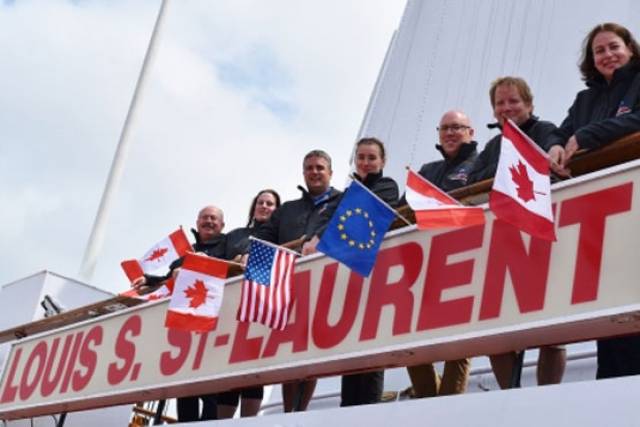
#SeabedMapping - The Atlantic Ocean Research Alliance's fifth transatlantic seabed mapping survey launched last Friday 22 July from eastern Canada.
Sailing on the Canadian Coast Guard Ship Louis S St-Laurent, the team will map the seafloor across the North Atlantic between Halifax in Nova Scotia and Tromso in Norway till next Tuesday 2 August.
The marine science team led by Paola Travaglini of Fisheries and Oceans Canada's Hydrographic Service are using state-of-the-art deep-water multibeam sonar technology to survey the seabed and study the physical characteristics of the seafloor, as well as other oceanographic data such as temperature and salinity, to better understand little-known areas of the North Atlantic and build on the work done last summer.
These surveys support the Galway Statement on Atlantic Ocean Co-operation, the goals of which are to join resources of its three signatories to better understand the North Atlantic, to promote sustainable management of its resources, and to promote citizens' understanding of the Atlantic through ocean literacy.
Participants in the survey include Fisheries and Oceans Canada's Hydrographic Service, the University of New Hampshire's Center for Coastal and Ocean Mapping Joint Hydrographic Center, and the Fisheries and Marine Institute of Memorial University of Newfoundland.
Students and early-career scientists representing Canada and the United States sailing on board the CCGS Louis S St-Laurent are writing daily blog posts to chronicle the mission. The team comprises:
- David Thornhill, Hydrographer, Fisheries and Oceans Canada Canadian Hydrographer Service
- Danielle Roche, Marine Institute of Memorial University of Newfoundland
- Darren Hiltz, Hydrographer, Fisheries and Oceans Canada Canadian Hydrographer Service
- Elizabeth Weindren, University of New Hampshire's Center for Coastal and Ocean Mapping Joint Hydrographic Center Fisheries
- Chris Hemmingway, National Director of UNCLOS, Fisheries and Oceans Canada Canadian Hydrographer Service
- David Levy, Electrical Technician, Fisheries and Oceans Canada Canadian Hydrographer Service
- Paola Travaglini, Hydrographer–In–Charge, Fisheries and Oceans Canada Canadian Hydrographer Service
Seabed mapping was one of the ocean research priorities and challenged discussed by the Marine Institute's CEO Dr Peter Heffernan with other heads of European marine science institutes in Ostend earlier this month, which followed a previous consultation that identified such mapping as crucial for managing human activities in our seas.


 County Kerry to celebrate the 10th anniversary of the iconic Wild Atlantic Way - Launched in 2014, the longest defined coastal routes in the world, which stretches for 2600 km from Cork to Donegal. At the anniversary, were staff of Wild Atlantic Way (Fáilte Ireland) in Kerry, Sharon Houlihan, Declan Murphy and Veronica O'Connor")


 Michael Murphy Schull Harbour Sailing Club (SHSC), Eric Coogan Heineken Ireland, Mark Murphy, Commodore SHSC, Jack Allen SHSC, Carmel O'Regan SHSC, Cornelious Ndlovu, Schull Harbour Hotel Operations Manager and Derval Murphy SHSC")

